Highway 60 Improvements Project
MnDOT Virtual Open House
Welcome
Welcome to the Hwy 60 Improvements Project virtual open house! Continue clicking through to learn more about future improvements coming to Highway 60 between Zumbrota and Zumbro Falls.
Following guidance from state health officials to prevent the further spread of COVID-19, the Minnesota Department of Transportation has temporarily postponed all public meetings and in-person events. Public engagement remains a priority and we appreciate you joining us online to learn more about this project.
How to navigate
- Click the arrows on the right of your screen to go forward or the left to go backward. Use the navigation bar on the top of your screen to revisit any part of the meeting.
- Use the navigation bar on the top of your screen to revisit any part of the meeting.
Project Overview
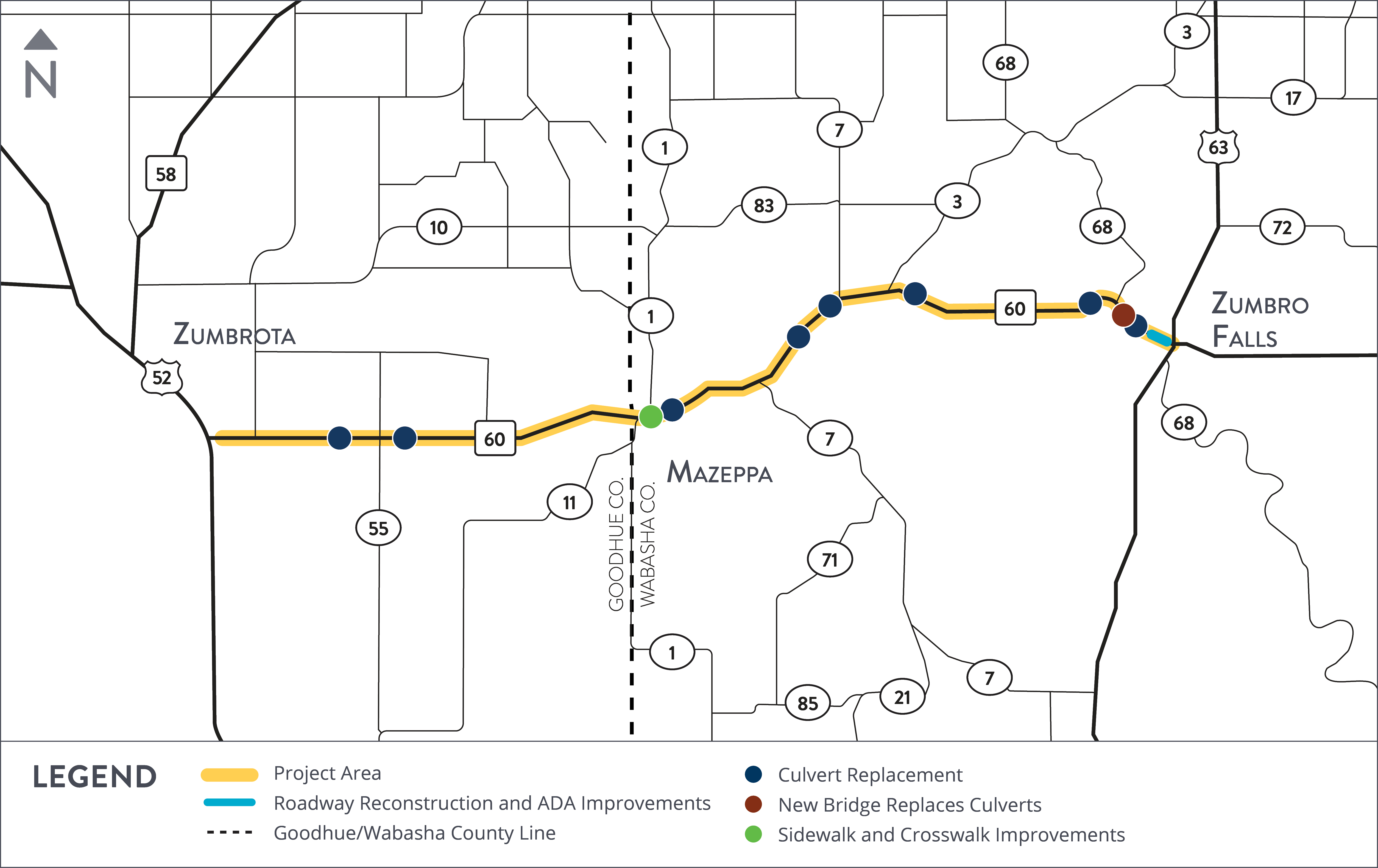
MnDOT is making improvements to a 12 mile stretch of Highway 60 between Zumbrota and Zumbro Falls. This project will improve pavement conditions and increase safety for all users of Highway 60. It also includes reconstructing areas of Zumbro Falls and building a new Highway 60 bridge west of Zumbro Falls. Construction is anticipated to begin in Spring 2022.
See the study area
Click the image below to enlarge.
Project benefits
- Improved safety for all users
- New roadway surface, signs, culverts and pipes, and guardrail
- Underground utility and drainage upgrades
- New pedestrian crossings and connections in Zumbro Falls & Mazeppa
Anticipated Schedule
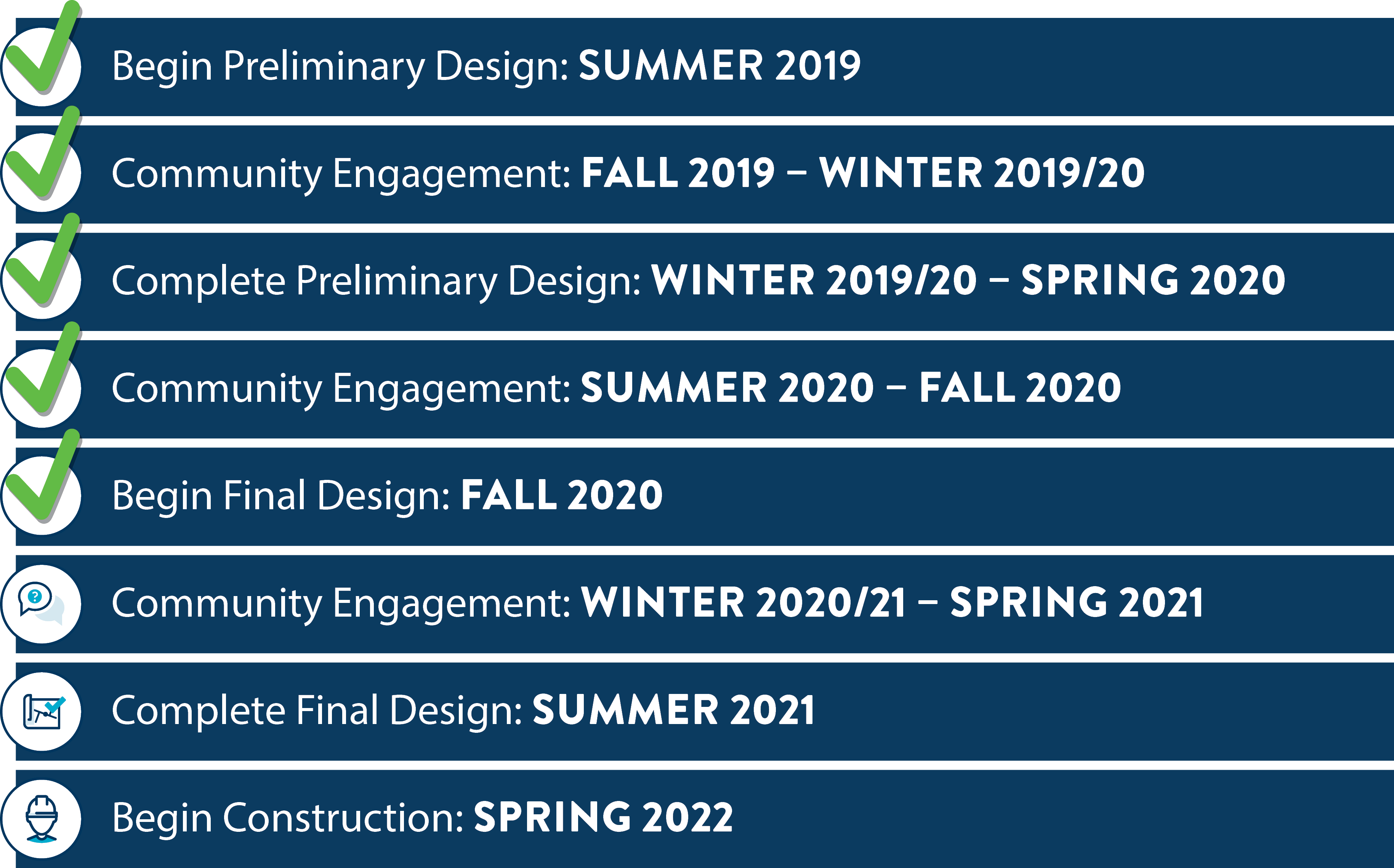
Project schedule
MnDOT identified issues along this stretch of Highway 60 and started developing solutions in summer 2019. We’ve been connecting with residents, business, residents and users of Highway 60 along the way to provide input. Before we finalize the design and start construction, we want to connect back with you to share our plans and hear what you think.
Click the image below to enlarge.
What to Expect During Construction
Our commitment
Our project team will be available to businesses, residents and visitors before, during and after construction. We’ll continue to listen to your needs and concerns and make adjustments when possible. Tell us what’s on your mind.
Click to the next slide to learn more about detours and traffic impacts during construction.
Construction impacts
Highway 60 will be closed to through traffic on the west side of Zumbro Falls due to bridge construction.
Short term detours at spots along Highway 60 during culvert work.

Local detours in Zumbro Falls during roadway reconstruction.

Temporary lane closures on Highway 60 during paving work.

All businesses will remain accessible during construction.
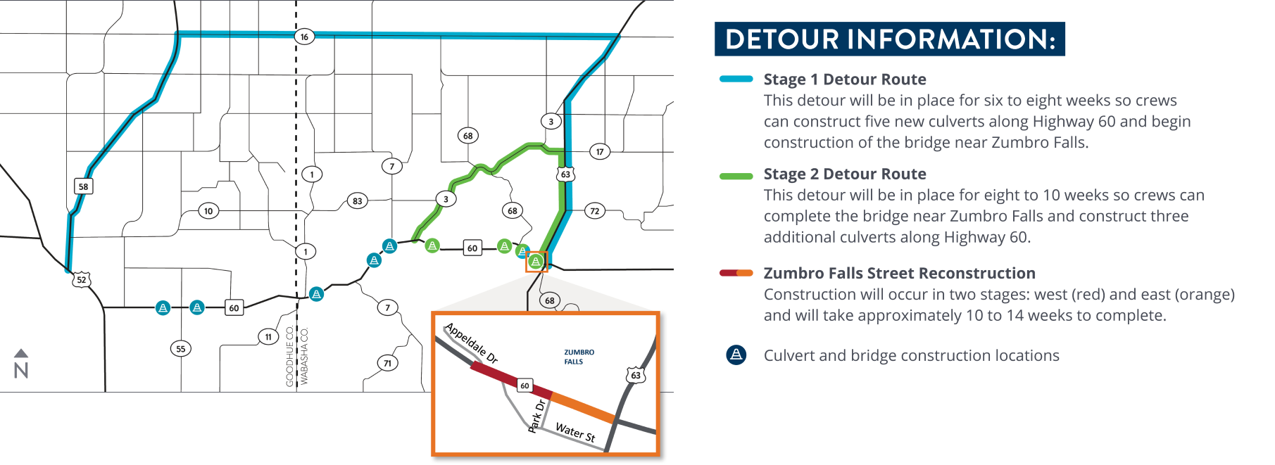
Detours and Traffic Impacts
Detours will occur in phases to accommodate construction and minimize impacts to residents, businesses and other users of this stretch of Highway 60. All businesses will remain accessible during construction. View the detour for more information
See the detour map
Click the image below to enlarge.
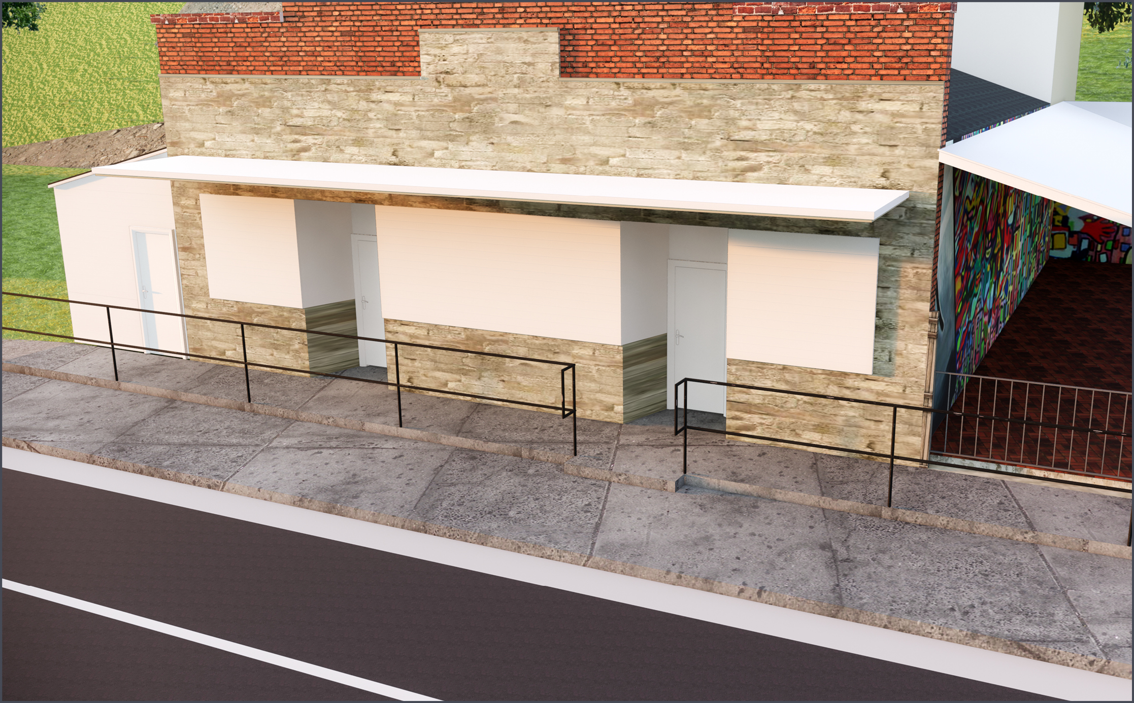
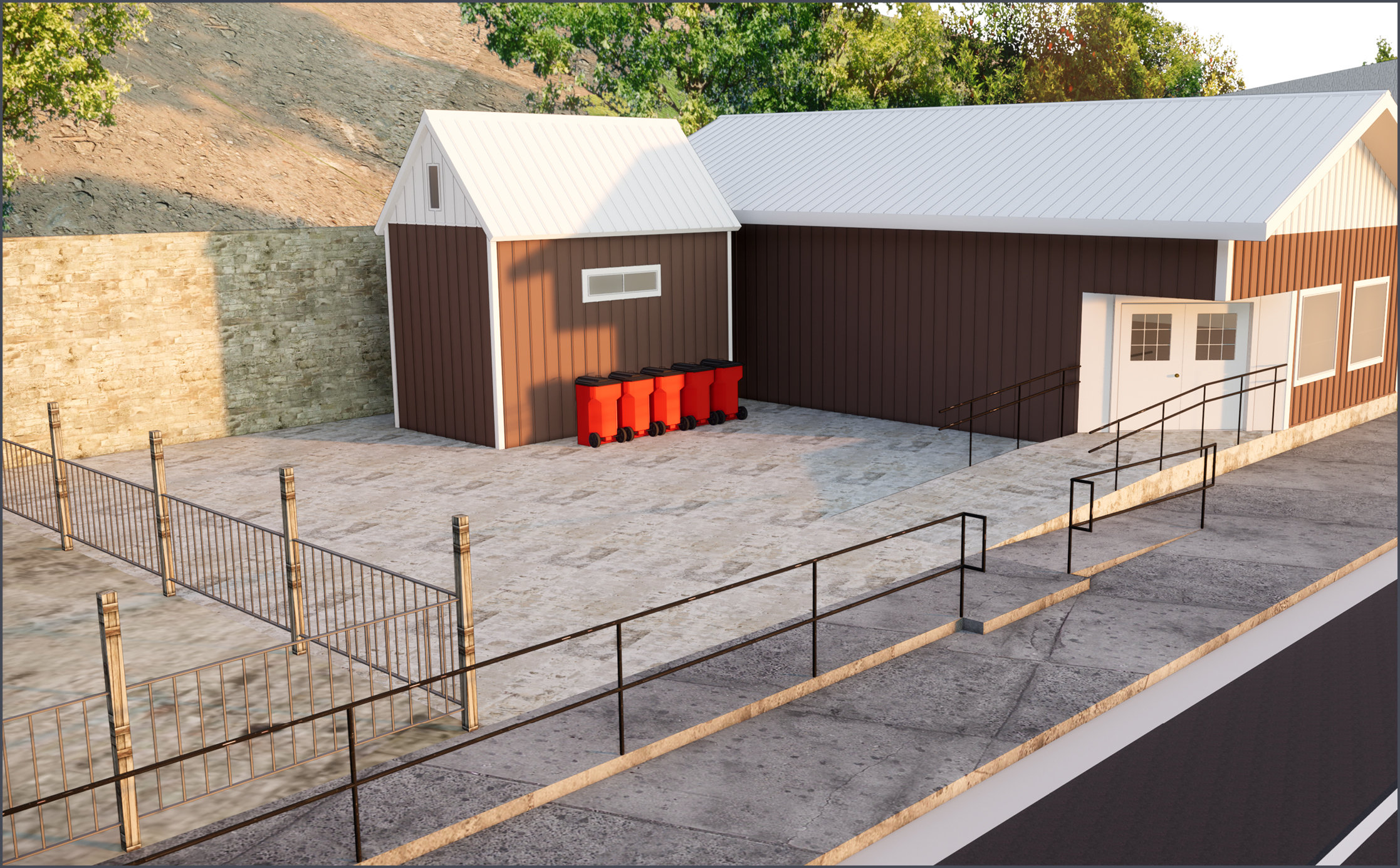
Zumbro Falls Sidewalk Renderings
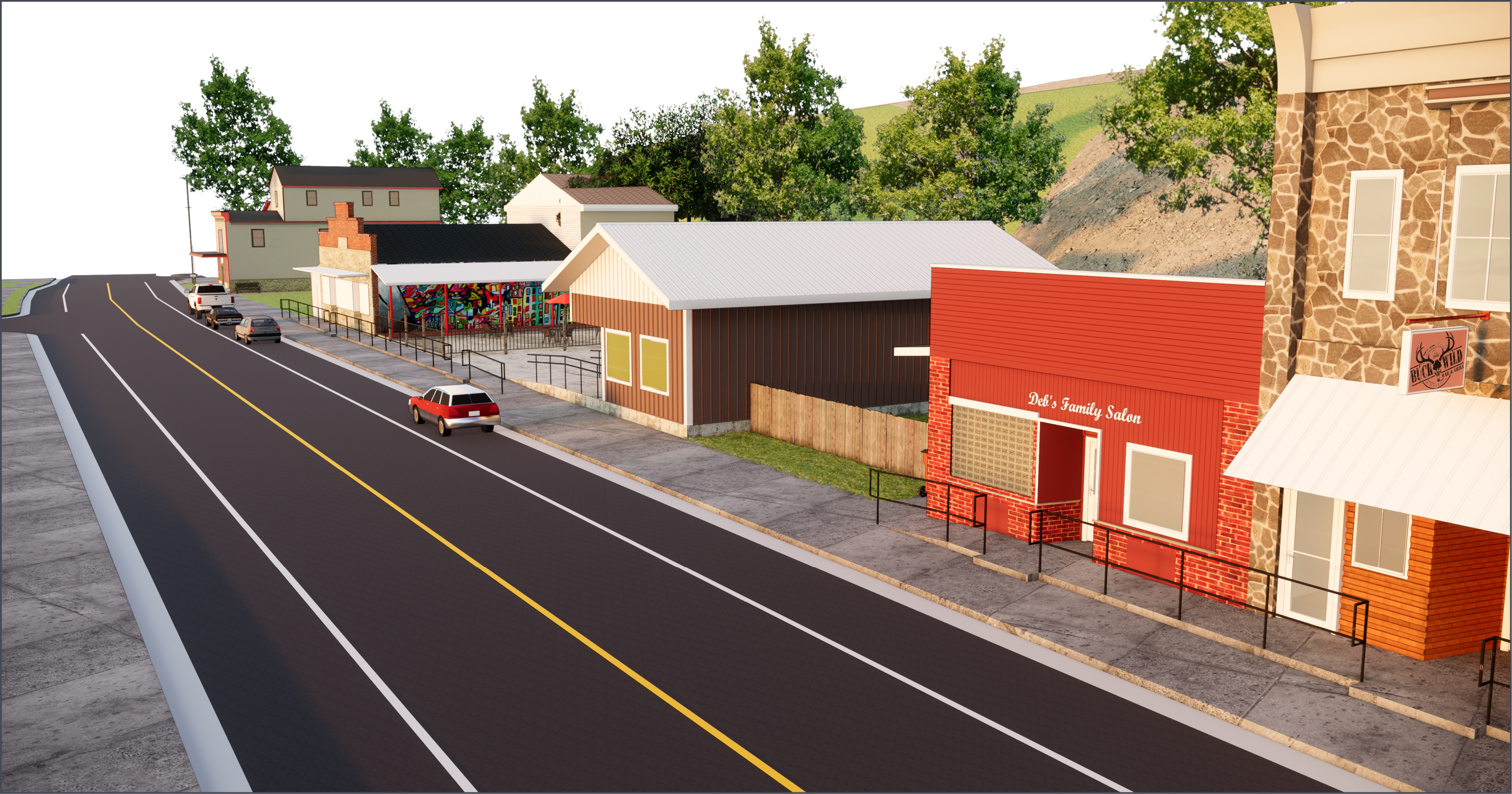
Tiered sidewalk renderings
The existing sidewalks on the north side of Highway 60 in Zumbro Falls are too steep to meet the current standards for accessibility. During construction, the sidewalks will be flattened and raised so they are even with business entrances.
- Steps and ramps will allow people to cross between the two sidewalk tiers.
- The lower tier sidewalk will improve access to those using street parking.
View the renderings below to see what the future tiered sidewalks will look like.
Click the images below to enlarge.
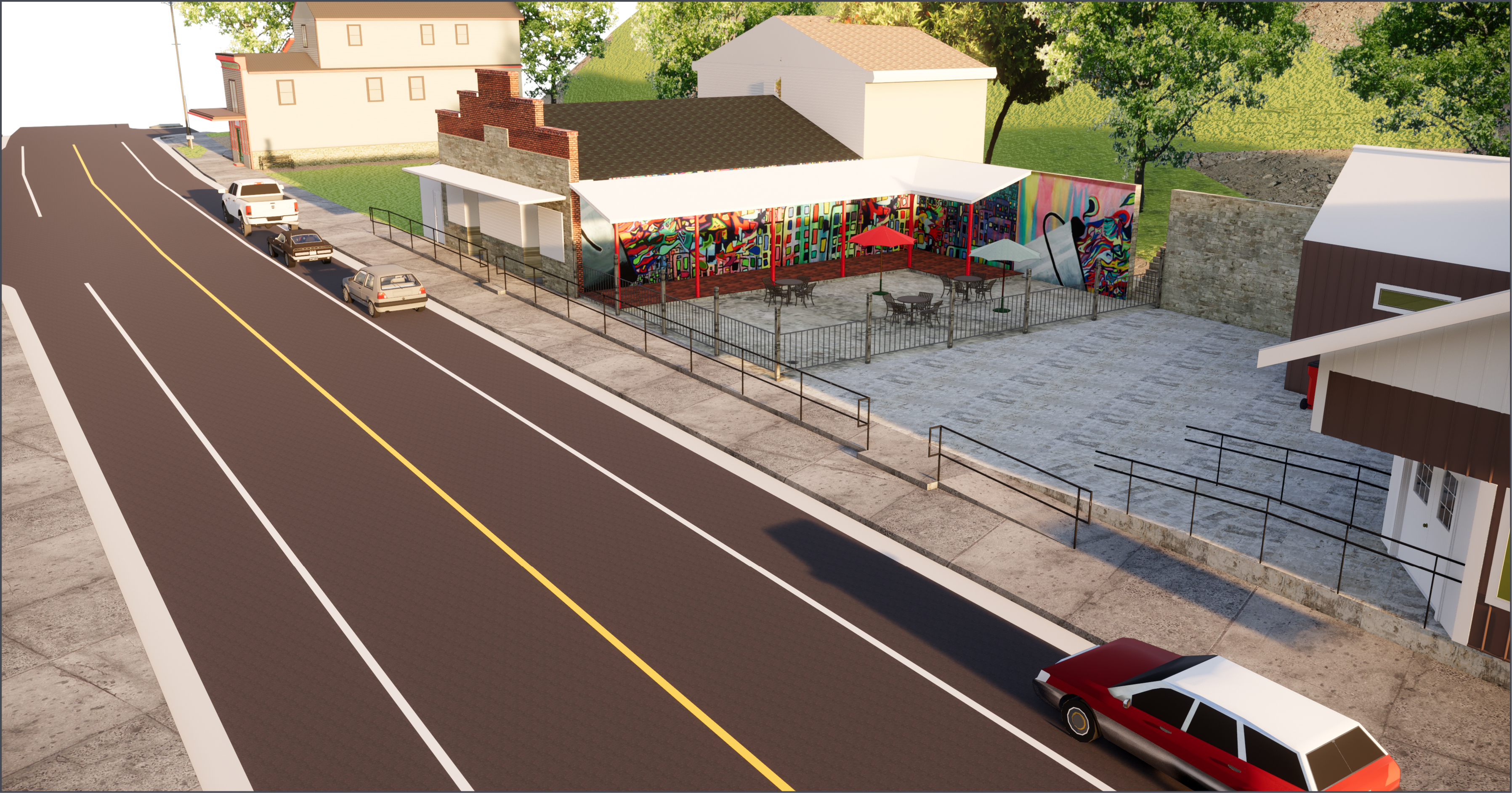
North side of Hwy 60 looking west from in front of Delila's Cafe.
North side of Hwy 60 looking west from in front of Buck Wild.
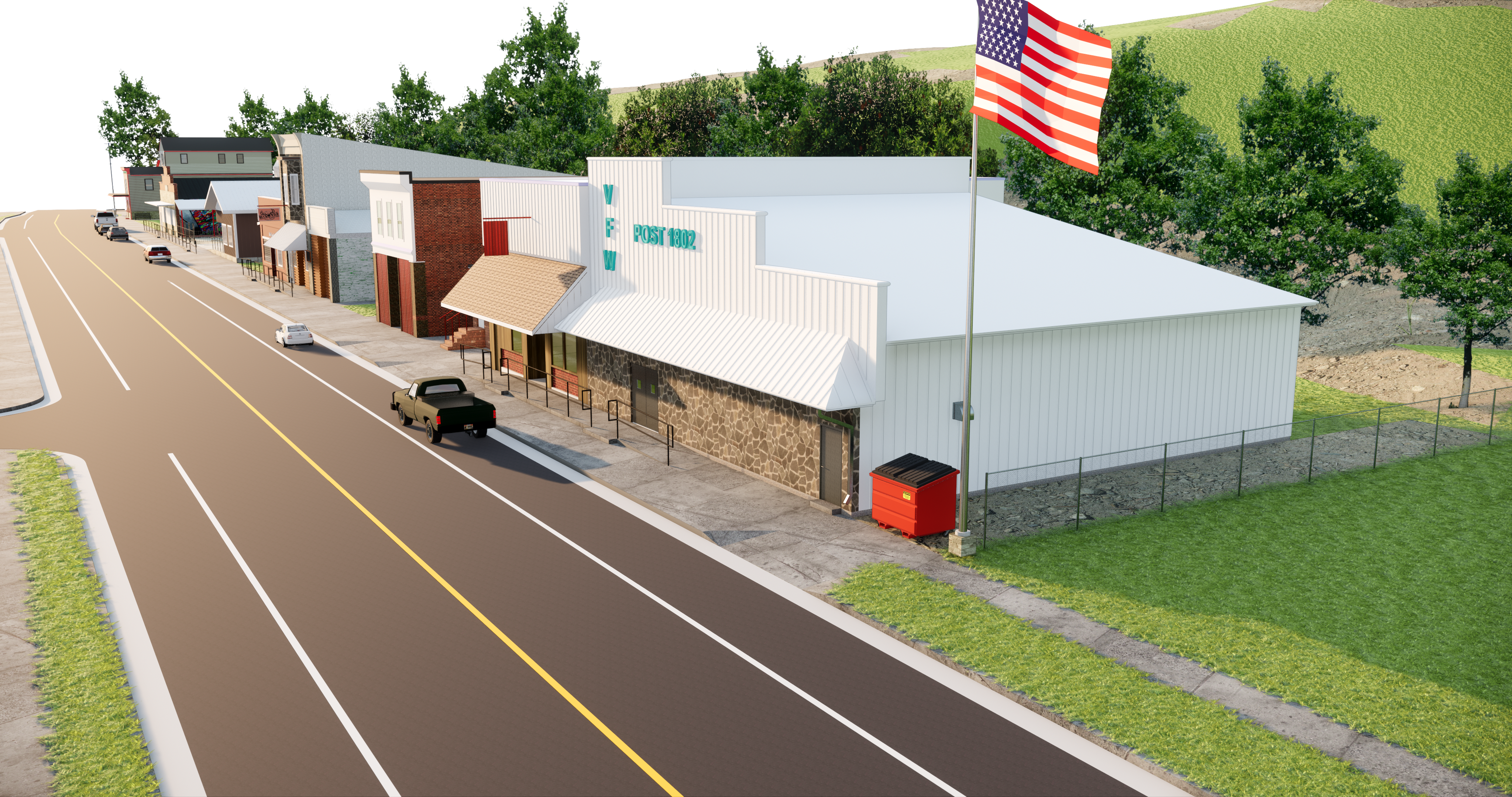
Tiered sidewalks and railing in front of the VFW.
Tiered sidewalks and railing in front of Neptune Bar.
Tiered sidewalks and railing looking east at Delila's Cafe.
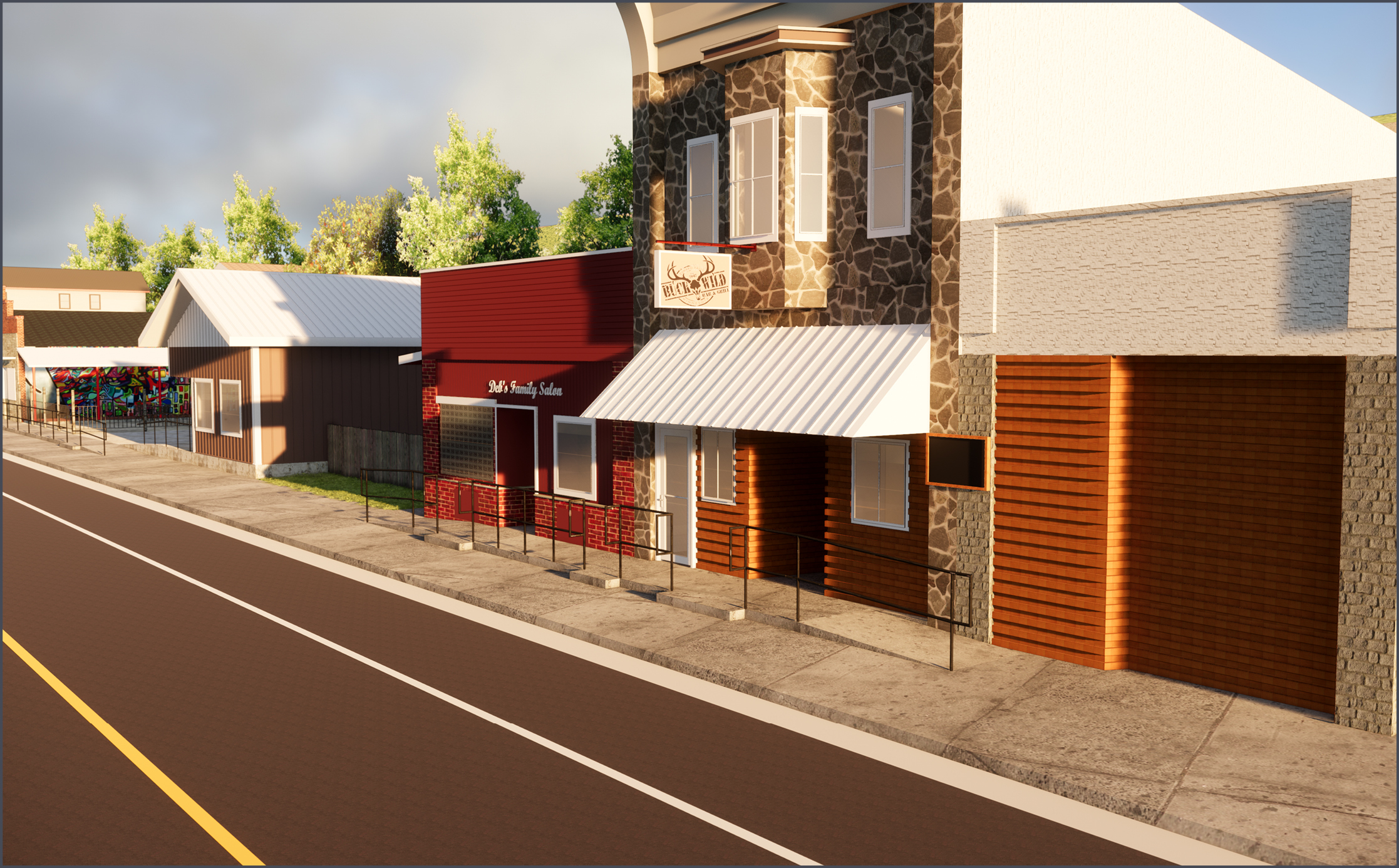
Tiered sidewalks in front of Buck Wild and Deb's Salon.
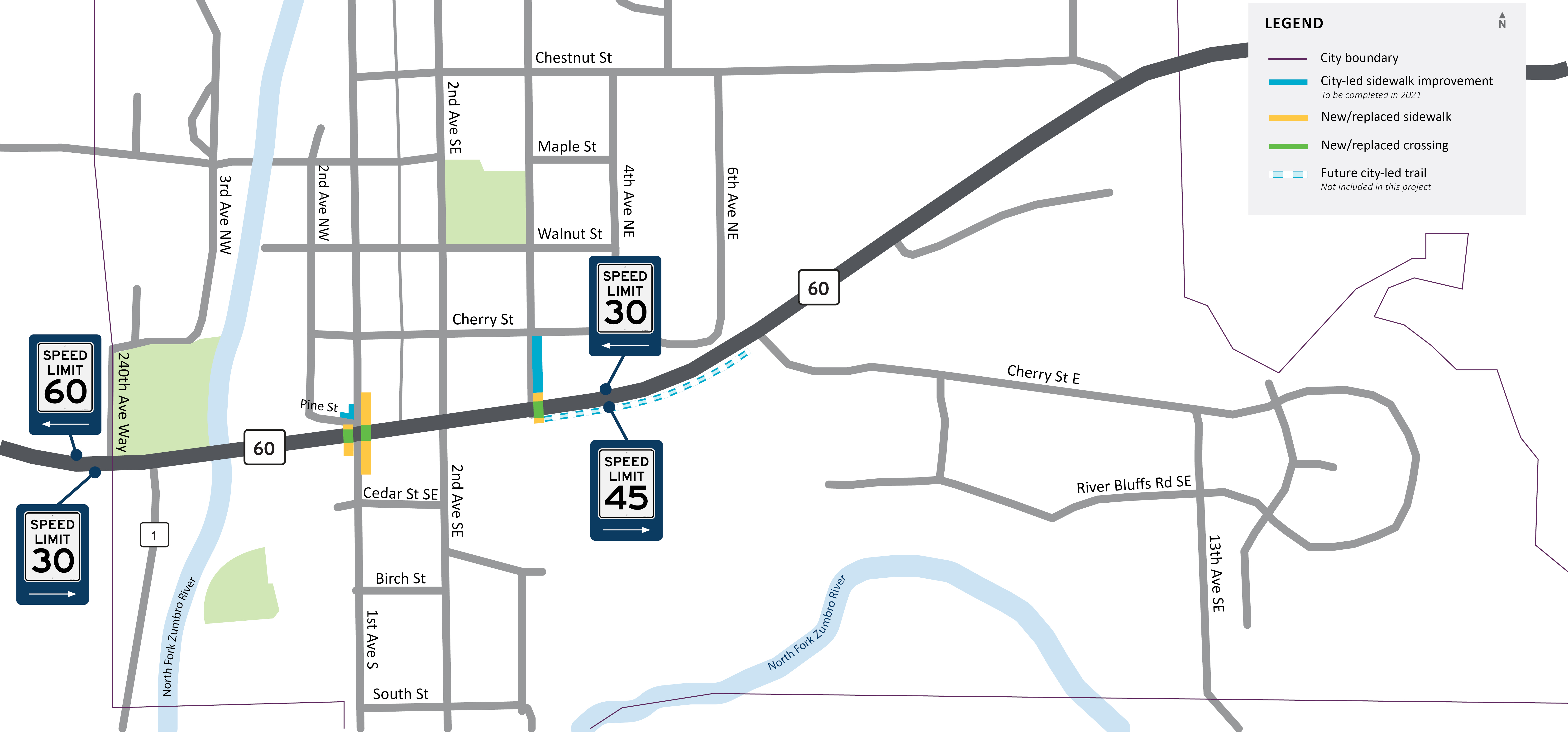
Mazeppa
Mazeppa sidewalk improvements
Improvements in Mazeppa will include:
- Pavement improvements – repaving the Highway 60 roadway surface for a smoother ride.
- Walking improvements – replacing one existing and adding two new pedestrian crossings. Sidewalks leading to those crossings will also be replaced or added.
- Drainage improvements – cleaning out the existing ditches so storm water flows better.
Click the images below to enlarge.
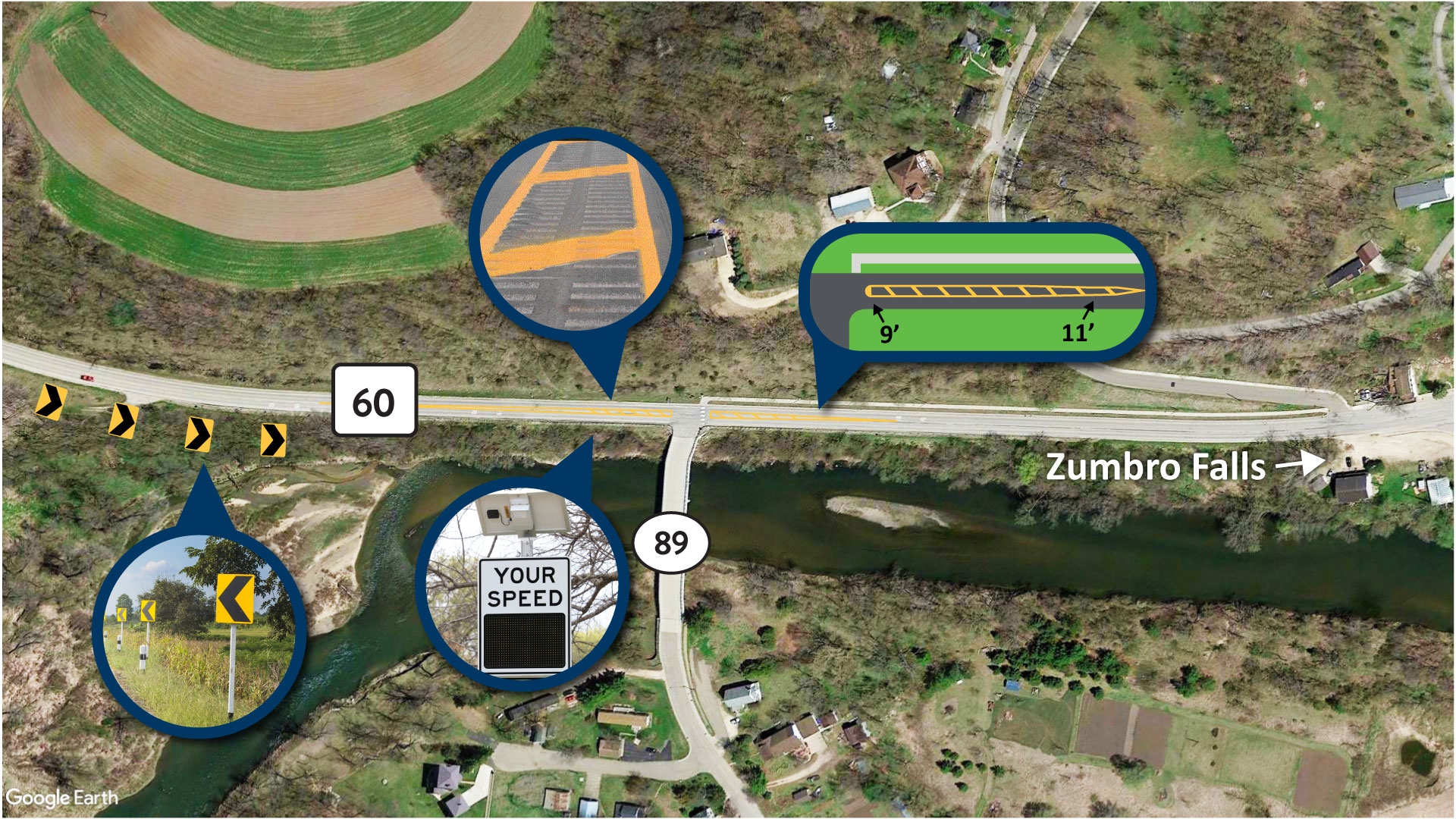
Traffic Calming Measures near County Rd 89
Transitional speed zone
To increase safety along this stretch of Highway 60, MnDOT is exploring several traffic calming measures to put in place west of Zumbro Falls. An effective measure to increase the safety of rural high-speed roads as they approach communities is a transitional speed zone. In this zone, drivers are encouraged and expected to reduce their speed to one suitable for passing through a community.
The intersection of County Road 89 and Highway 60 is in the middle of a rural, two-lane, high-speed roadway to the west (posted at 60 miles per hour) and an urban, two-lane, low-speed roadway to the east (posted at 30 miles per hour). This location is well-suited for a transitional speed zone.
Elements of a transitional speed zone that MnDOT is considering for this location include:
- Transition from 11-foot wide lanes down to 9-foot lanes
- Wide median
- Center rumble stripes
- Chevron signage along the roadway curve
- Dynamic Speeds Signs
Example traffic calming measures
Click the image below to enlarge.