Queen Street-Highway 7 BRT
-
Segment 1 Mississauga Road to McLaughlin Road
-
Segment 2 McLaughlin Road to Kennedy Road
-
Segment 3 Kennedy Road to Highway 410
-
Segment 4 Highway 410 to Highway 50
-
Segment 5 Highway 50 to Kipling Avenue
-
Segment 6 Kipling Avenue to Wigwoss Drive
-
 Focus Area A Downtown Bus Terminal / GO Station
 -
 Focus Area B Kitchener-Georgetown GO Rail Corridor Underpass
 -
 Focus Area C Highway 410 Interchange
 -
 Focus Area D Bramalea City Centre Transit Hub
 -
 Focus Area E Delta Park Boulevard to Auction Lane & Rail Structure at CN Intermodal Yard
 -
 Focus Area F Claireville Conservation Area (Goreway Drive to The Gore Road)
 -
 Focus Area G Highway 427 Interchange - 6 Lane Structure
 -
 Focus Area H Humber River / Rail Corridor
Segment 1: Mississauga Road to McLaughlin Road
Overview:
- Length: 4 km
- Land Use: Future High-Density Mixed-Use development at major intersections
- Lanes: Five (5). Two (2) general purpose lanes in each direction and one (1) shared centre-turning lane. See design concepts below.
- Paths: Multi-use path for pedestrians, cyclists on north side
Right-of-Way:
- Existing: 20 - 50 m
- Official Plan: 36 - 45 m
Planning Concepts:
Concept A: Convert general purpose lane for median BRT.
Concept B: Keep all existing lanes and widen to include median BRT.
Concept C: Convert general purpose lane for curbside business access and transit lane.
Concept D: Keep all general purpose lanes and widen for curbside business access and transit lane.
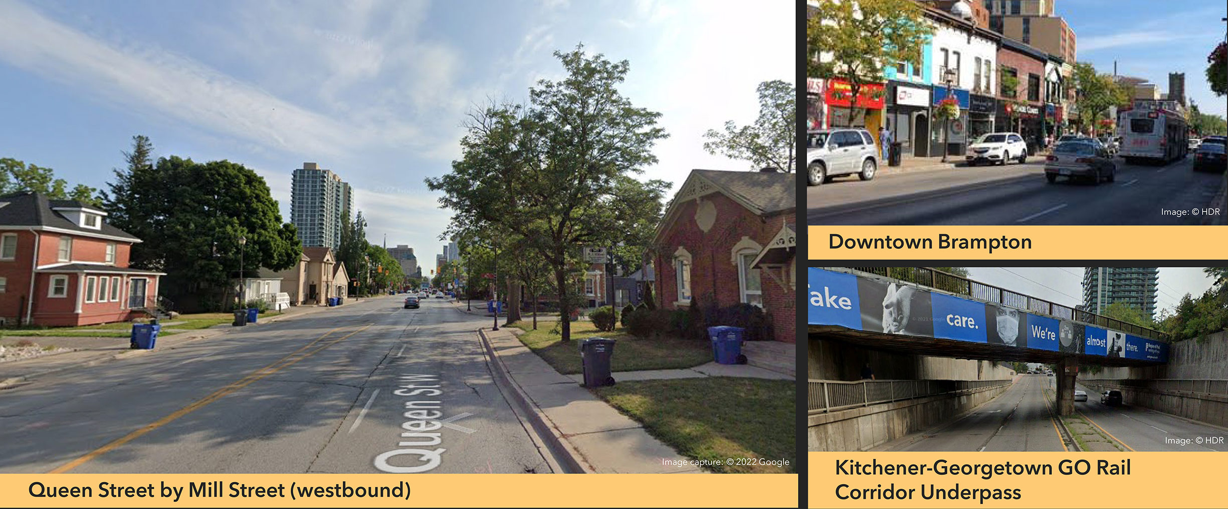
Segment 2: McLaughlin Road to Kennedy Road
Overview:
- Length: 3 km
- Land Use: Mix of residential and downtown commercial.
- Lanes: Four (4) to Five (5) through most of segment. On-street parking lanes in section of downtown area. Will be reduced to a 2-lane cross section between Theatre Lane and Mill Street (future condition).
- Additional Conditions: No dedicated cycling facilities
Right-of-Way:
- Existing: 20 - 35 m
- Official Plan: 20 - 36 m
Planning Concepts:
Click Focus Areas A and B on the map to see planning concepts for these specific areas in Segment 2.
Click on image to enlarge.
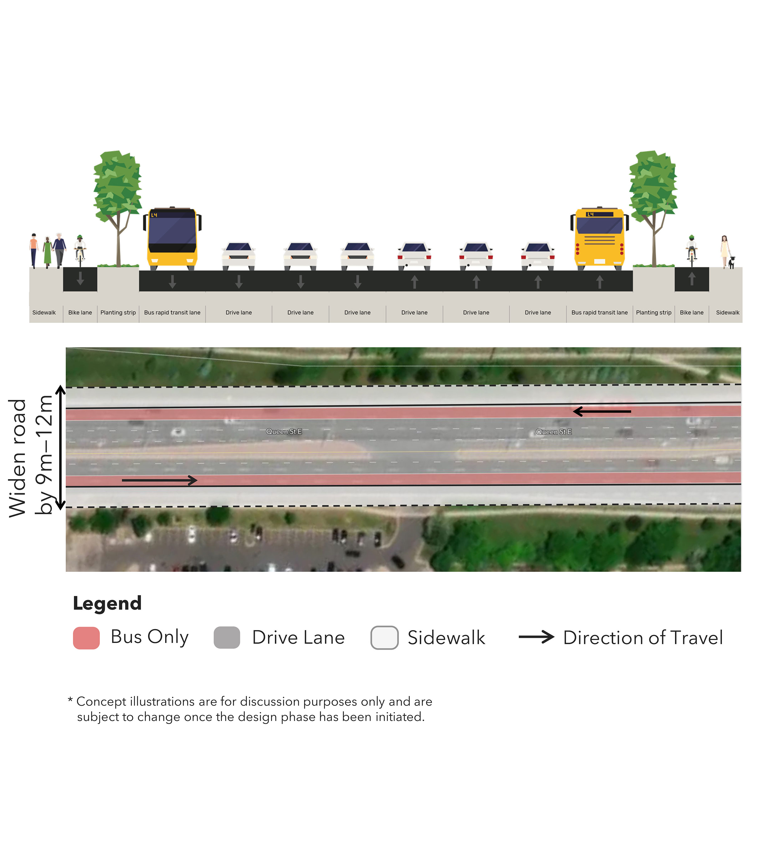
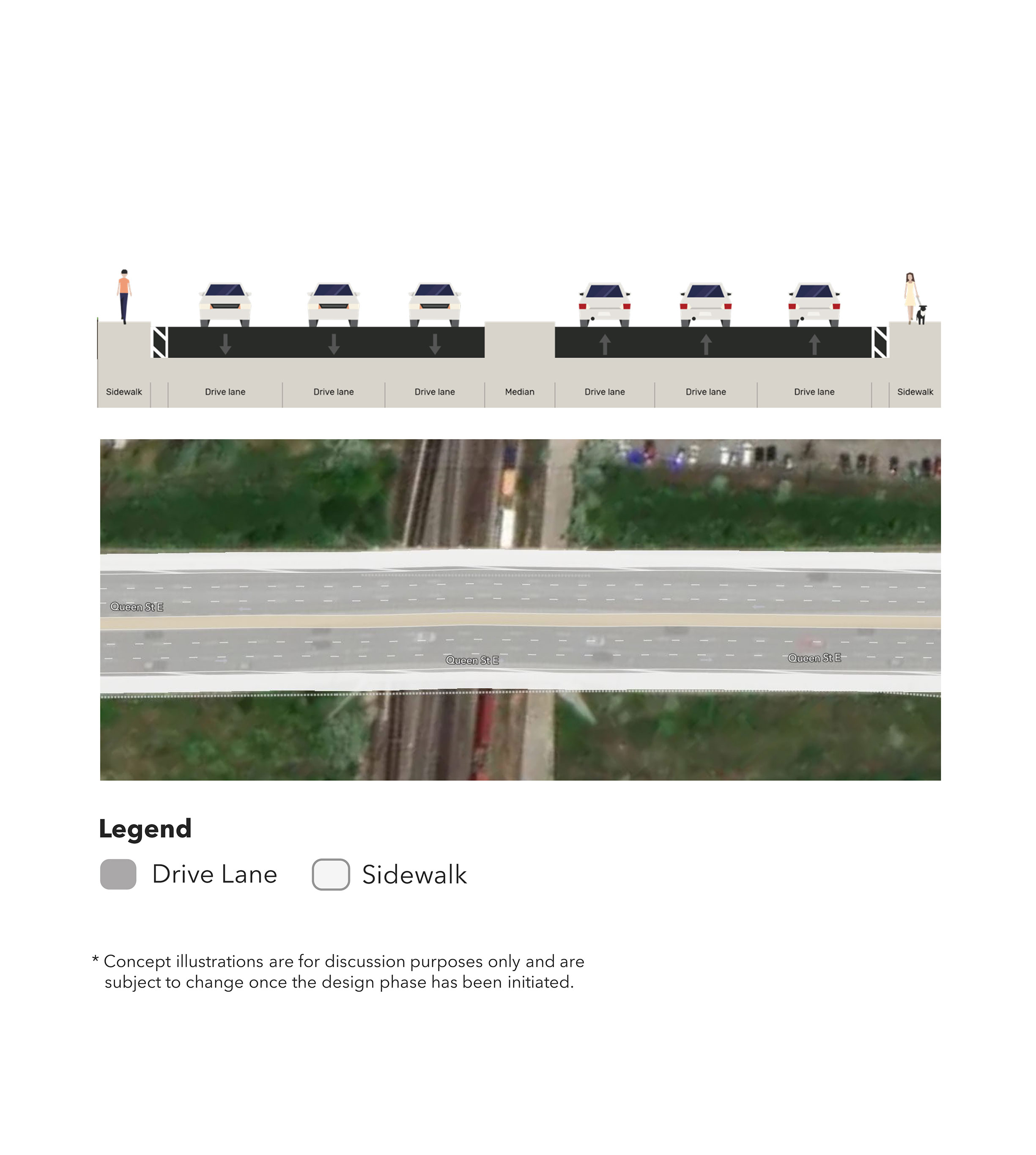
Segment 3: Kennedy Road to Highway 410
Overview:
- Length: 1.5 km
- Land Use: Mostly commercial
- Lanes: Seven (7).
- Additional Conditions: No cycling facilities. Many driveways/property access points on Queen Street.
Right-of-Way:
- Existing: 33 - 47 m
- Official Plan: 26 - 45 m
Planning Concepts:
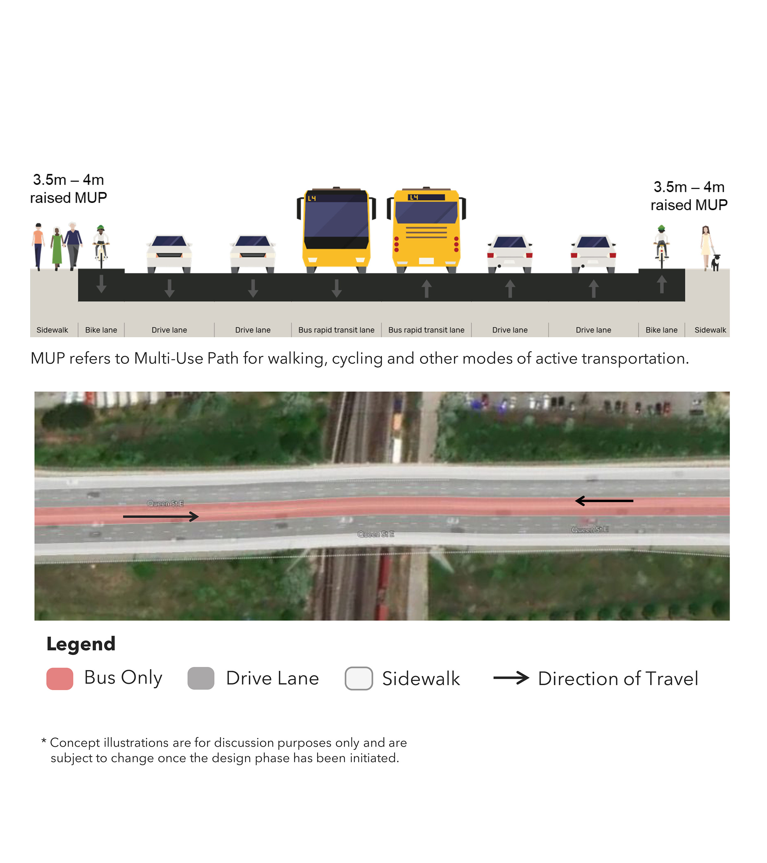
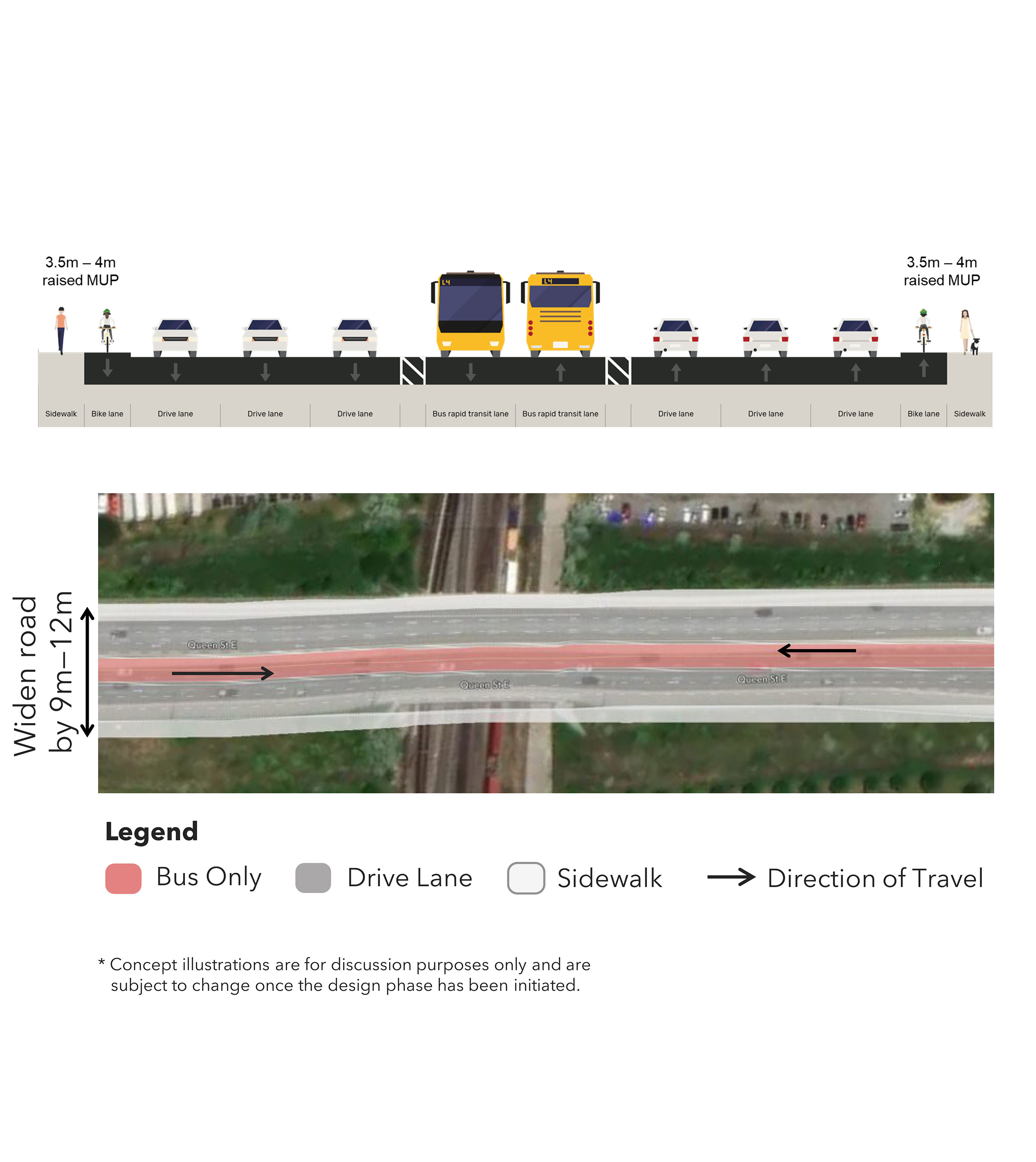
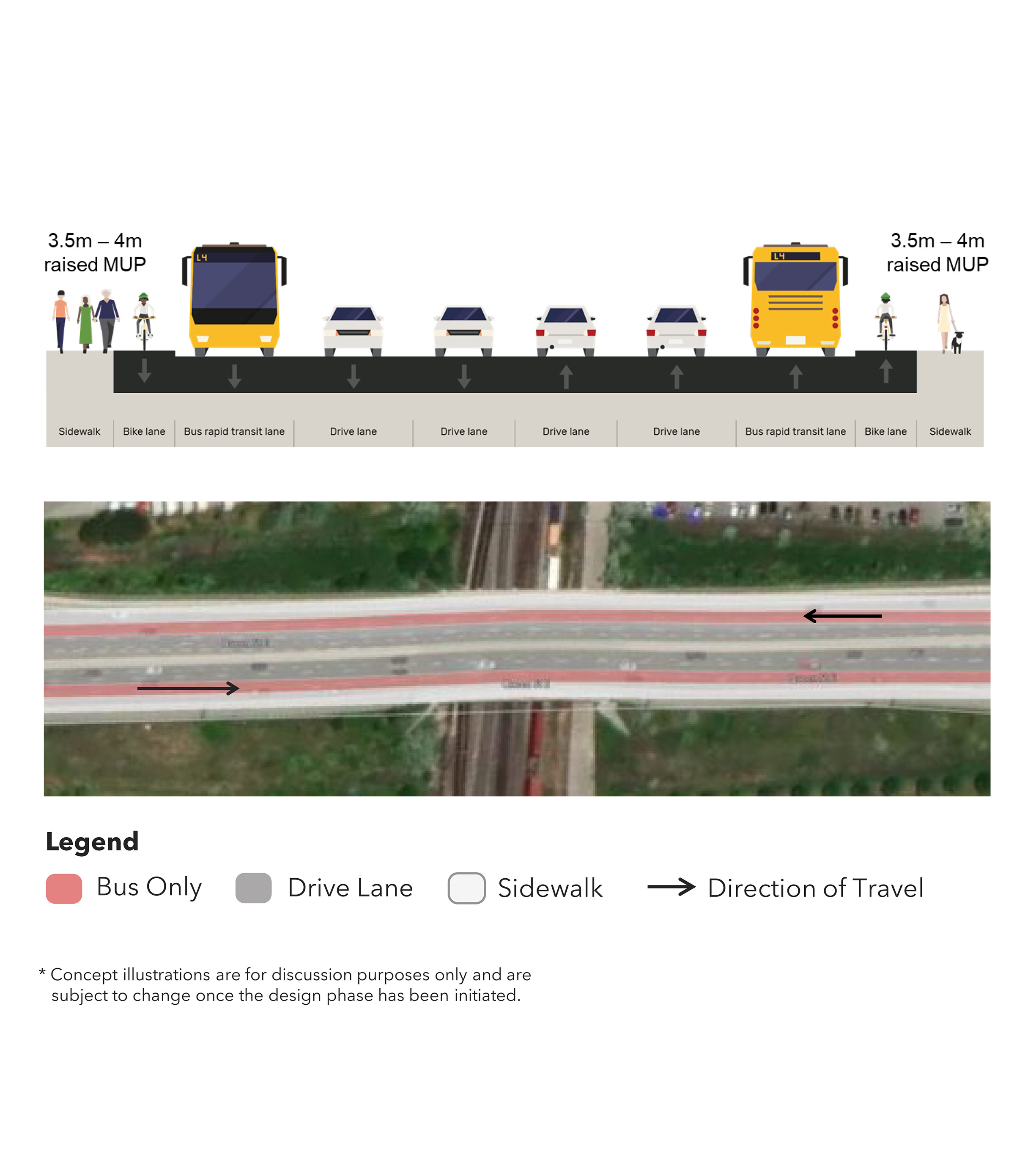
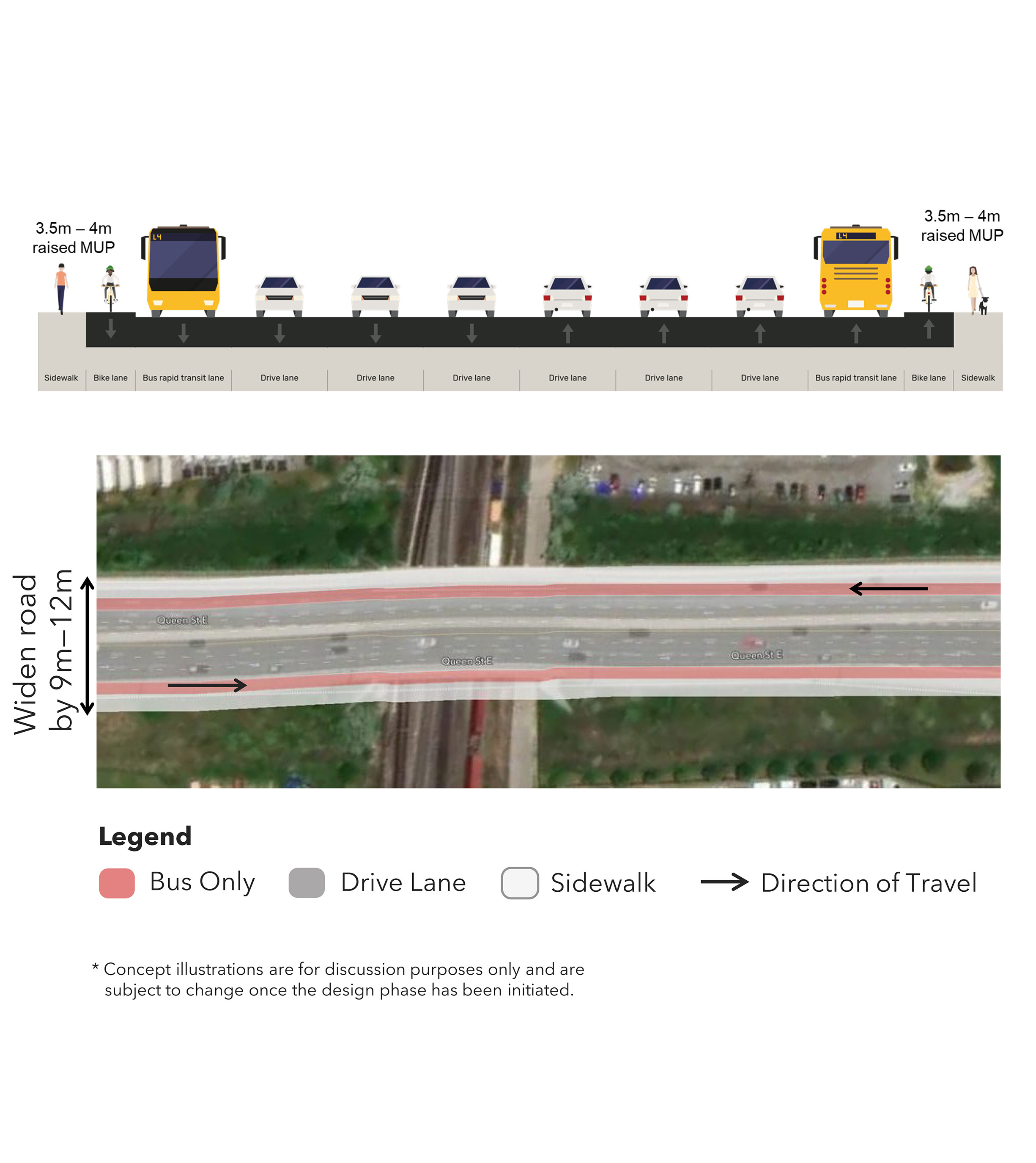
Concept A: Convert general purpose lane for median BRT.
Concept B: Keep all existing lanes and widen to include median BRT.
Concept C: Convert general purpose lane for curbside business access and transit lane.
Concept D: Keep all general purpose lanes and widen for curbside business access and transit lane.
Segment 4: Highway 410 to Highway 50
Overview:
- Length: 10 km
- Land Use: Mix of commercial, industrial, and residential land with conservation areas
- Lanes: Seven (7).
- Additional Conditions: No cycling facilities.
Right-of-Way:
- Existing: 42 - 55 m
- Official Plan: 45 m
Planning Concepts:
Concept A: Convert general purpose lane for median BRT.
Concept B: Keep all existing lanes and widen to include median BRT.
Concept C: Convert general purpose lane for curbside business access and transit lane.
Concept D: Keep all general purpose lanes and widen for curbside business access and transit lane.
Segment 5: Highway 50 to Kipling Avenue
Overview:
- Length: 4.5 km
- Land Use: Commercial and industrial.
- Lanes: Six (6) to Seven (7).
- Additional Features: Goods movement corridor. No cycling facilities. Many driveways/property access points on Highway 7.
Right-of-Way:
- Existing: 42 - 56 m
- Official Plan: 45 m
Planning Concepts:
Concept A: Convert general purpose lane for median BRT.
Concept B: Keep all existing lanes and widen to include median BRT.
Concept C: Convert general purpose lane for curbside business access and transit lane.
Concept D: Keep all general purpose lanes and widen for curbside business access and transit lane.
Segment 6: Kipling Avenue to Wigwoss Drive
Overview:
- Length: 1.5 km
- Land Use: Residential with natural features.
- Lanes: Four (4) to Five (5).
- Additional Conditions: No dedicated cycling facilities. Connects to existing Viva Rapidway.
Right-of-Way:
- Existing: 28 - 48 m
- Official Plan: 45 m
Planning Concepts:
Concept A: Convert general purpose lane for median BRT.
Concept B: Keep all existing lanes and widen to include median BRT.
Concept C: Convert general purpose lane for curbside business access and transit lane.
Concept D: Keep all general purpose lanes and widen for curbside business access and transit lane.
Focus Area A: Downtown Bus Terminal / GO Station
Opportunities:
- Provincial Urban Growth Centre, part of the Central Area of a rapidly developing city.
- Development potential for a walkable, mixed-use, transit-oriented centre.
- Connecting local and regional transit (bus and rail) at Brampton GO Station.
Challenges:
- Strong heritage value: the intersection of Queen Street and Main Street, the ‘Four Corners,’ marks the symbolic heart of the historic downtown.
- Integrate BRT exchange and transfers with possible future transit projects (Brampton LRT and Downtown Transit Hub location).
- Narrow streets limiting the opportunity for dedicated transit.
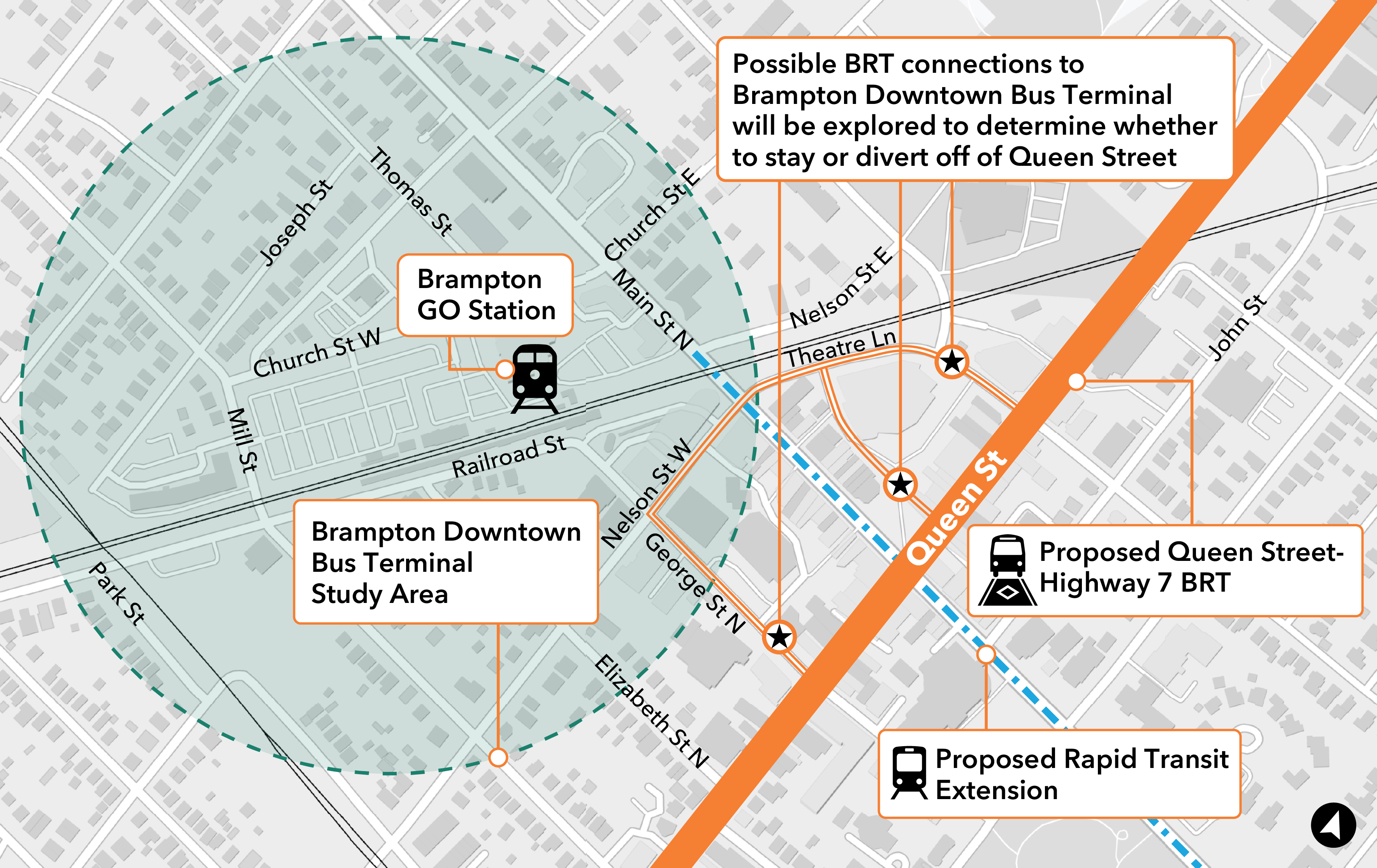
Click on image to enlarge.
Planning Concepts:
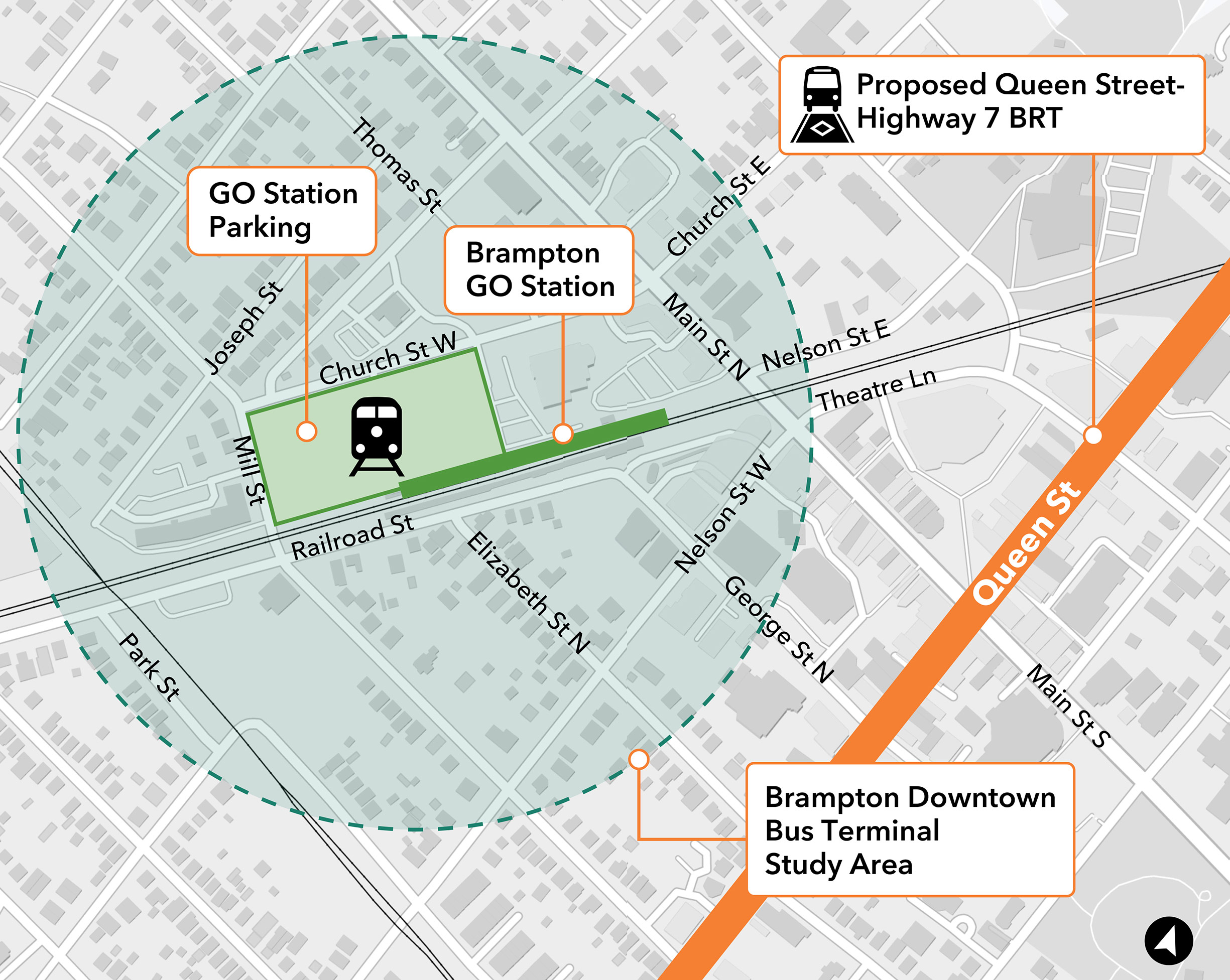
Concept A: BRT stays on Queen Street with station located near Main Street.
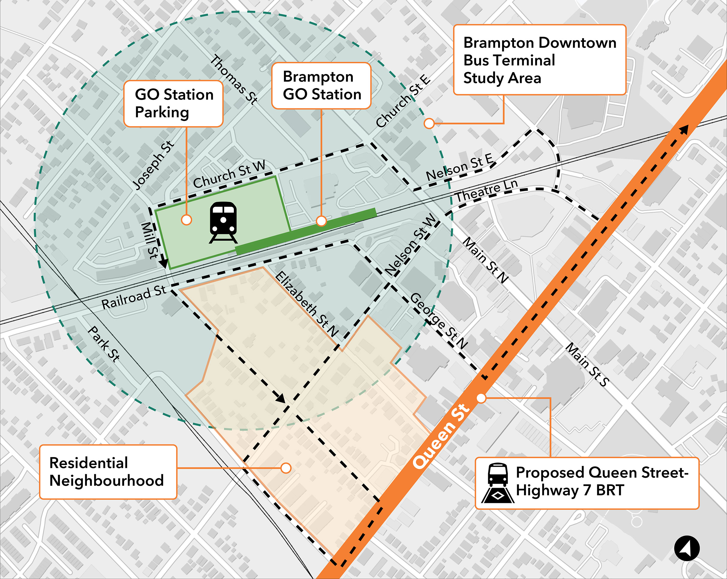
Concept B: Divert BRT off Queen Street to the Future Bus Terminal or GO Station.
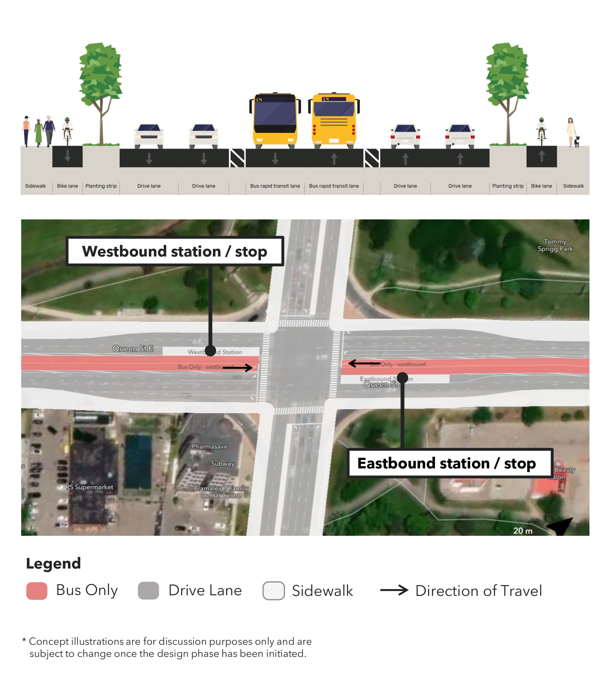
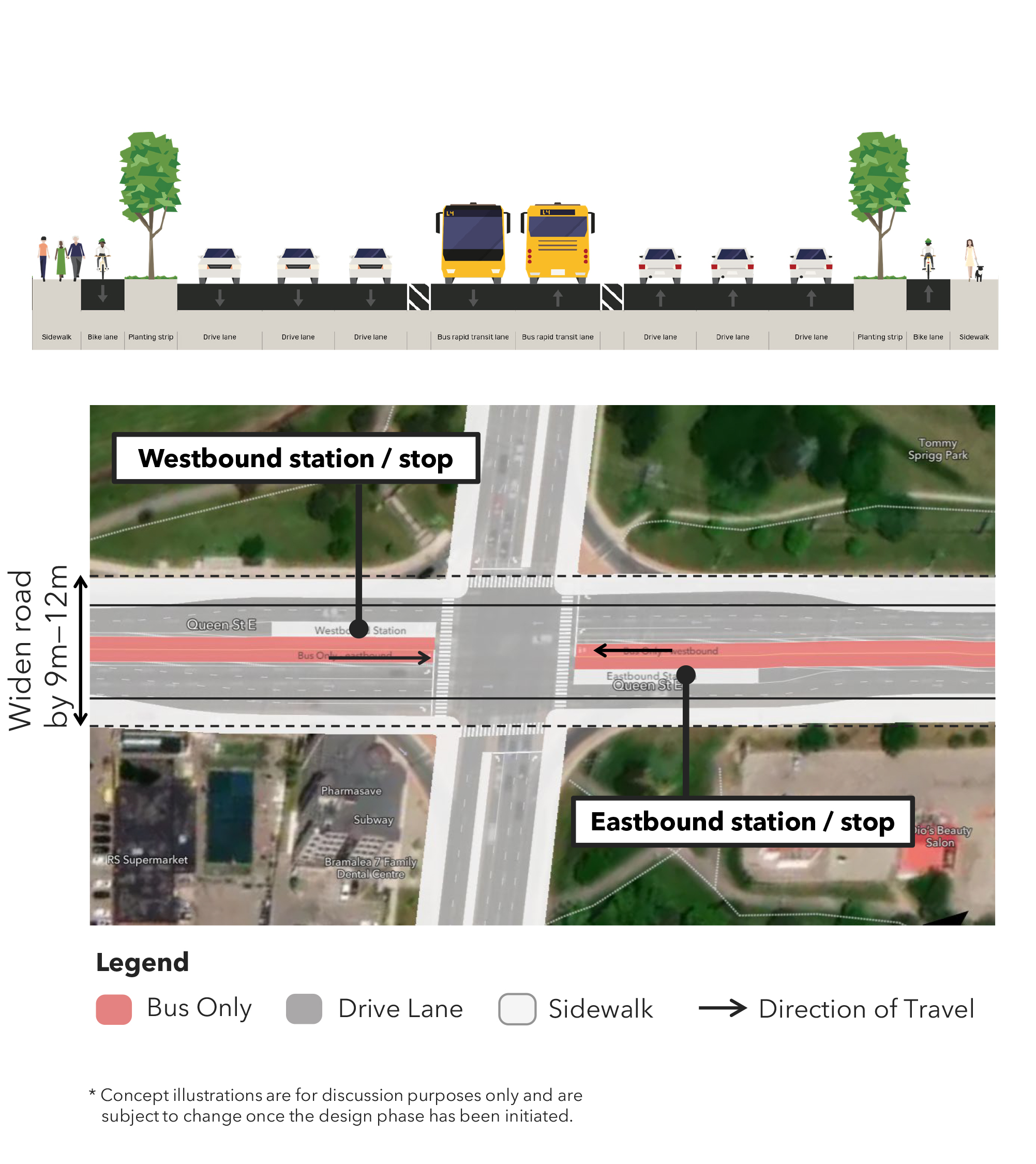
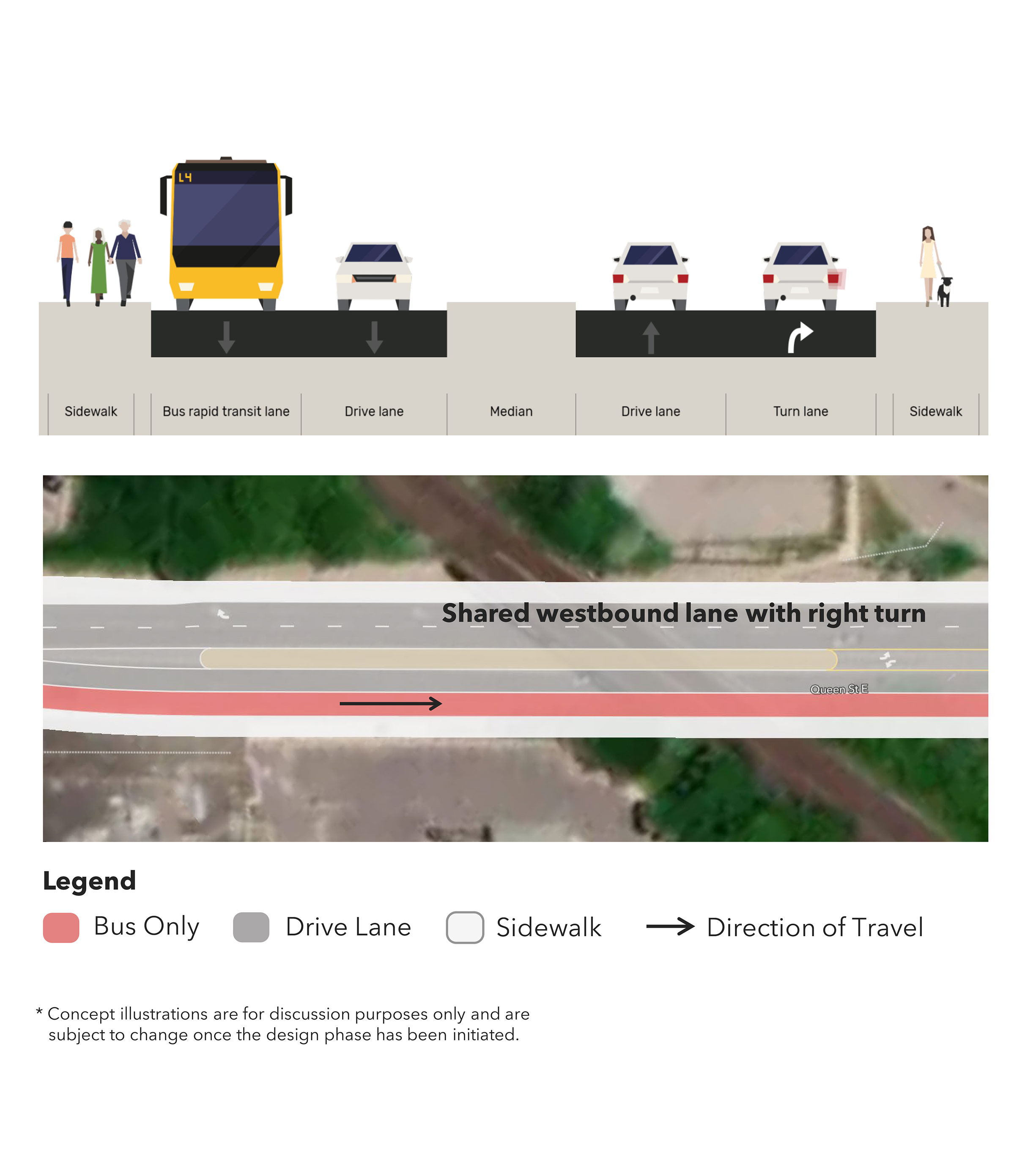
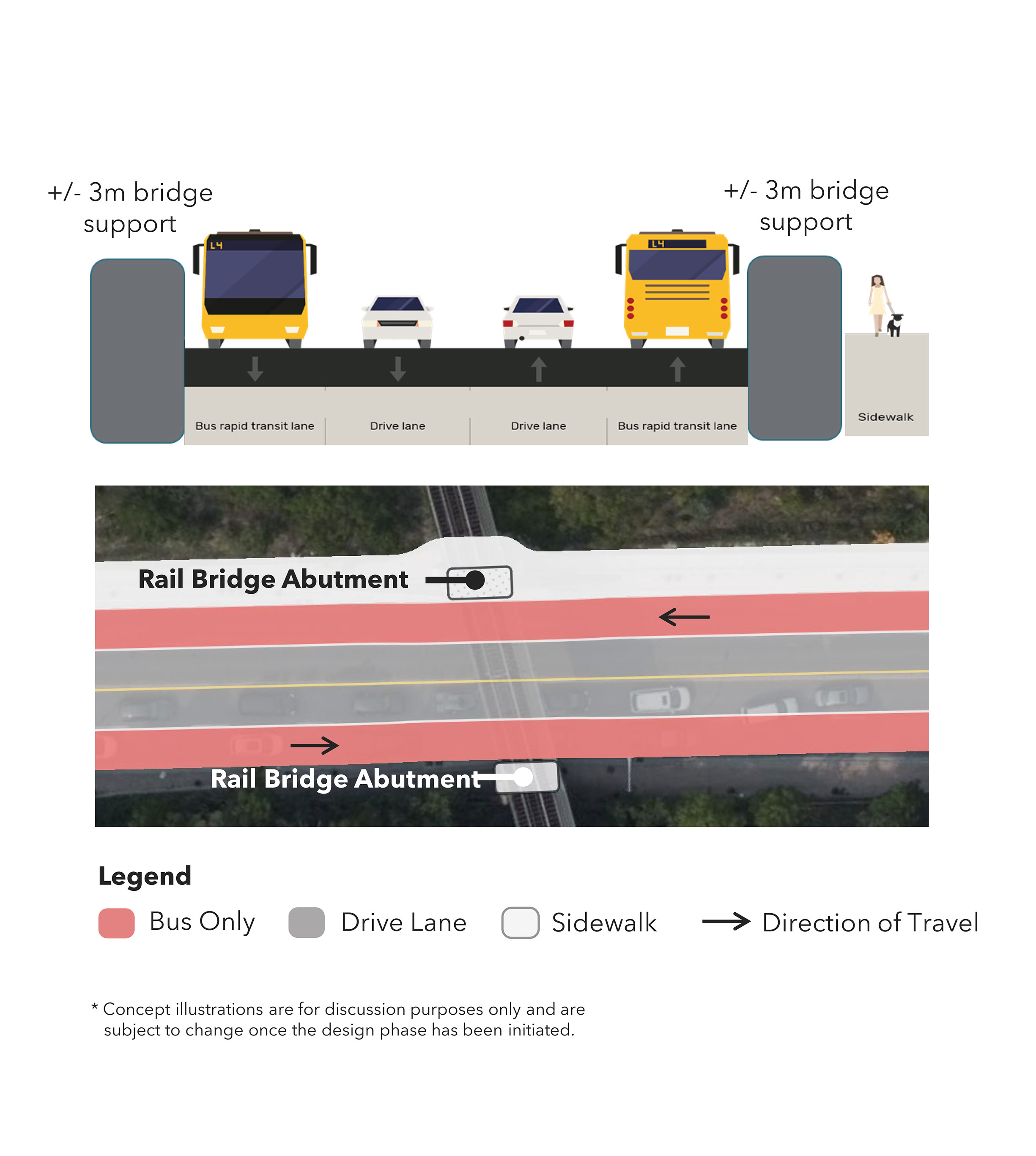
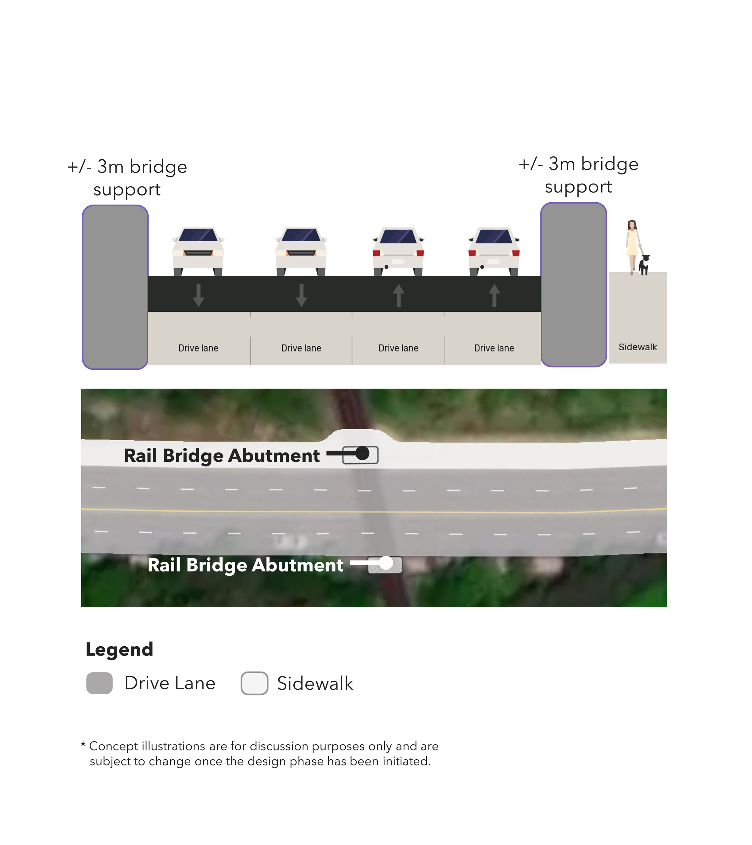
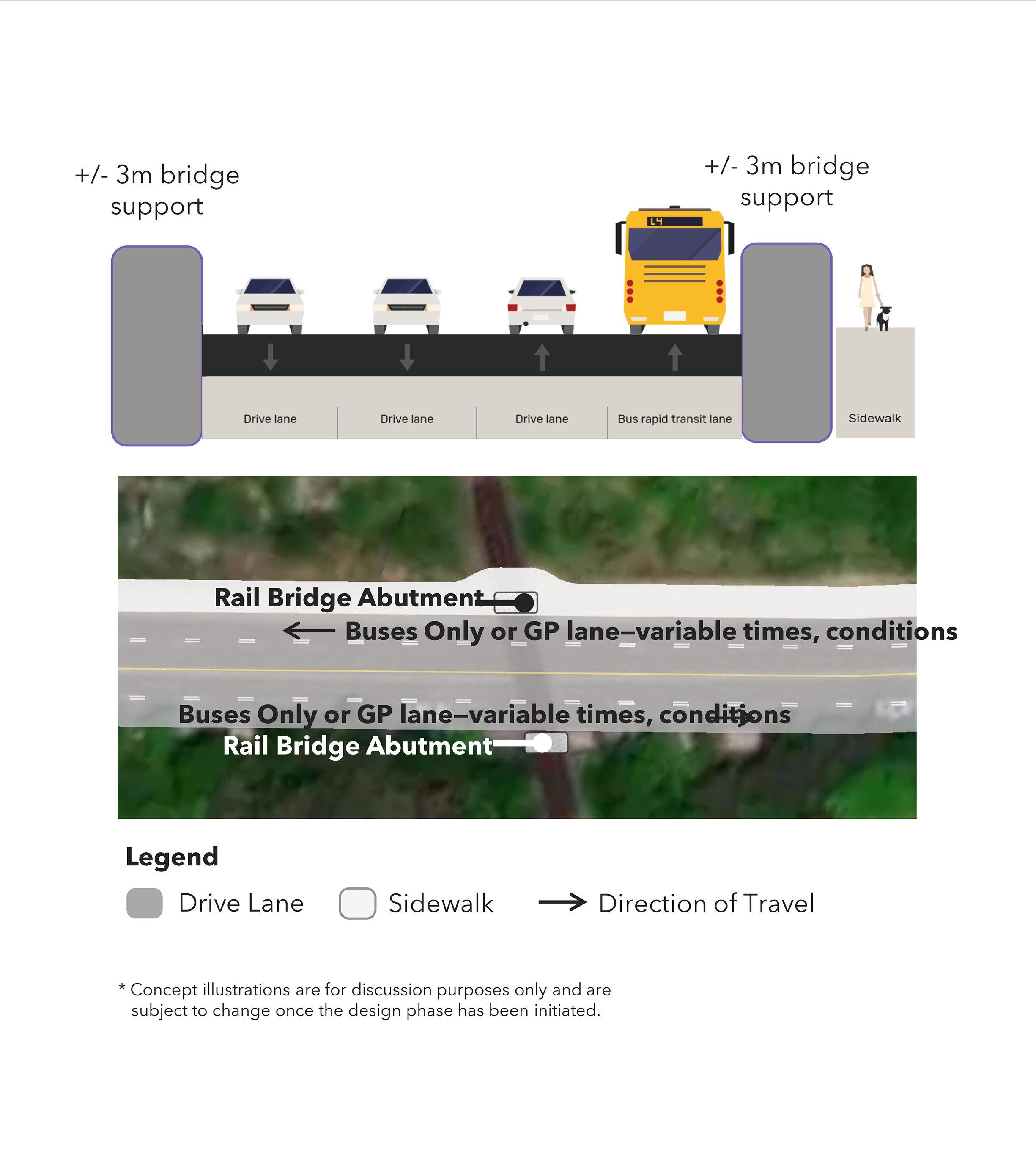
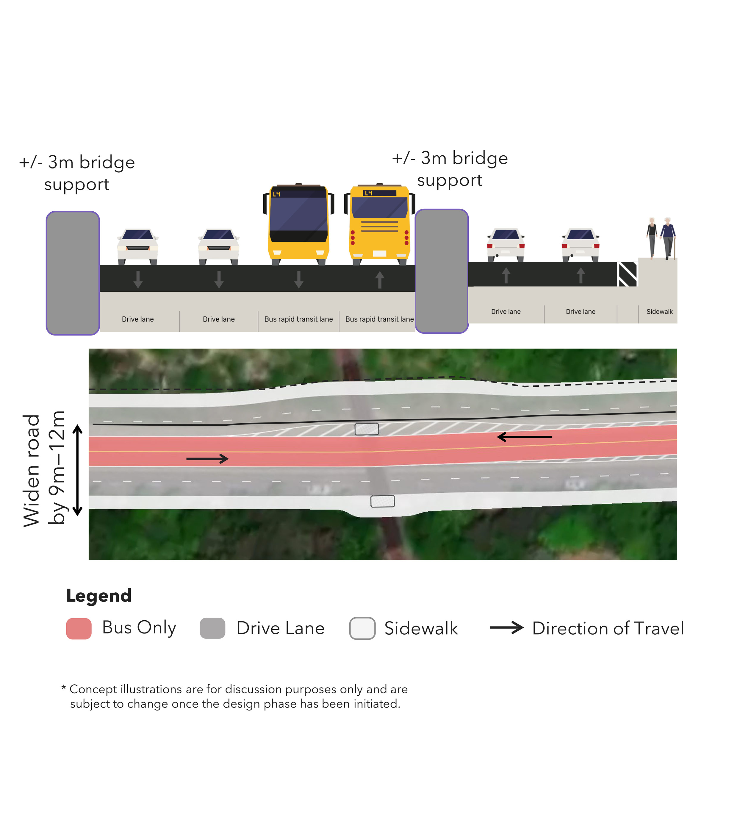
Focus Area B: Kitchener-Georgetown GO Rail Corridor Underpass
Opportunities:
- Improve connections to Züm and GO Transit services.
- Improve connection of Queen Street with Downtown Brampton.
- Prioritizing transit in a constrained area to improve greater mobility along Queen Street.
Challenges:
- Narrow Right-of-Way.
- High costs to acquire land for rail bridge widening.
- Service impacts to Kitchener-Georgetown GO service due to construction.
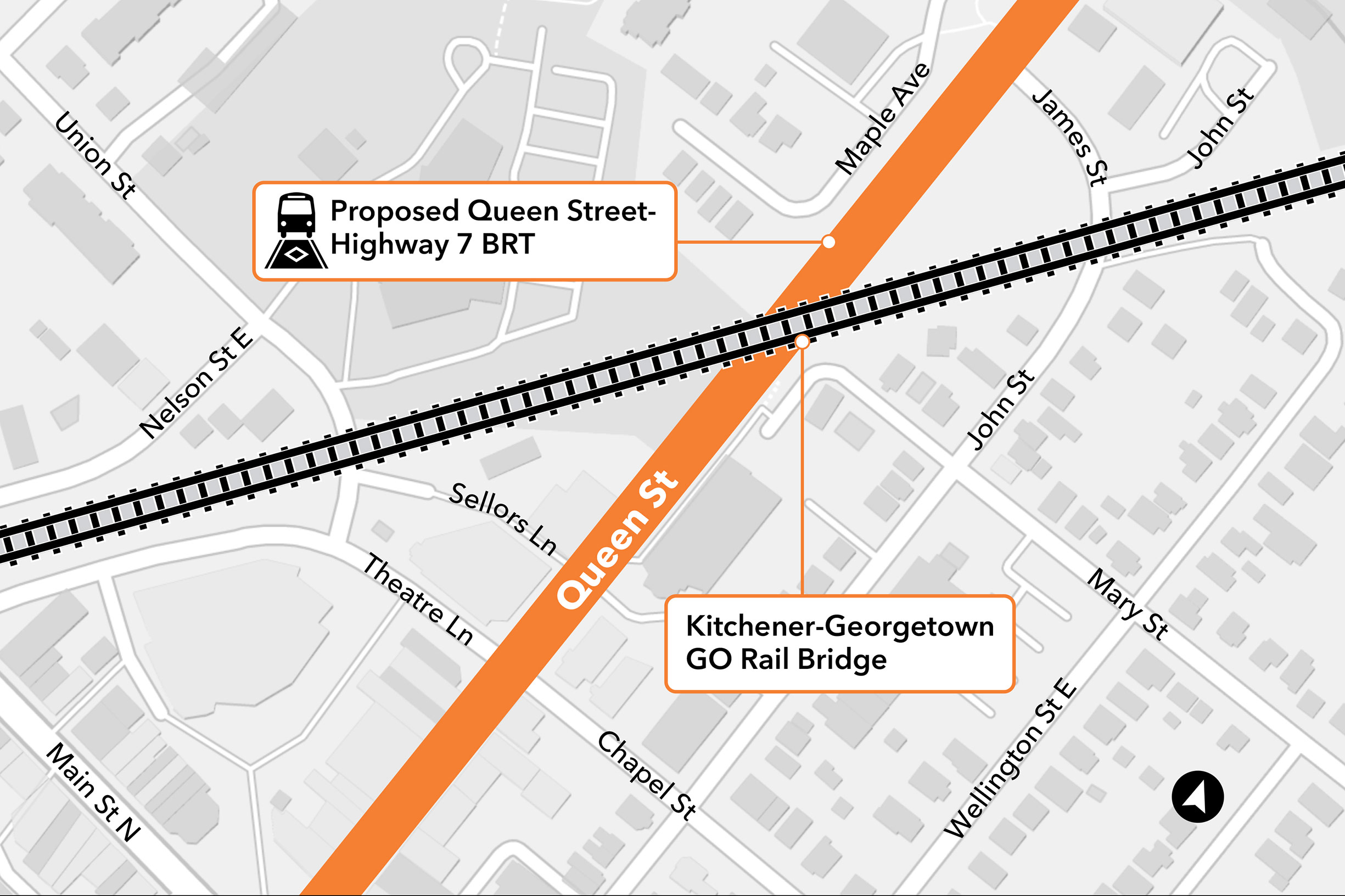
Click on image to enlarge.
Planning Concepts:
Concept A: Eastbound BRT lane with general purpose lane removed.
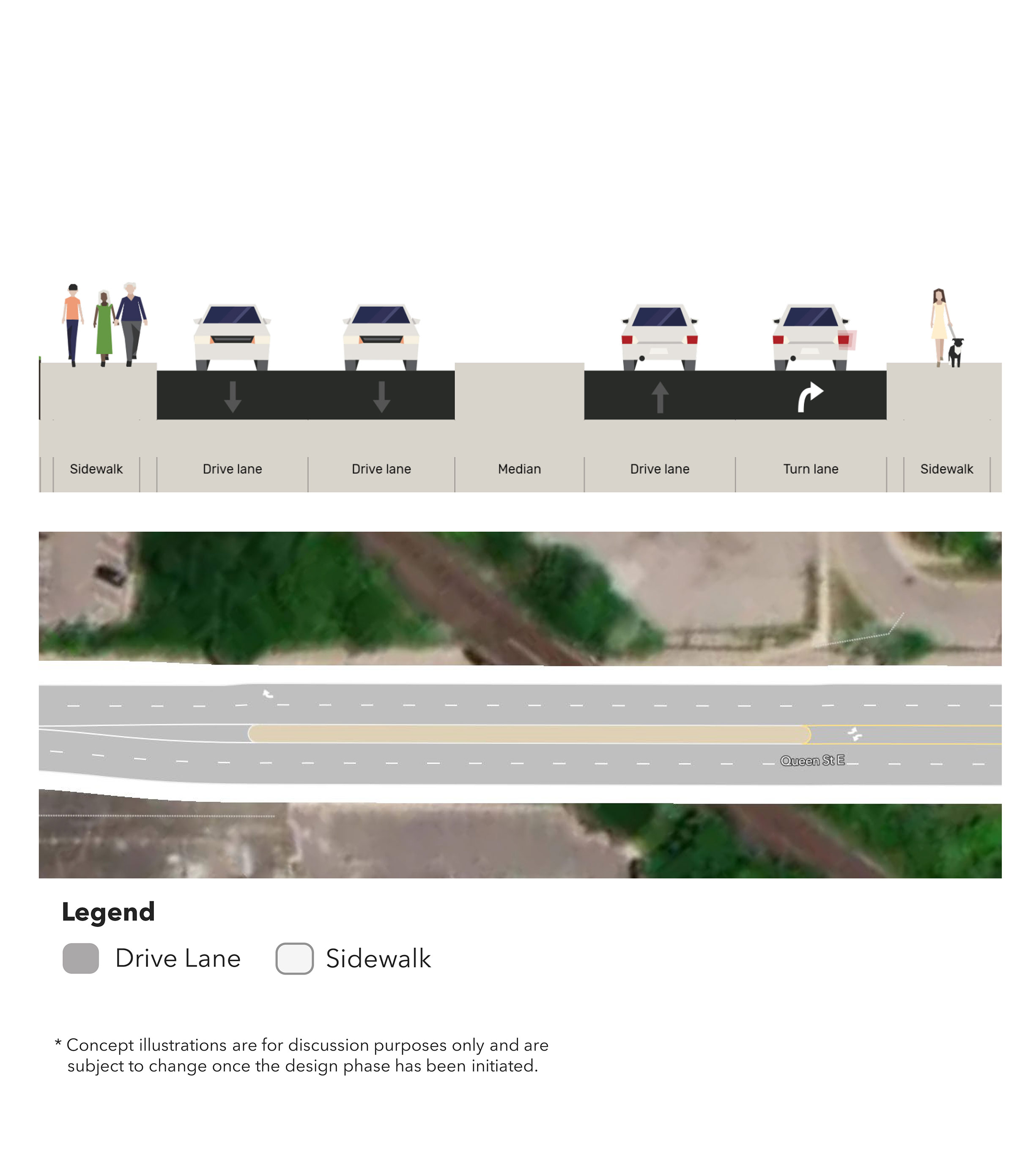
Concept B: Mixed traffic operations.
Concept C: Eastbound BRT lane with one general purpose lane removed.
Concept D: Westbound BRT lane.
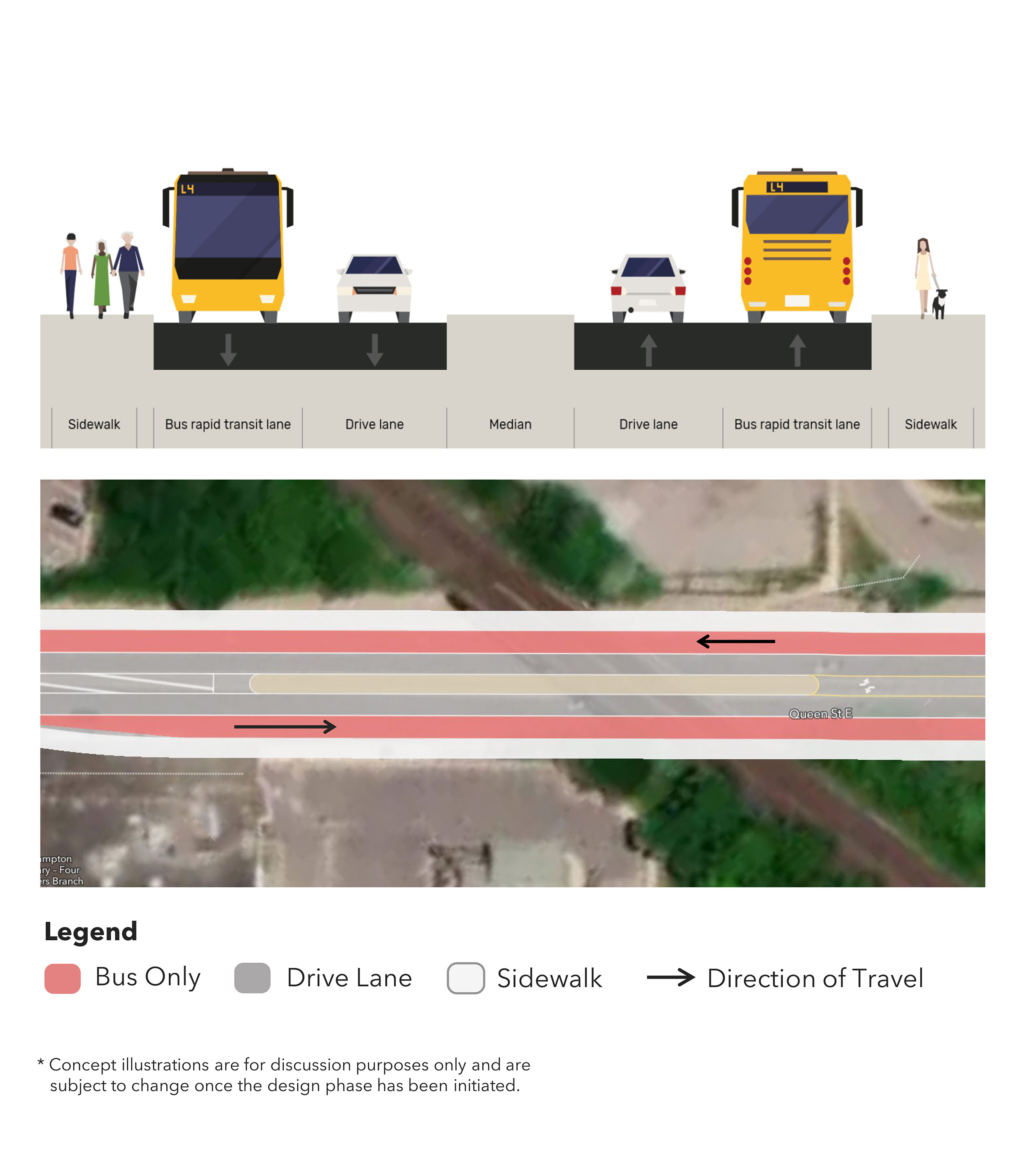
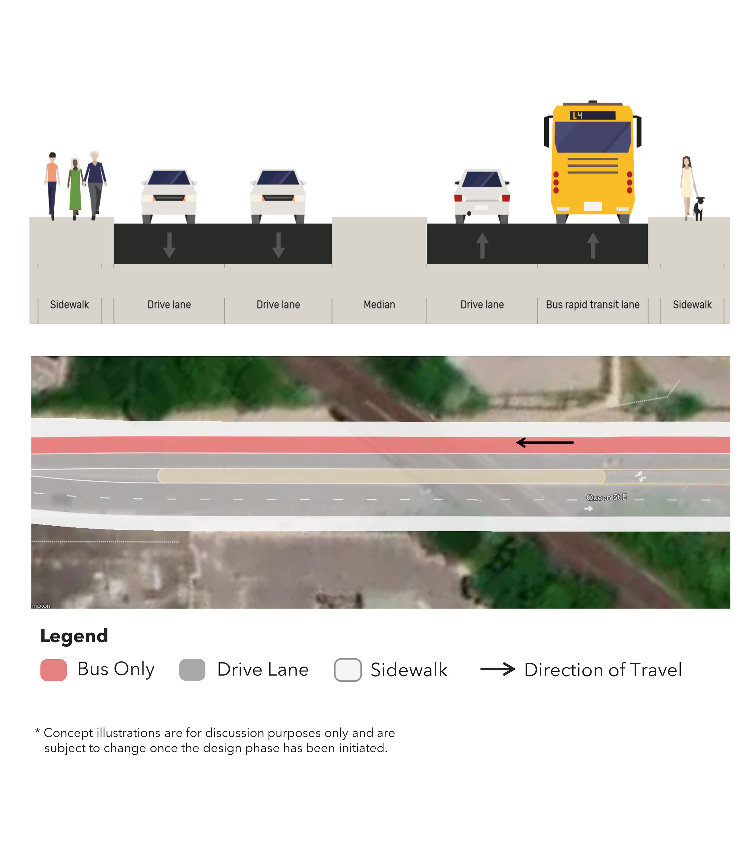
Focus Area C: Highway 410 Interchange
Opportunities:
- Next to commercial lands with access to employment (opportunity for higher density).
- Active transportation facilities approaching the Highway 410 interchange.
Challenges:
- High costs to reconstruct interchange ramps and to widen bridge.
- Property acquisitions needed to widen the Right-of-Way.
- Highway on/off ramps create conflicts for cyclists and pedestrians.
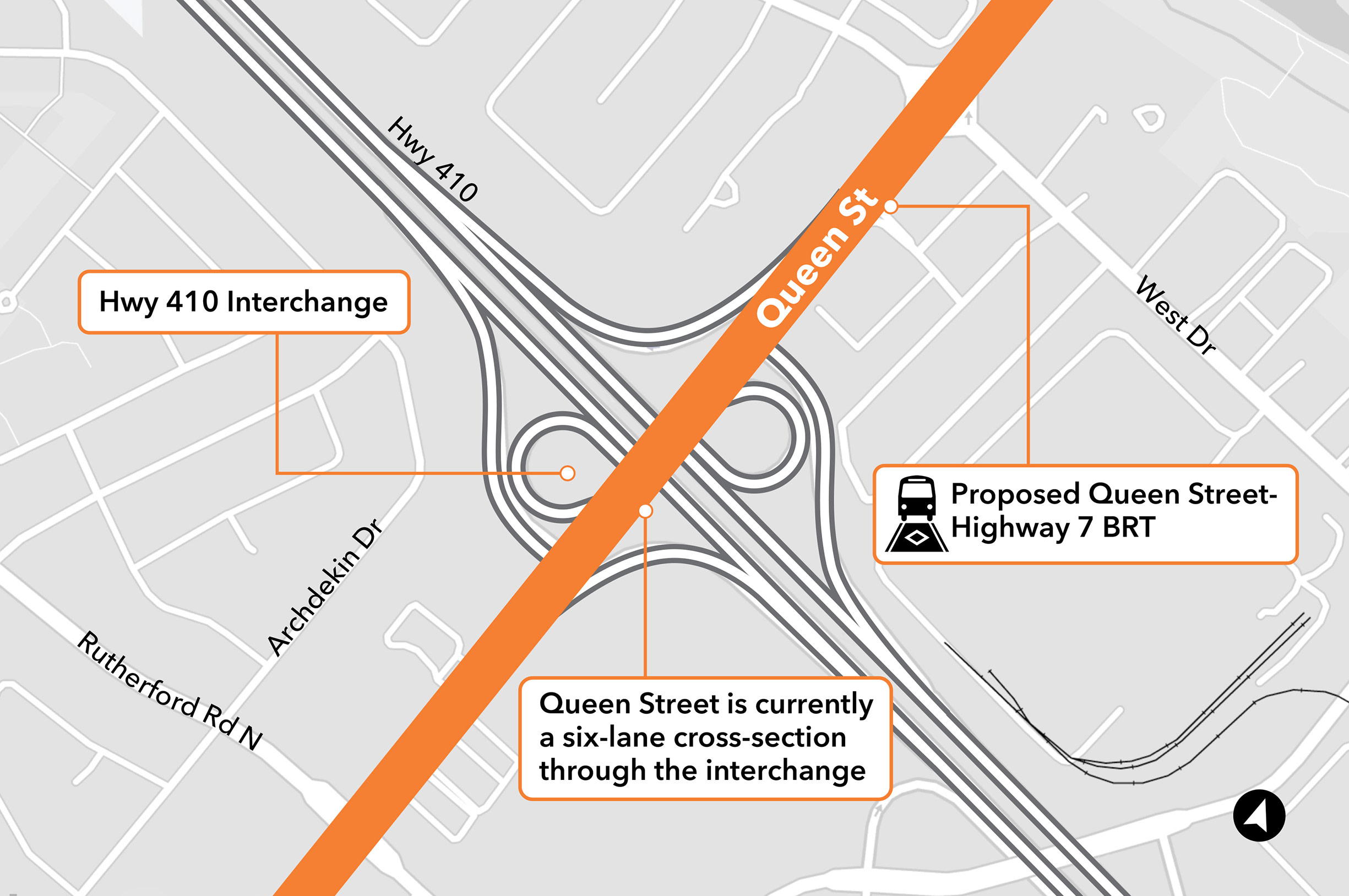
Click on image to enlarge.
Planning Concepts:
Planning concepts for Highway 410 are being developed in consultation with Ministry of Transportation.
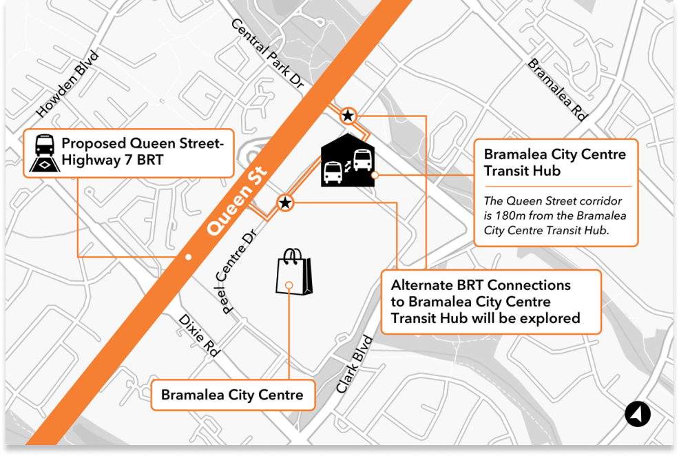
Focus Area D: Bramalea City Centre Transit Hub
Opportunities:
- Refreshed Bramalea City Centre with opportunities for residential, employment, and retail.
- Connections to Chinguacousy Park: a major landmark and recreation destination.
- Connection of local and regional (bus) transit at Bramalea Terminal.
Challenges:
- Costs to widen structure and ramp into Bramalea City Centre.
- Primary truck route.
- High auto volumes in some areas, partially due to access to Highway 410.
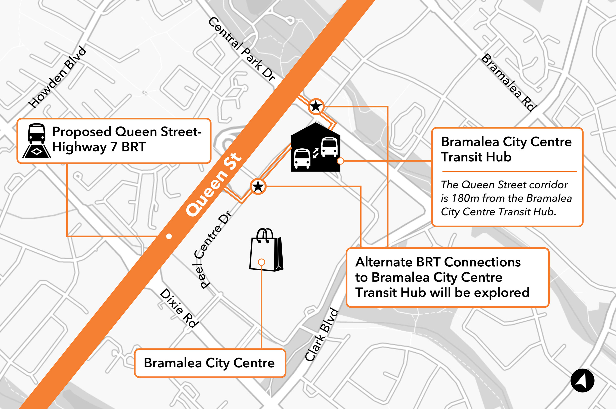
Click on image to enlarge.
Planning Concepts:
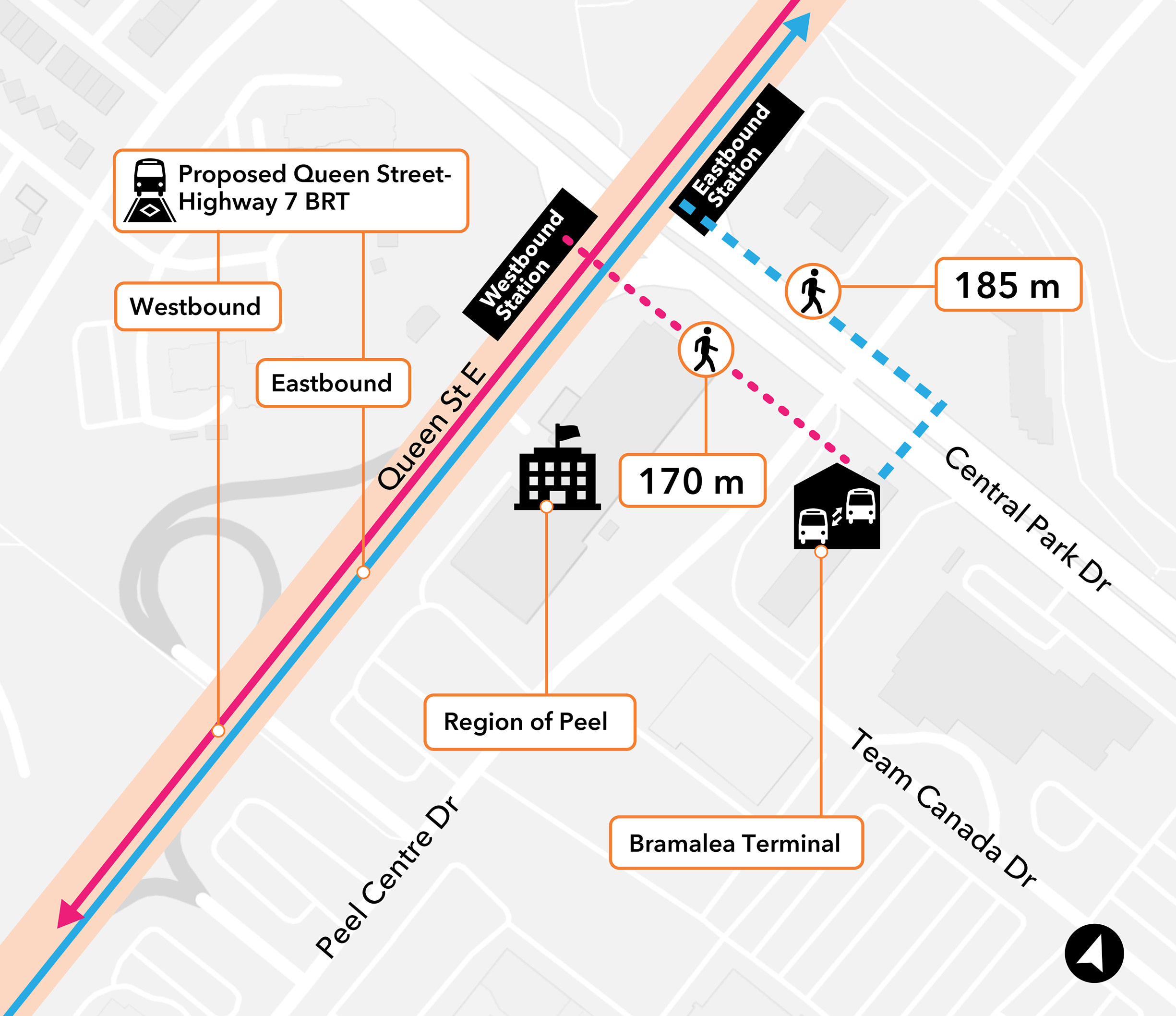
Concept A: Station located on Queen Street.
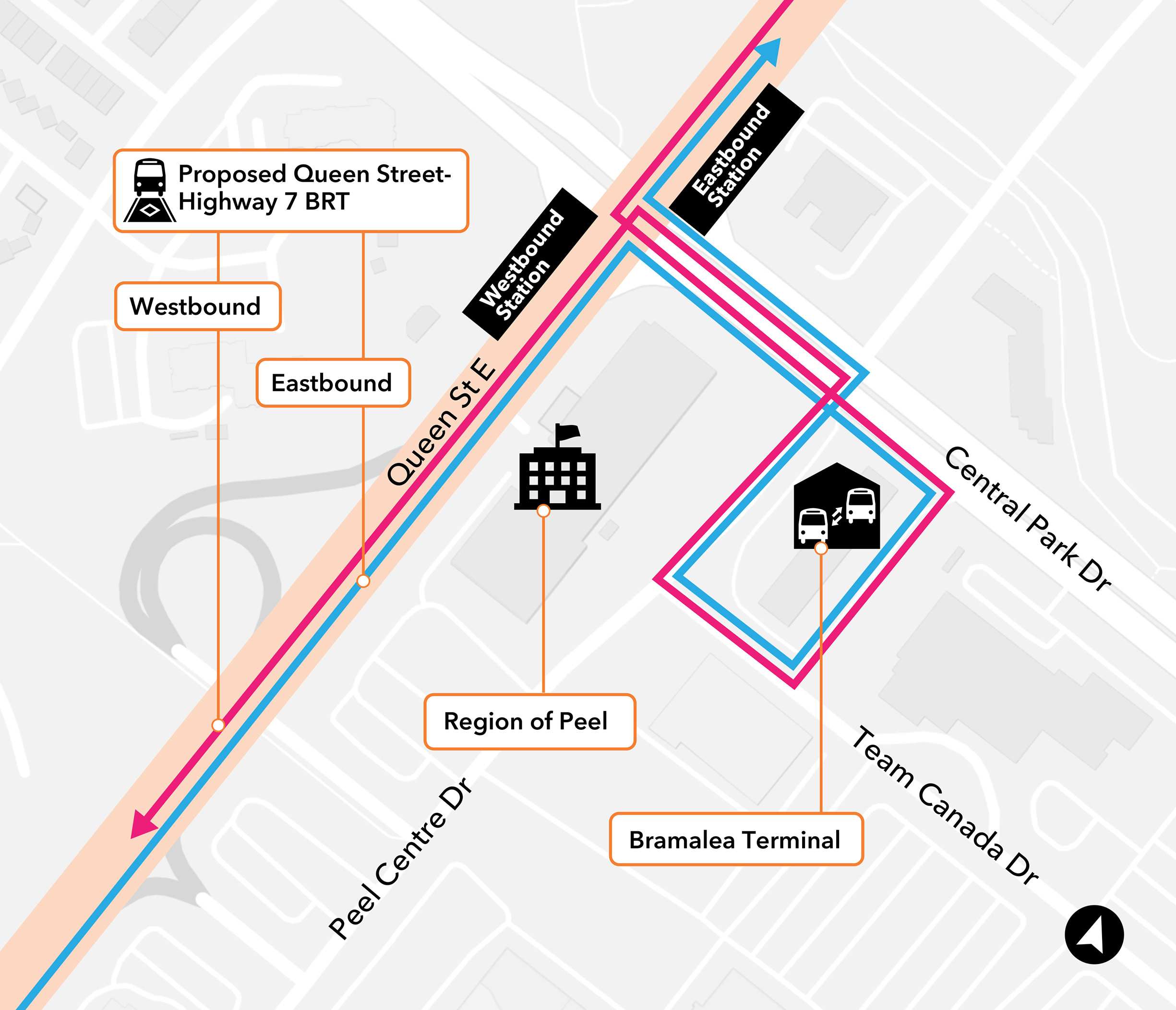
Concept B: BRT diverts off Queen Street to Bramalea Terminal via Central Park Drive.
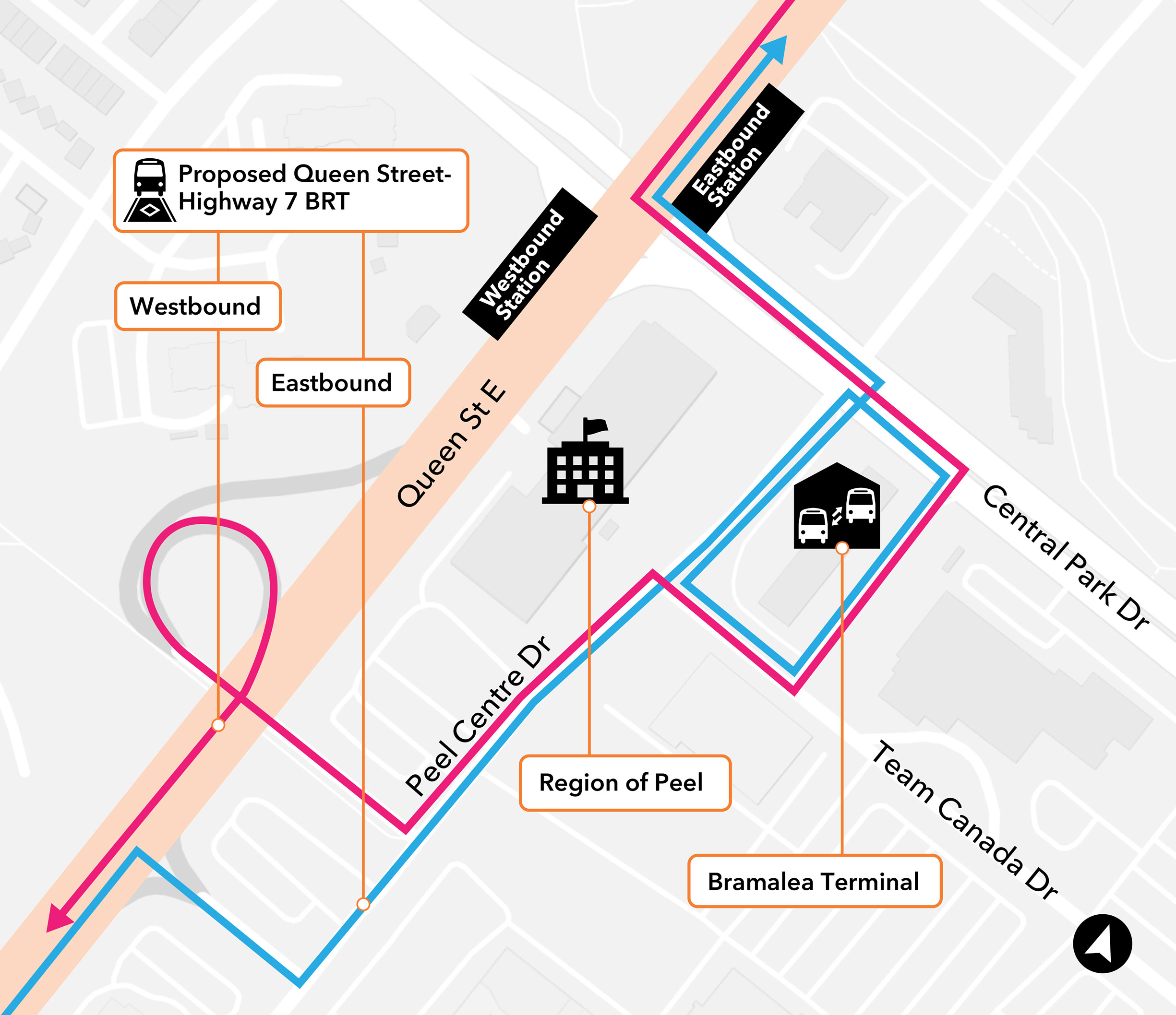
Concept C: BRT diverts off Queen Street to Bramalea Terminal via Peel Centre Drive.
Focus Area E: Delta Park Boulevard to Auction Lane & Rail Structure at CN Intermodal Yard
Opportunities:
- Improve access to manufacturing and industrial employment areas.
- Redevelopment potential of large, low-intensity sites fronting Queen Street.
- Potential connection point to existing transit routes on Goreway Drive.
Challenges:
- Primary trucking route with high traffic volumes.
- Property acquisition needed to widen the area.
- Widening the structure may result in clearance-related impacts.
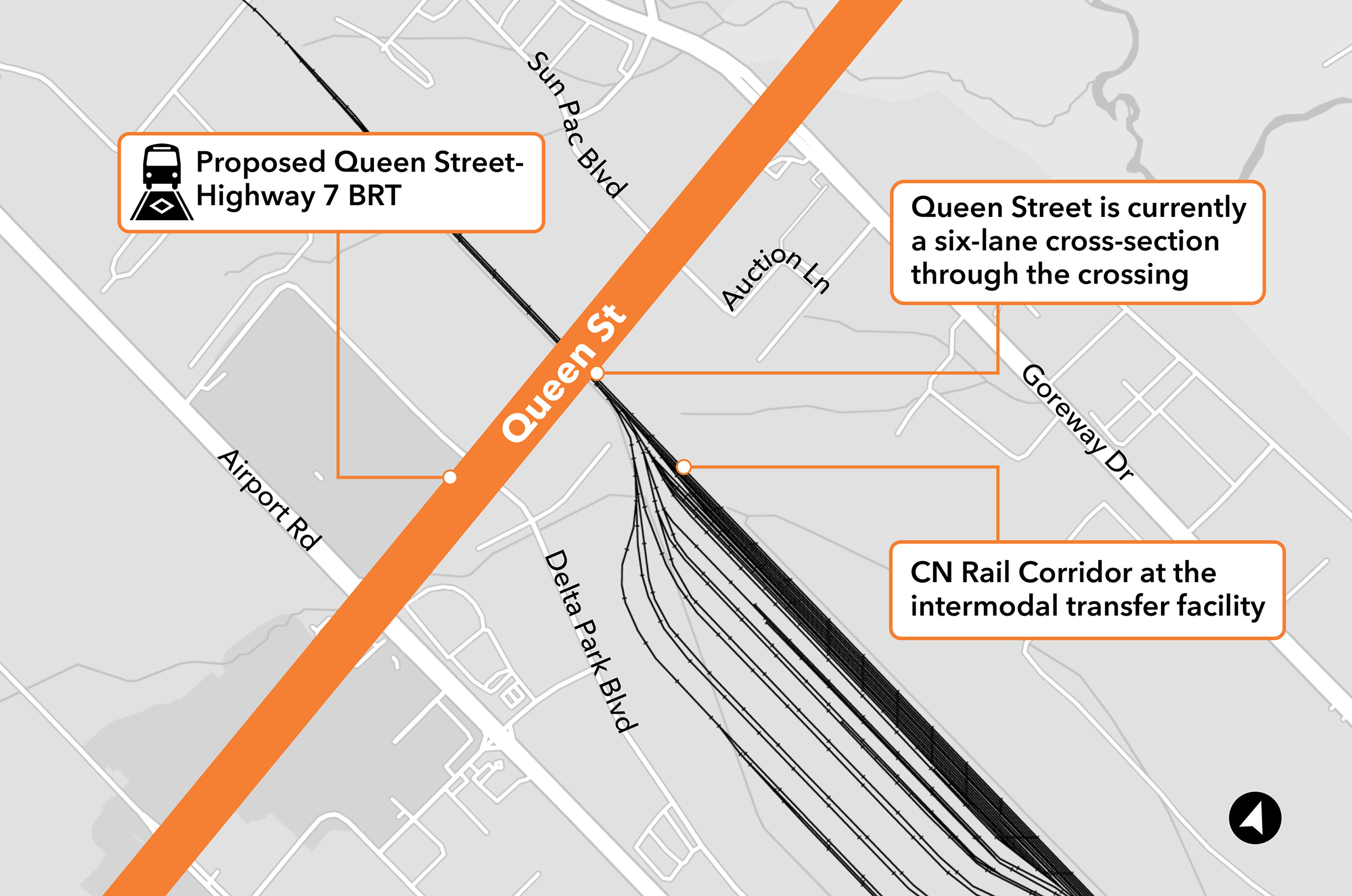
Click on image to enlarge.
Planning Concepts:
Concept A: Centre BRT with one general purpose lane removed.
Concept B: Centre BRT with all general purpose lanes retained. A new structure would be needed.
Concept C: Curbside BRT with one general purpose lane removed.
Concept D: Curbside BRT with all general purpose lanes retained. A new structure would be needed.
Concept E: Mixed traffic operations.
Focus Area F: Claireville Conservation Area (Goreway Drive to The Gore Road)
Opportunities:
- Connections to Claireville Conservation Area, parks, and valley lands.
- Opportunity to improve street network.
- The Gore neighbourhood is designated for mix of residential and employment land.
- Streetscaping and active transportation infrastructure.
Challenges:
- The Claireville Conversation Area and associated valley lands is of significant natural heritage.
- Valley lands act as pedestrian barrier.
- Primary trucking route.
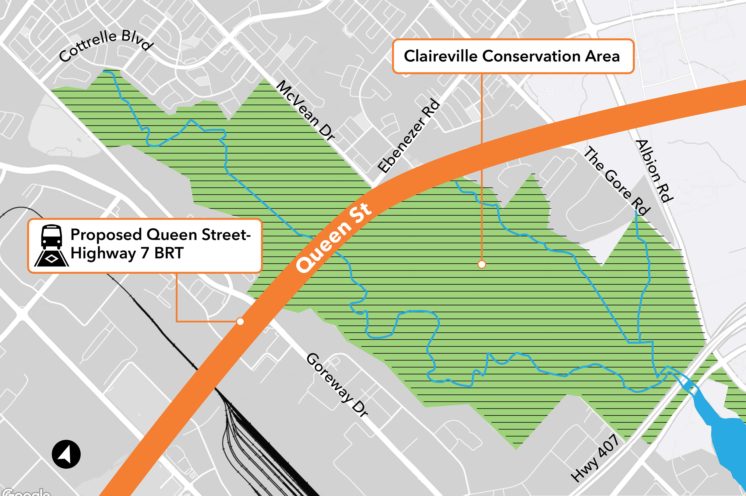
Click on image to enlarge.
Focus Area G: Highway 427 Interchange - 6 Lane Structure
Opportunities:
- Access to the industrial and manufacturing employment area.
- Active transportation facilities approaching the interchange.
Challenges:
- Costs to widen bridge and reconstruction of interchange ramps.
- Land acquisitions needed to widen area.
- On/off ramps create conflicts for cyclists and pedestrians.
- North-south hydro corridor.
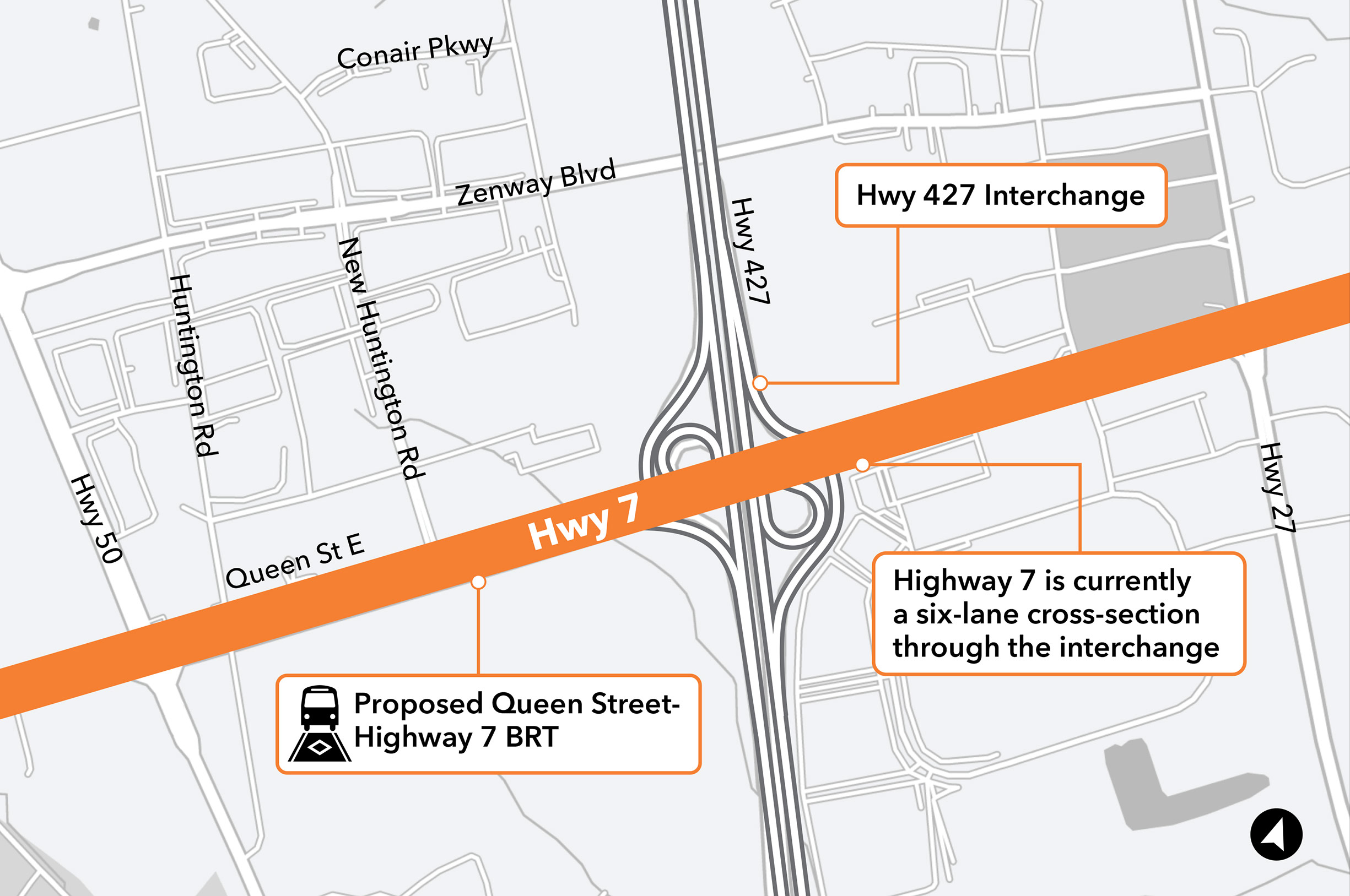
Click on image to enlarge.
Planning Concepts:
Planning concepts for Highway 427 are being developed in consultation with Ministry of Transportation.
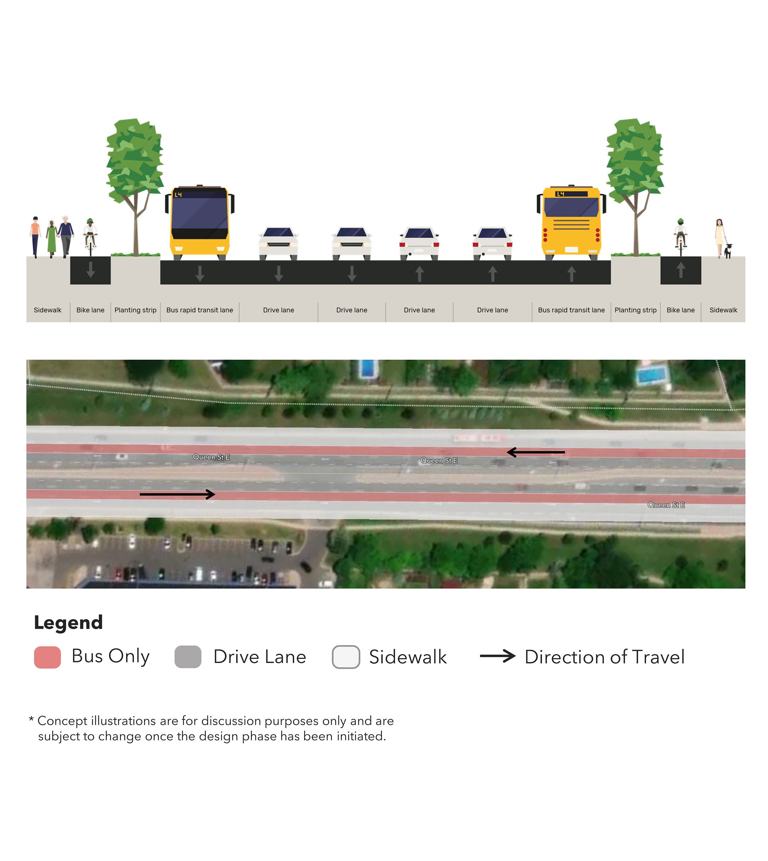
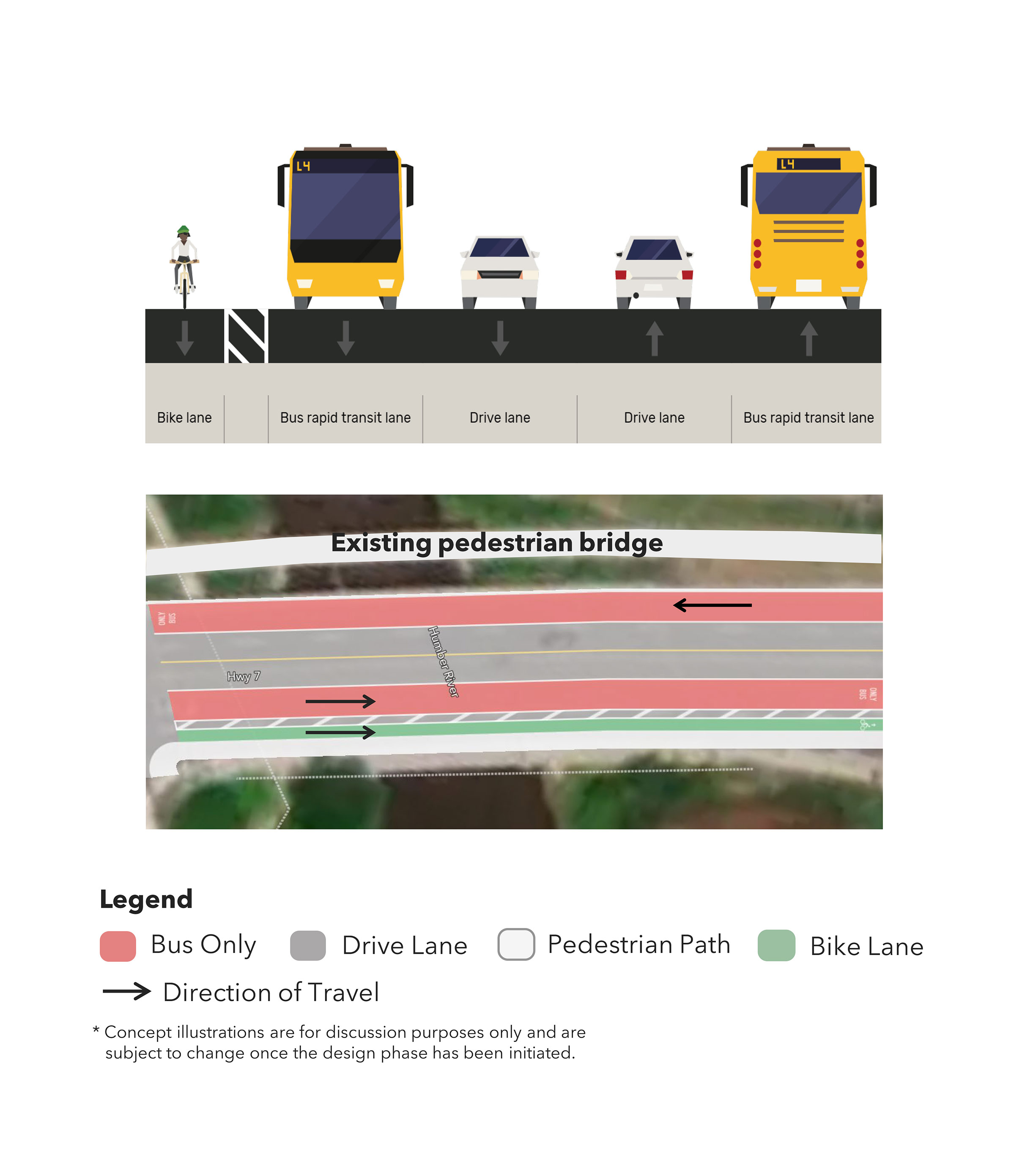
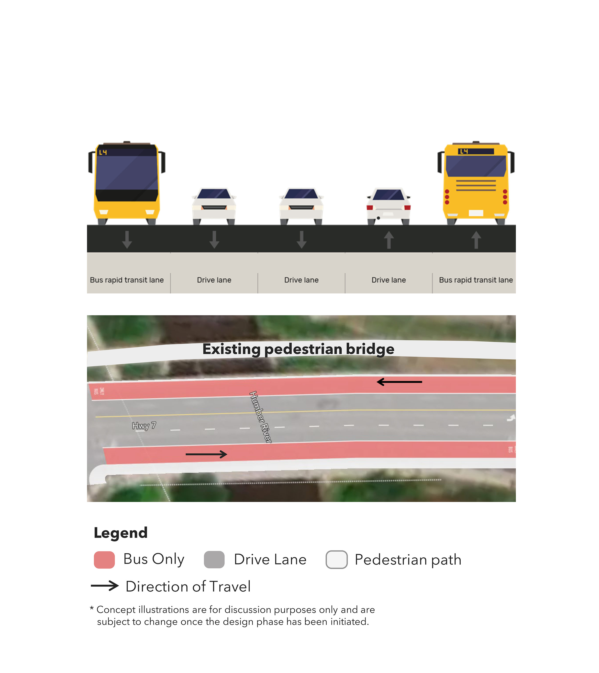
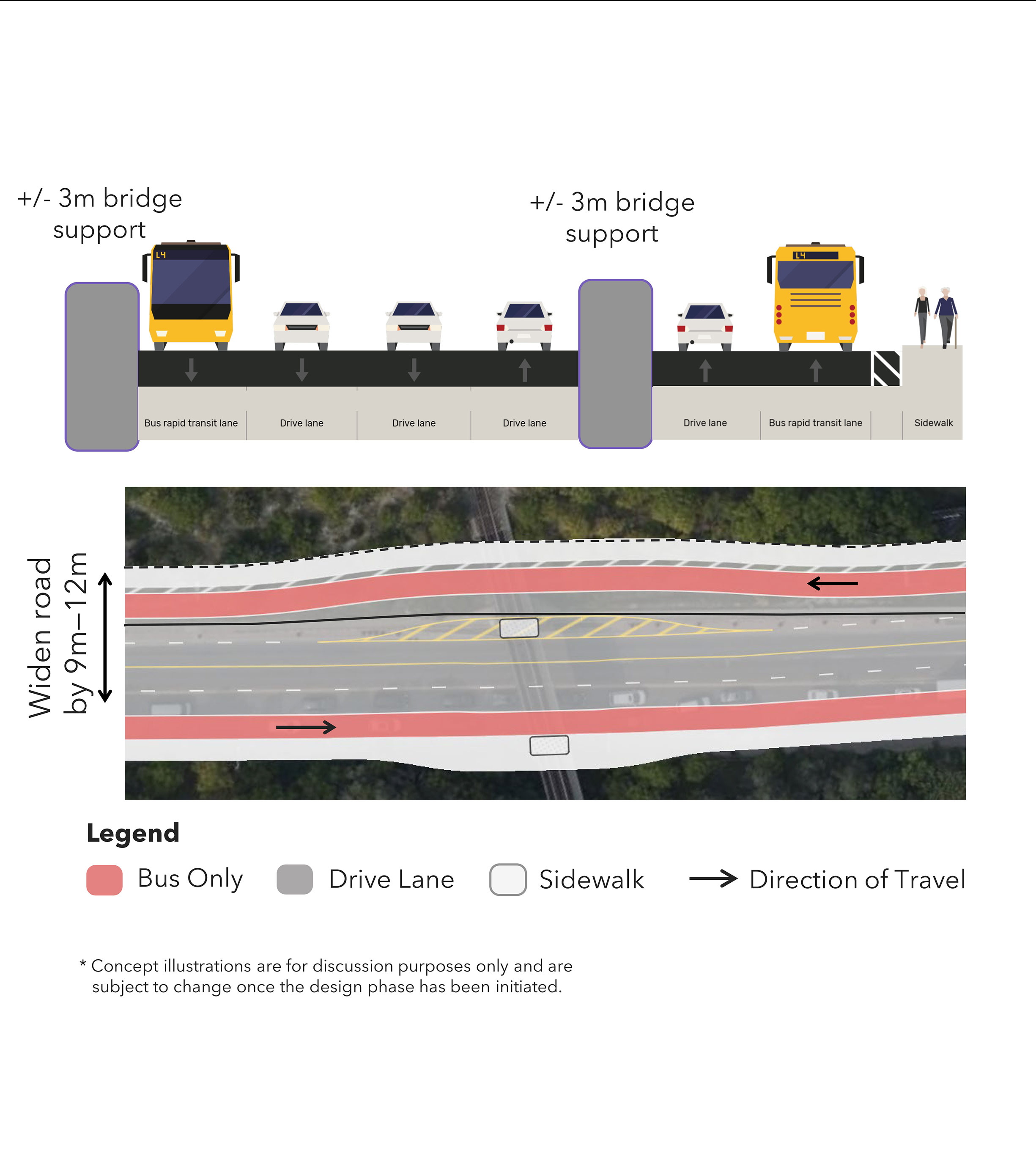
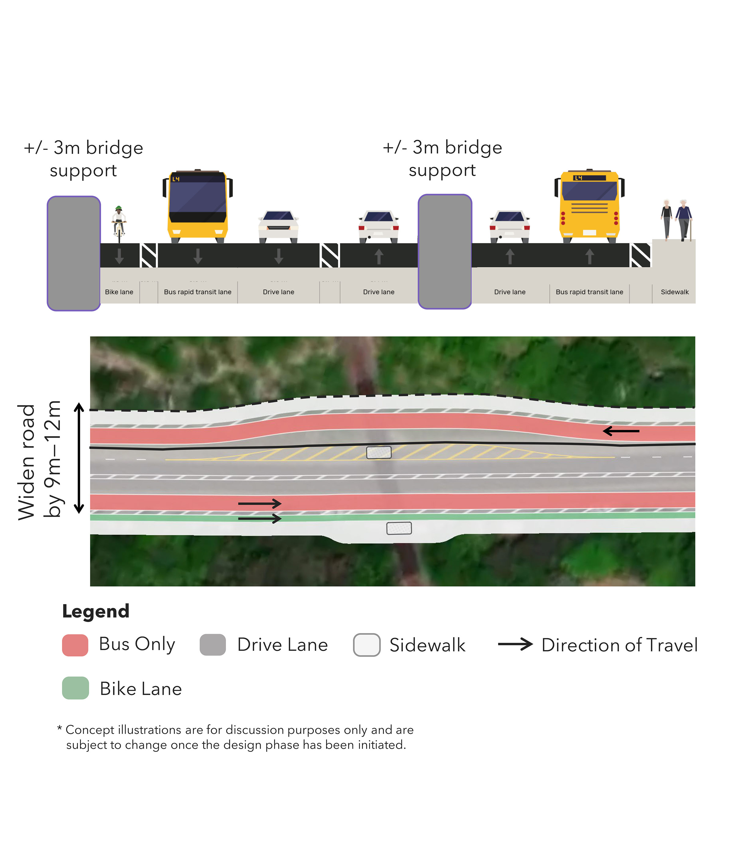
Focus Area H: Humber River / Rail Corridor
Opportunities:
- Improve streetscaping and Active Transportation infrastructure.
- Highway 7 transitions to the existing centre median BRT between Bruce Street and Helen Street.
- Connect to the Humber River.
Challenges:
- Impacts to Humber River, a significant natural environment.
- Costs to widen rail, bridge, and stormwater structures.
- Above ground utilities within the Right-of-Way.
Humber Bridge Planning Concepts:
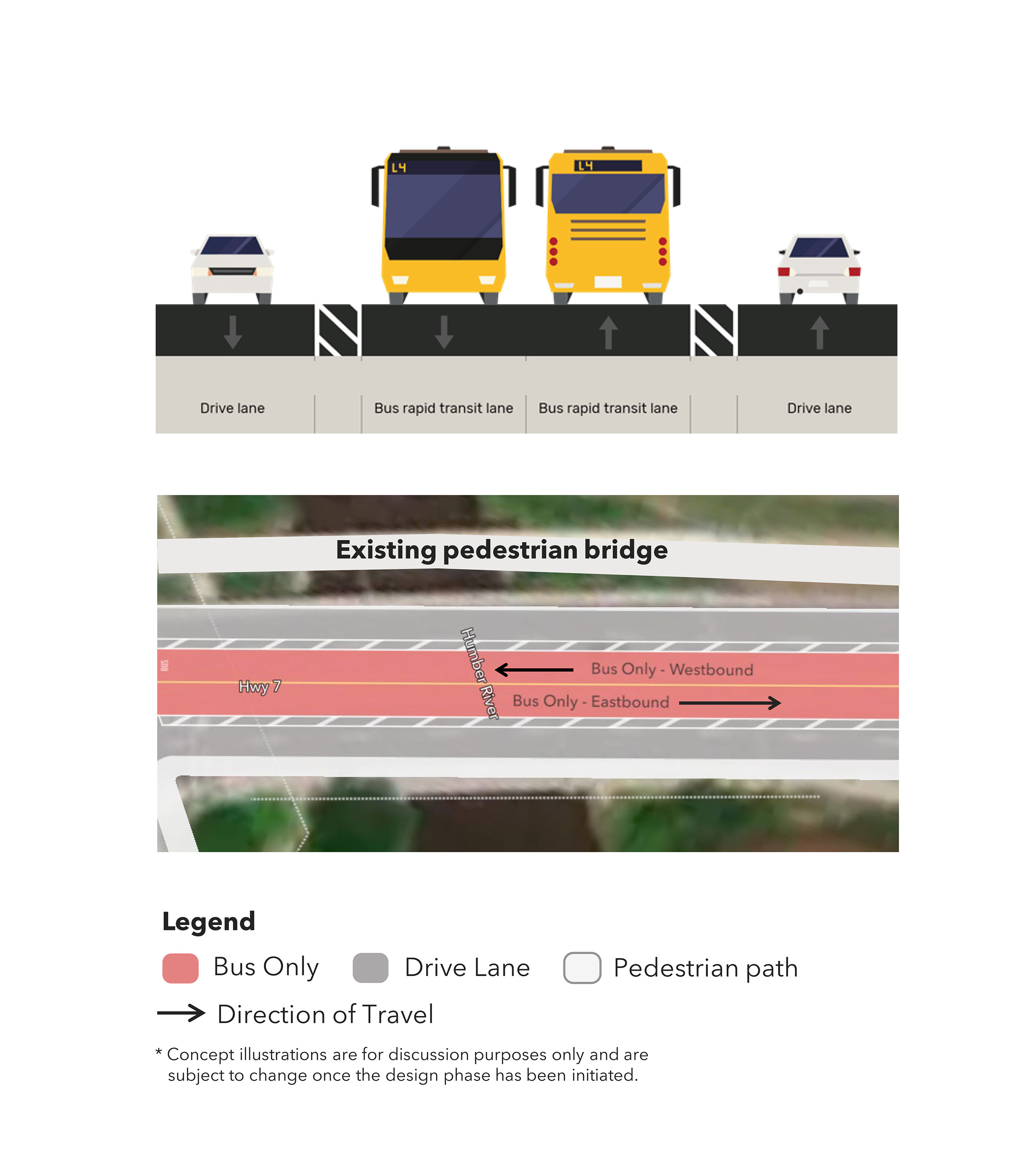
Concept A: Convert general purpose lane for median BRT.
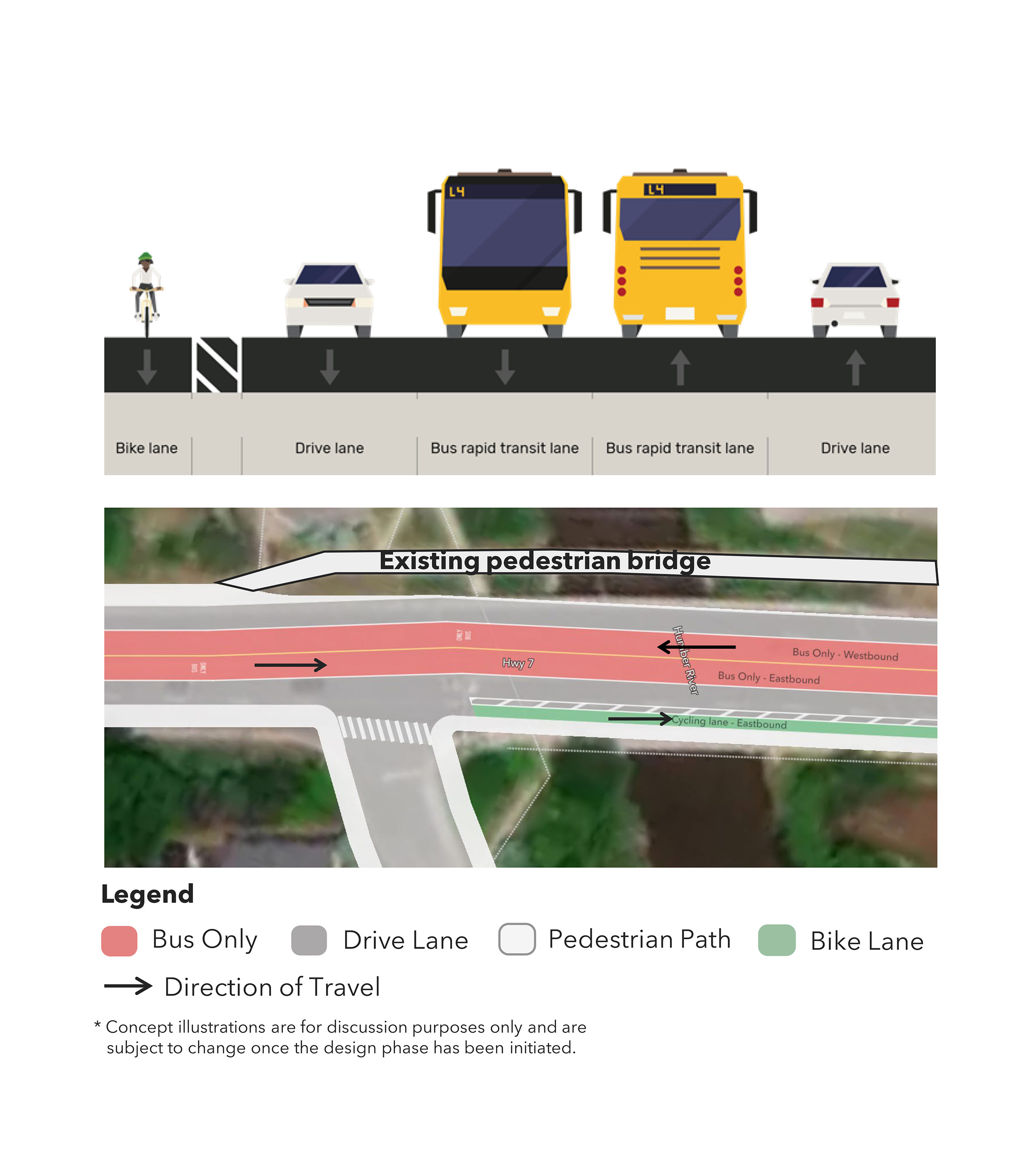
Concept B: Convert general purpose lane for median BRT. Addition of eastbound cycling lane.
Concept C: Convert general purpose lane for curbside BRT. Addition of eastbound cycling lane.
Concept D: Convert general purpose lane for curbside BRT.
Concept E: No BRT.
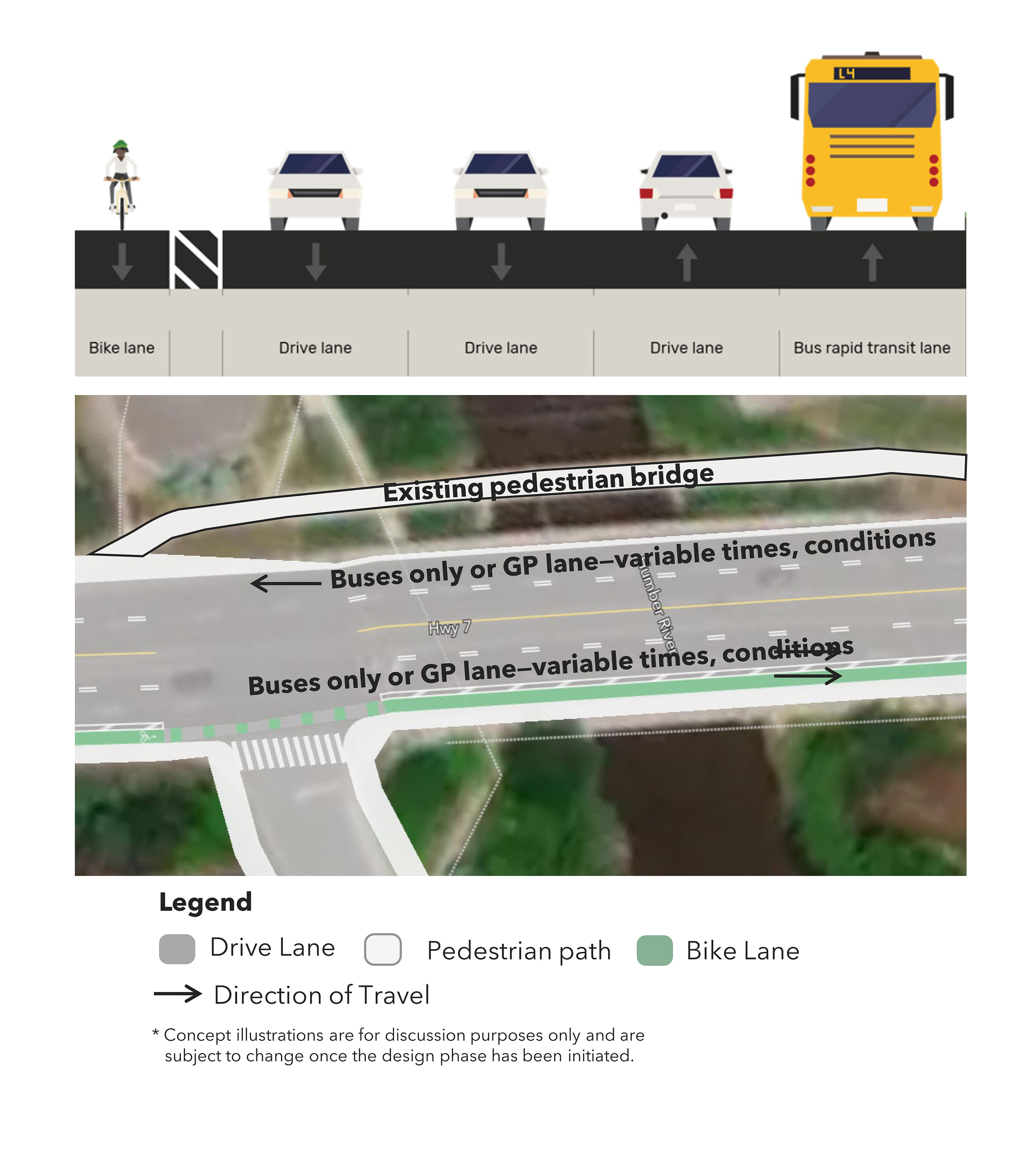
Concept F: Curbside BRT in one direction only.
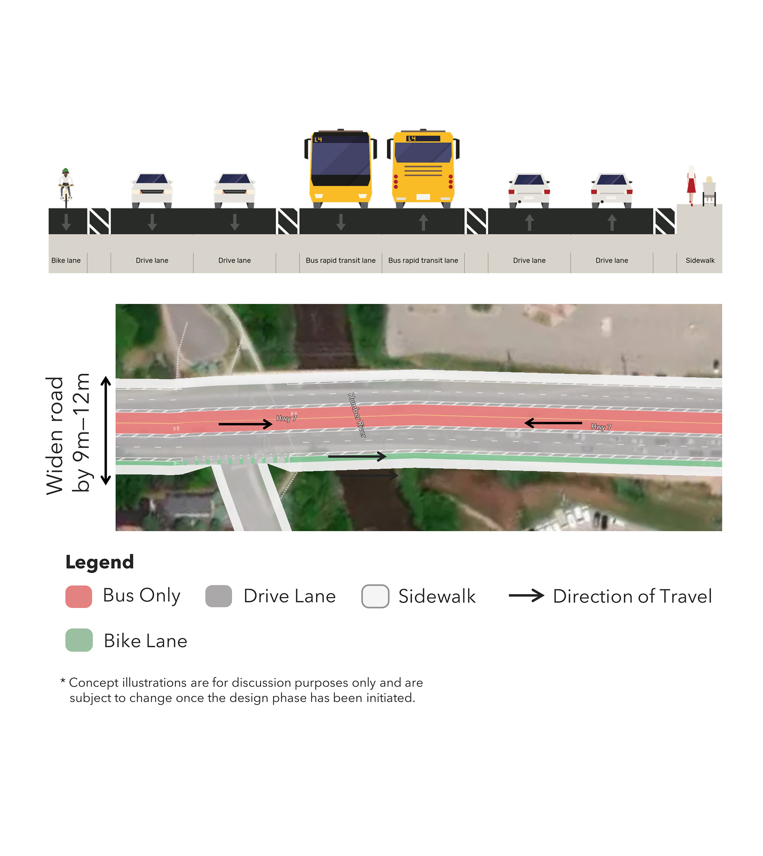
Concept G: New structure with median BRT. Keep general purpose lanes.
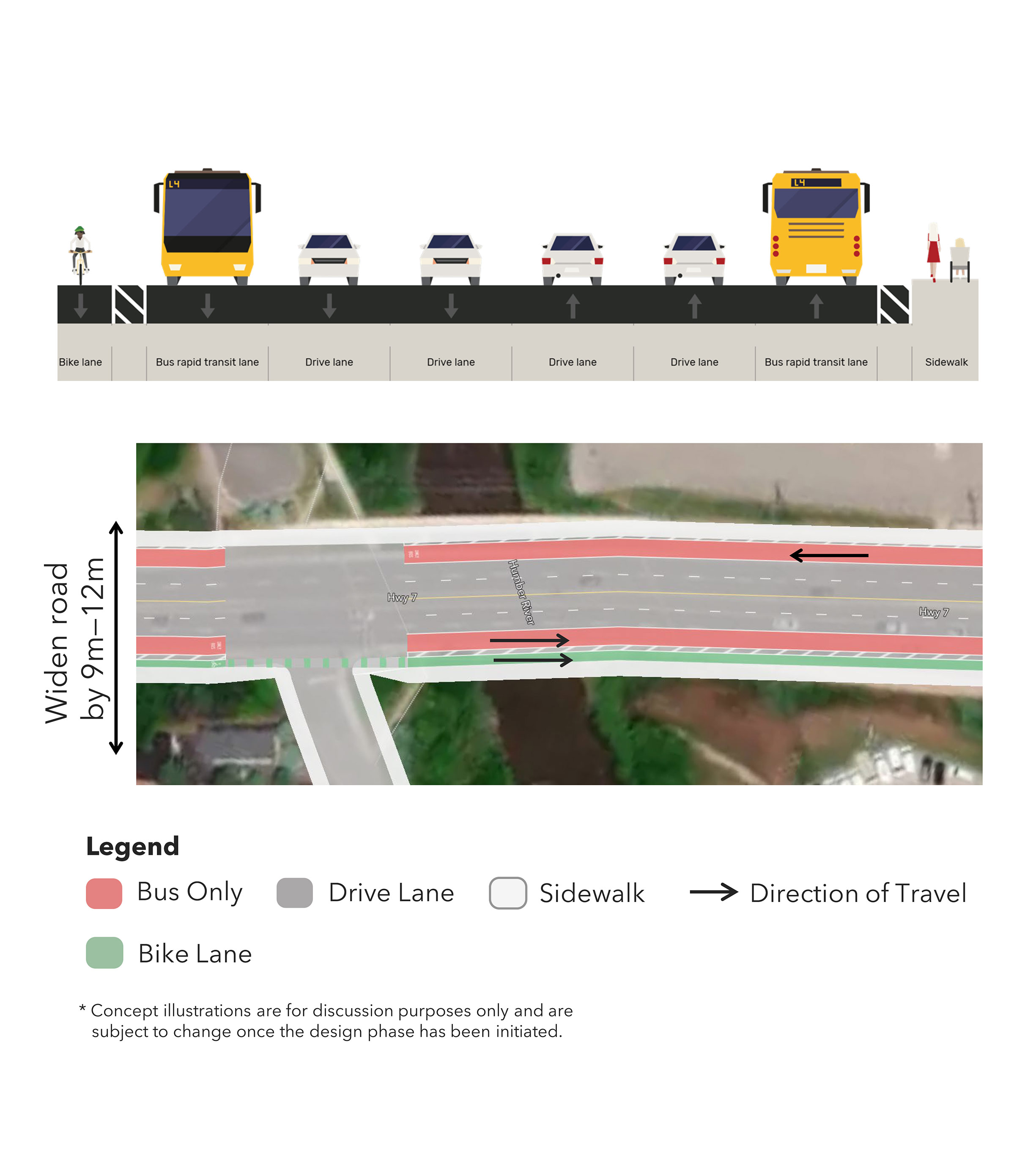
Concept H: New structure with curbside BRT. Keep general purpose lanes.
CP Overpass Bridge Planning Concepts:
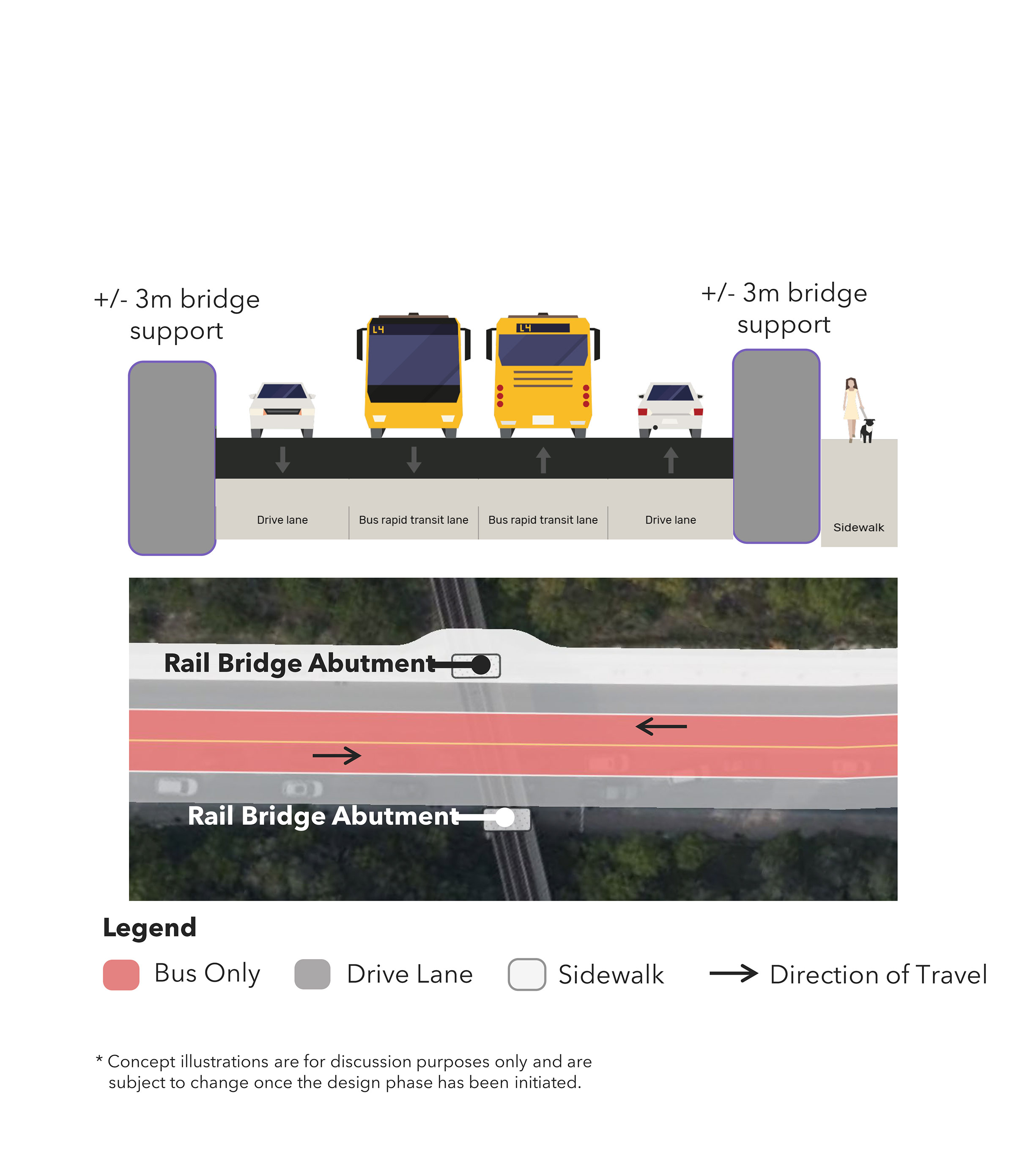
Concept A: Centre BRT with one general purpose lane removed.
Concept B: Curbside BRT with one general purpose lane removed.
Concept C: No BRT — shared curbside lanes.
Concept D: Curbside BRT with one general purpose lane removed.
Concept E: Centre BRT. Bridge widening on north side.
Concept F: Curbside BRT. Bridge widening on north side.
Concept G: Curbside BRT with eastbound cycling lane. Bridge widening on north side.
Thank You
Your comment is under review and will be added to the map when it’s approved.
List of All Comments