What is the Santa Fe Drive Action Plan?
The Santa Fe Drive Action Plan is a Planning and Environmental Linkages (PEL) Study that will identify future transportation and safety improvements for an 11-mile stretch of Santa Fe Dr (US Highway 85) between C-470 and the junction of Alameda Dr and I-25.
Santa Fe Dr is located in three counties and four municipalities which are all funding partners in this PEL study.
Project Partners

This video describes what steps take place during a Planning and Environmental Linkages (PEL) study.
Purpose
The purpose of the recommended transportation improvements from this analysis is to improve safety for all users, improve operational performance, and enhance multimodal connectivity for the Santa Fe Dr (US 85) corridor from C-470 to I-25 through Arapahoe County, City and County of Denver, Douglas County, Englewood, Littleton, and Sheridan.

Need
- Increase safety on the corridor by reducing crashes caused by congestion and direct access to the corridor from local roads and driveways
- Increase the operational performance of the corridor that currently results in poor travel time reliability and congestion
- Create multimodal connections, including pedestrian, bicycle, and transit

Goals
- Consider local community surroundings and context
- Support local and regional planning efforts
- Minimize environmental impacts as practicable
- Balance local access and regional travel with consistent application of the defined access category for Santa Fe Dr
- Optimize transit use and multimodal travel opportunities for the travel corridor
- Enhance connections and wayfinding to adjacent pedestrian and bicycle facilities
- Provide redundancy for the regional transportation system to accommodate traffic when incidents impact other north-south routes such as I-25, Broadway, or Federal Blvd

Crashes
- From 2016 to 2018, there were 2,282 crashes on Santa Fe Dr with 10 fatalities
- At 2.86 crashes per million vehicle miles traveled, total crash rates on all segments of Santa Fe Dr exceed the CDOT average rate for an expressway facility of 1.62 crashes per million vehicle miles traveled
- Common crash types are typically related to vehicular congestion
- Crashes often occur during the peak commuting periods at the signalized intersections
- Areas with more direct access to Santa Fe Dr and more intersections see an increase in overall crash frequency

Travel Time
- Travel times during the AM and PM peak hours are up to 40% longer than the travel time to drive the corridor at free flow speeds
- Bottlenecks with congestion and long queues regularly occur at the signalized intersections
- The percentage of truck traffic to the overall daily volume is approximately 4 times higher than a typical urban principal arterial highway, approximately 2% (Santa Fe is 7.5% - 9.2%)
- Unreliable or unpredictable travel times along the corridor cause difficulty in trip planning and have negative impacts for freight operators

Multimodal Connections
- Lack of adequate facilities to accommodate pedestrian and bicyclist crossings of Santa Fe Dr
- Lack of sidewalks and pedestrian crossing opportunities impact comfort and safety at bus stops on street crossing Santa Fe Dr and along Santa Fe Dr such as at County Line Rd and Mineral Ave
- Lack of connections across Santa Fe Dr to access the adjacent RTD light rail facility
Where are we in the process?
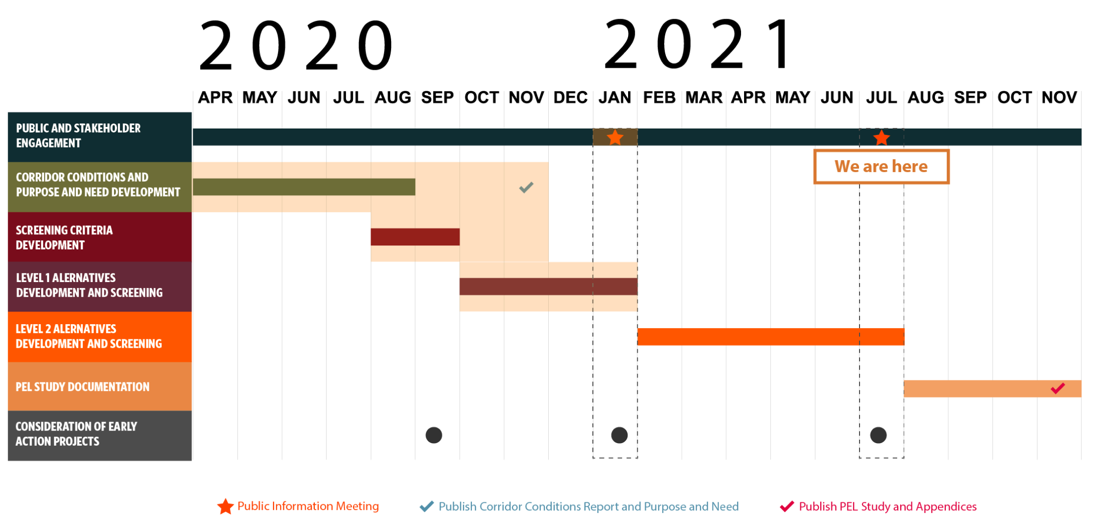
Click on image to enlarge
Tasks Completed to Date:
- The Corridor Conditions Report summarizes the existing conditions, infrastructure, and travel conditions. It also shows the social, built, and natural environmental resources within the Santa Fe Dr corridor.
- The Purpose and Need was developed based on the findings of the Corridor Conditions Report and stakeholder involvement, and endorsed by CDOT and the local agency partners. The report can be viewed on the project website here.
- Reasonable and Foreseeable Concepts were developed and evaluated against the Purpose and Need. These concepts were shown to the public during the Online Public Event in January 2021.
- Location-Specific Design Options and Criteria were developed based on the concepts and evaluated to determine which should be carried forward into the next round of evaluation.
Alternatives Evaluation Process
Our evaluation process is outlined in the graphic below. We are currently in the Level 2B Corridor Themes phase of the process.
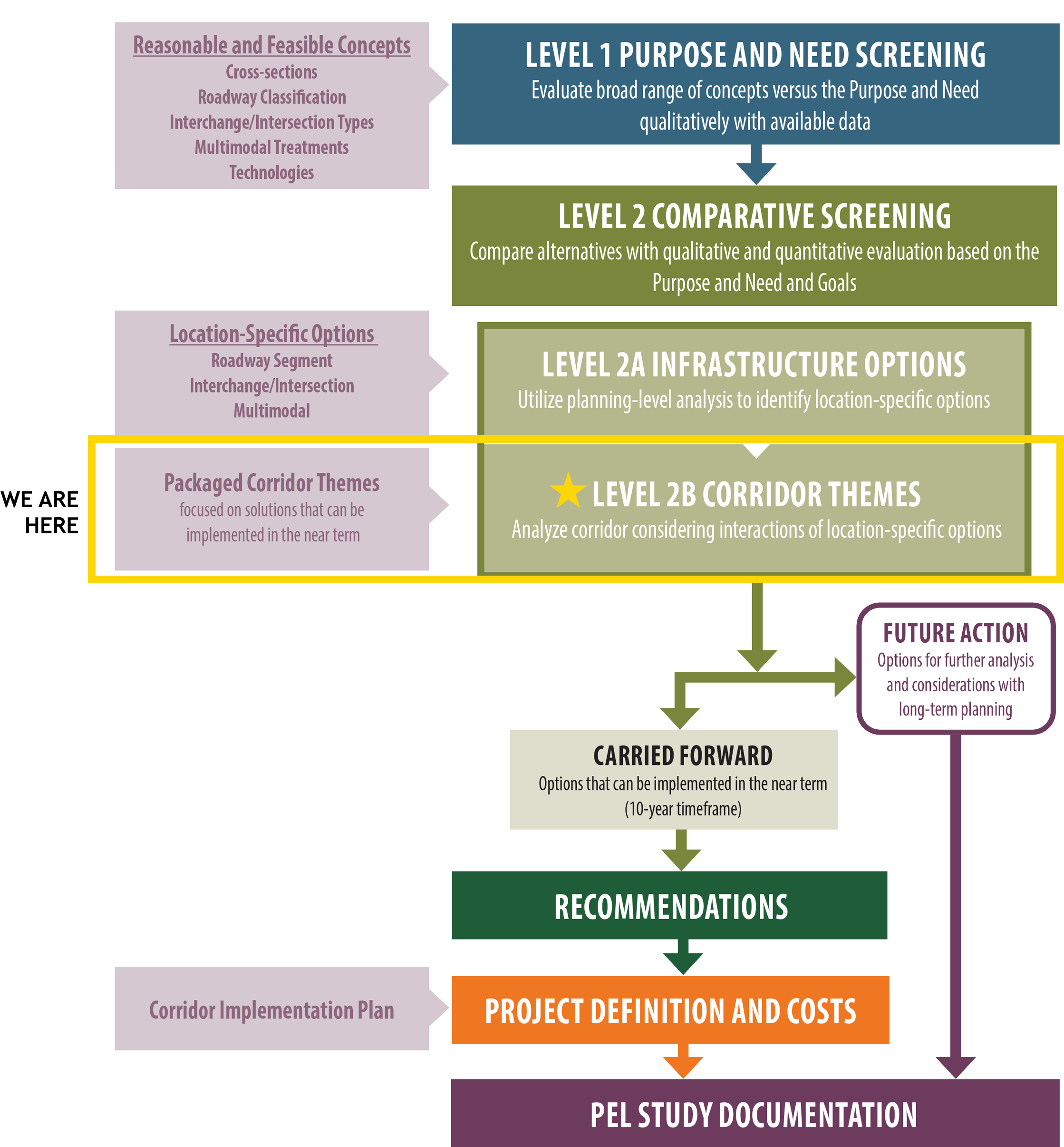
Click on image to enlarge
Early Action Projects
As part of the process, early action projects have been identified that have the potential to be implemented sooner. These early action projects have been analyzed with the goal of addressing existing issues in the near term.
Click on each early action project tab below to learn more and give it a thumbs up or thumbs down. This will help us understand which projects you’d like us to prioritize.
-
Crestline Avenue Conversion to Right-in/Right-out
-
Northbound Auxiliary Lane at Prince Street with Bike Lanes
-
Auxiliary Lanes - Hampden Avenue to Florida Avenue
-
Northbound Auxiliary Lane – Vinewood Street to Bowles Avenue
-
New Sidewalk – South Side of Oxford Avenue
-
New Sidewalk – North Side Hampden Avenue (US 285)
-
Little Dry Creek Trail Wayfinding at Dartmouth Avenue
-
Little’s Creek Trail Wayfinding South of Bowles Avenue
Crestline Avenue Conversion to Right-in/Right-out
Raised center median along Santa Fe Dr would be closed at Crestline Ave to prohibit southbound left turns and a new northbound right turn lane constructed with island modifications. The southbound left turn movement to the area east of Santa Fe Dr would shift to the Prince St signalized intersection, less than 1,000 feet to the north.
Benefits:
- Improves safety by eliminating intersection left turn conflicts
- Improves operations along Santa Fe Dr by shifting slower, right turning traffic out of the mainline through lanes
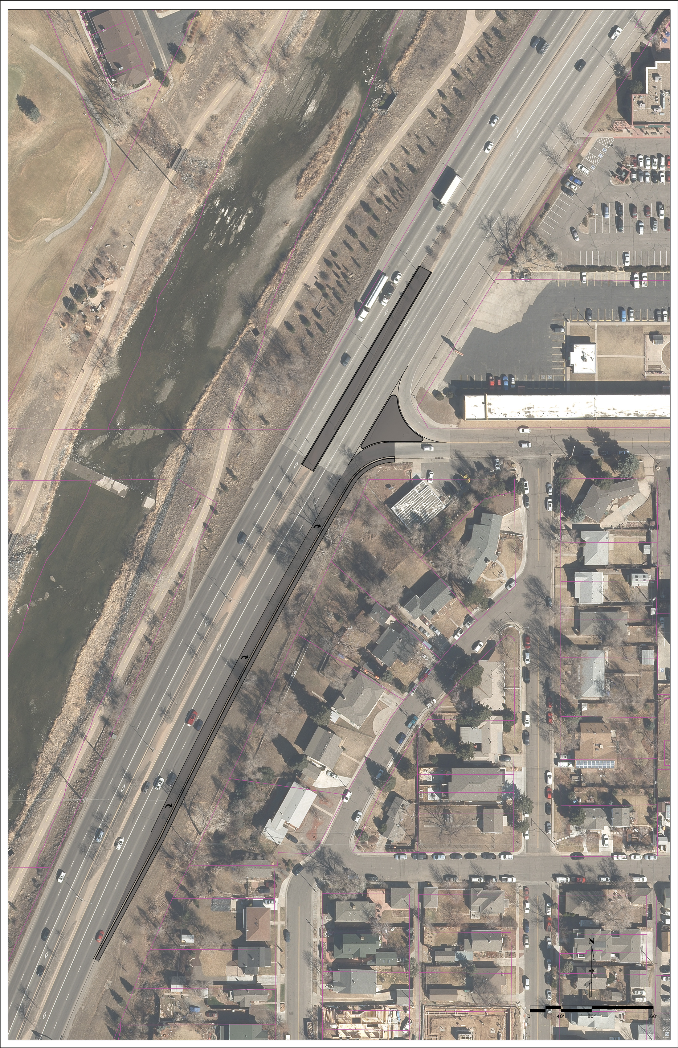
Click on image to enlarge
Northbound Auxiliary Lane at Prince Street with Bike Lanes
Raised center median on Santa Fe Dr and striping would be modified to delineate the left turn lane more clearly from the HOV lane at Prince St and to add a northbound lane through the intersection. Island modifications would add the northbound through lane and eastbound/westbound bike lanes through the intersection, extending the existing bike lanes along Prince St west of Santa Fe Dr.
Benefits:
- Improves safety by reducing conflicts that occur due to drivers confusing the northbound HOV lane for a second left turn lane
- Improves multimodal safety and connections with striped bike lane through the intersection
- Improves operations along northbound Santa Fe Dr with additional through lane reducing the bottleneck at the Prince St traffic signal
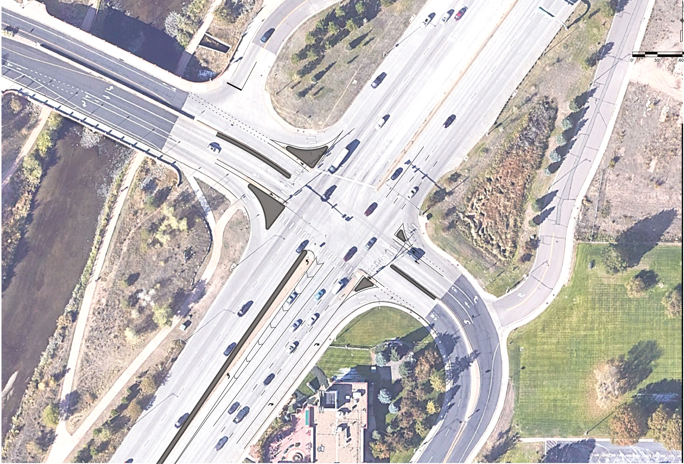
Click on image to enlarge
Auxiliary Lanes - Hampden Avenue to Florida Avenue
Striping along Santa Fe Dr would be modified from Hampden Ave to Florida Ave with island modifications at the Dartmouth Ave signal to provide auxiliary lanes from Hampden Ave to Florida Ave. The ramp areas at the Evans Ave interchange would also be modified for the auxiliary lanes under the Evans Ave bridge.
Benefits:
- Improves operations along Santa Fe Dr with auxiliary lanes reducing the bottlenecks at the Dartmouth Ave, Iowa Ave, and Florida Ave signals
- Improves safety by reducing crashes related to congestion and long queues at the Dartmouth Ave and Iowa Ave traffic signals
- Improves safety and operations along Santa Fe Dr by removing the added and dropped lanes between intersections and interchanges between Hampden Ave and Florida Ave
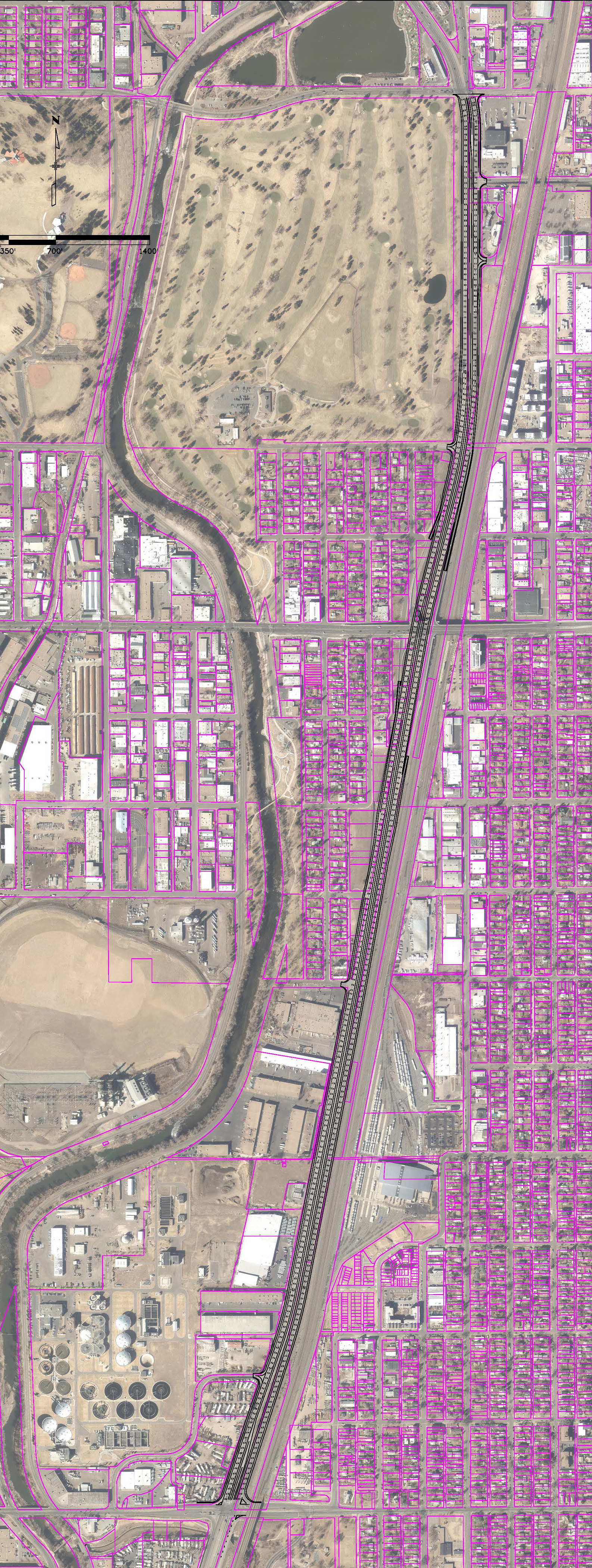
Click on image to enlarge
Northbound Auxiliary Lane – Vinewood Street to Bowles Avenue
Striping along northbound Santa Fe Dr would be modified, along with island modifications, to provide an extended through lane through the Vinewood St/Sumner St, Church St, and Bowles Ave signals. New northbound right turn lanes would be provided at the Church St and Bowles Ave signals.
Benefits:
- Improves operations along northbound Santa Fe Dr with additional through lane reducing the bottlenecks at the Church St and Bowles Ave traffic signals
- Improves safety by reducing crashes related to congestion and long queues at the Church St and Bowles Ave traffic signals
Click on image to enlarge
New Sidewalk – South Side of Oxford Avenue
New sidewalk connection would be constructed along the south side of Oxford Ave west of Santa Fe Dr. The new sidewalk would connect to existing sidewalk at the bus stop east of River Point Pkwy and at the Santa Fe Dr intersection
Benefits:
- Provides missing pedestrian connection to Santa Fe Dr
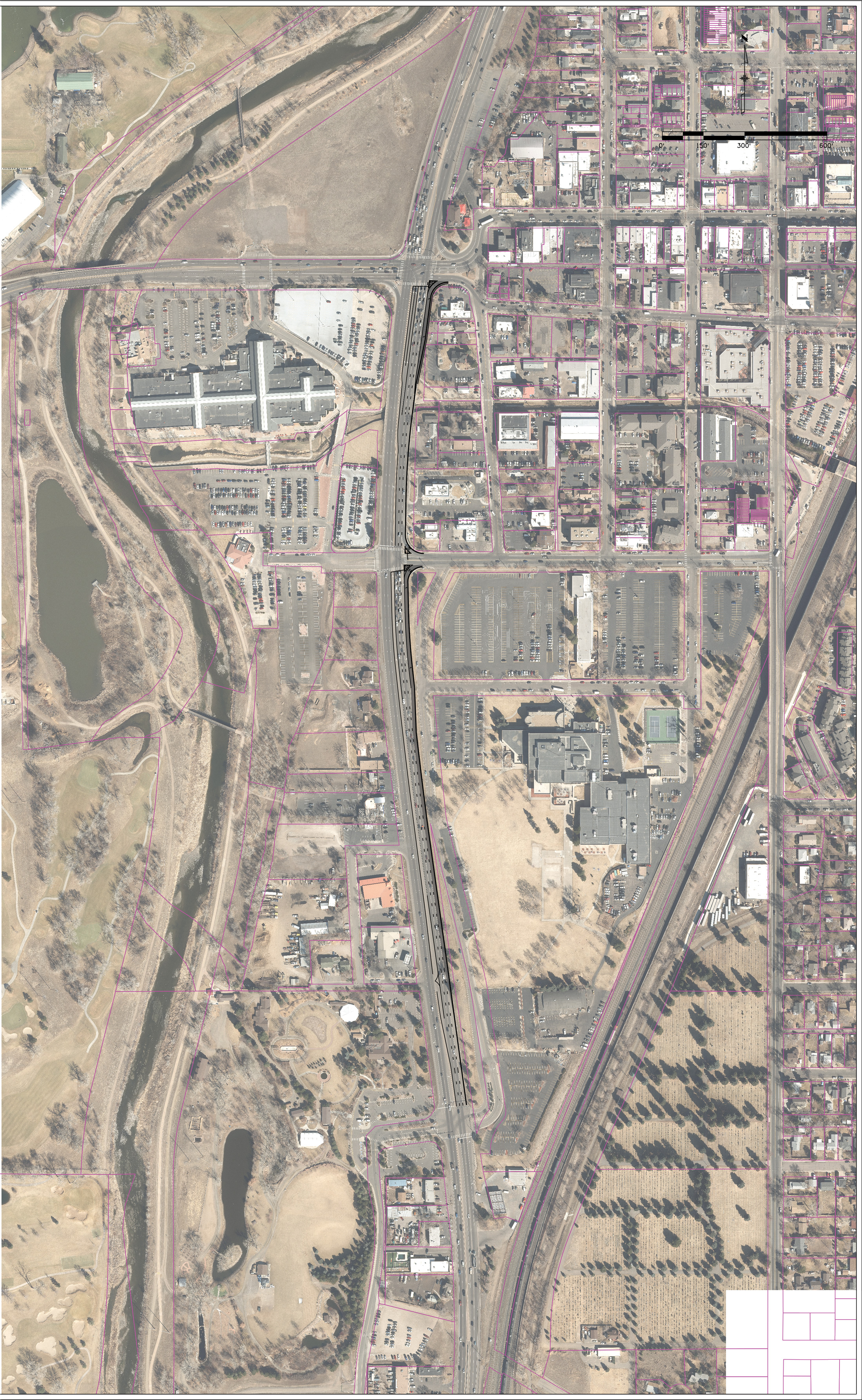
New Sidewalk – North Side Hampden Avenue (US 285)
New sidewalk connection would be constructed along the north side of Hampden Ave through the Santa Fe Dr interchange. The new sidewalk would connect to existing sidewalk at South Platte River Dr and along Hampden Ave under the railroad bridge east of Santa Fe Dr. The sidewalk would be attached to Hampden Ave to fit under the existing Santa Fe Dr bridge and enhanced pedestrian crossing treatments would be installed at the three interchange ramp crossings.
Benefits:
- Provides important missing pedestrian/bicyclist connection across Santa Fe Dr and to the Englewood light rail station
- Improves safety by reducing pedestrian conflicts at the ramp crossings
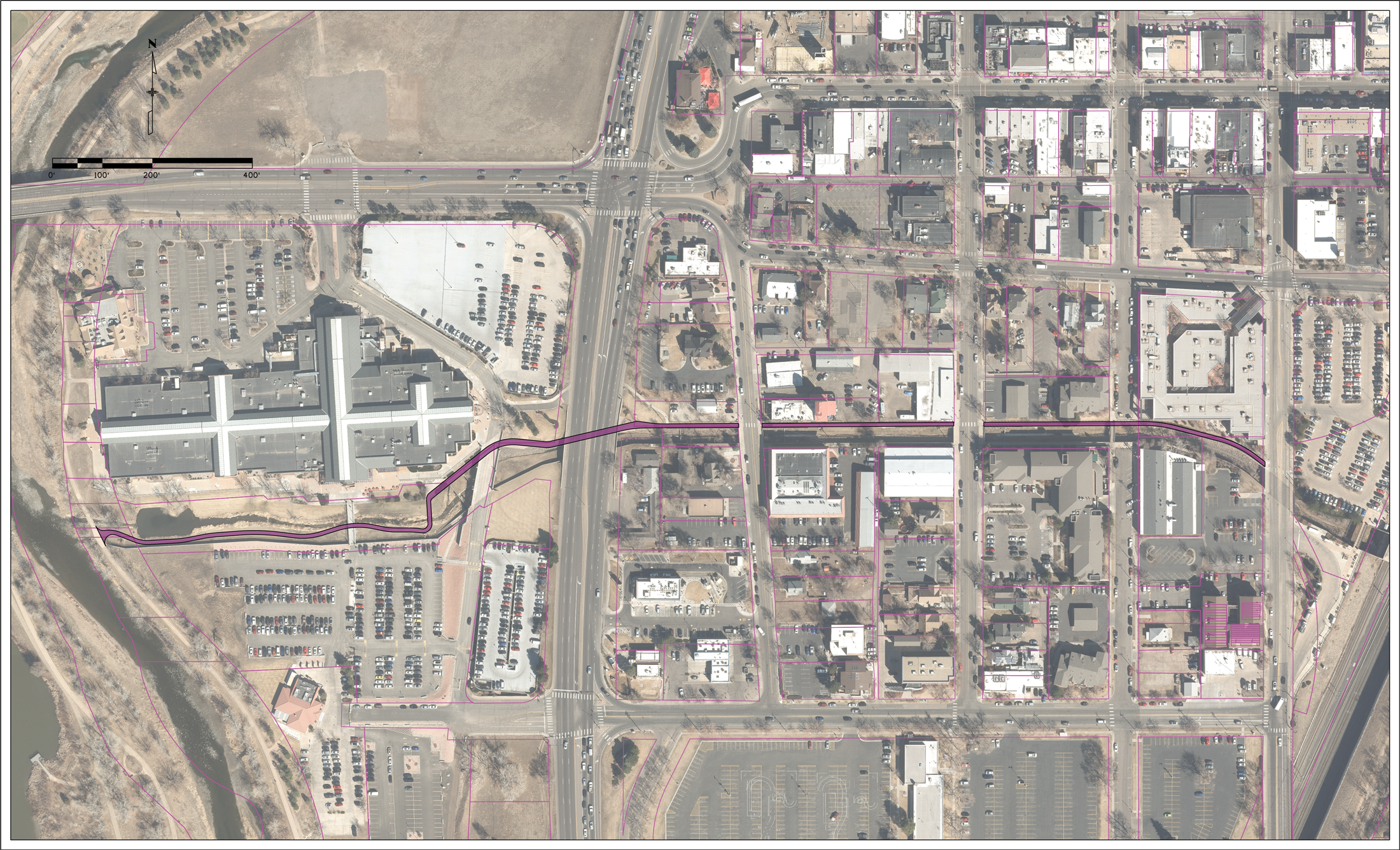
Little Dry Creek Trail Wayfinding at Dartmouth Avenue
Enhanced and additional wayfinding signage would be installed along the Little Dry Creek Trail south of the Dartmouth Ave intersection to direct pedestrians and bicyclists to utilize the trail underpass to cross Santa Fe Dr.
Benefits:
- Improves pedestrian/bicyclist safety by reducing potential crossing conflicts at the Dartmouth Ave intersection
- Improves traffic operations at the Dartmouth Ave intersection by reducing the number of pedestrian crossings shifting green time away from the heavy Santa Fe Dr traffic movements
Click on image to enlarge
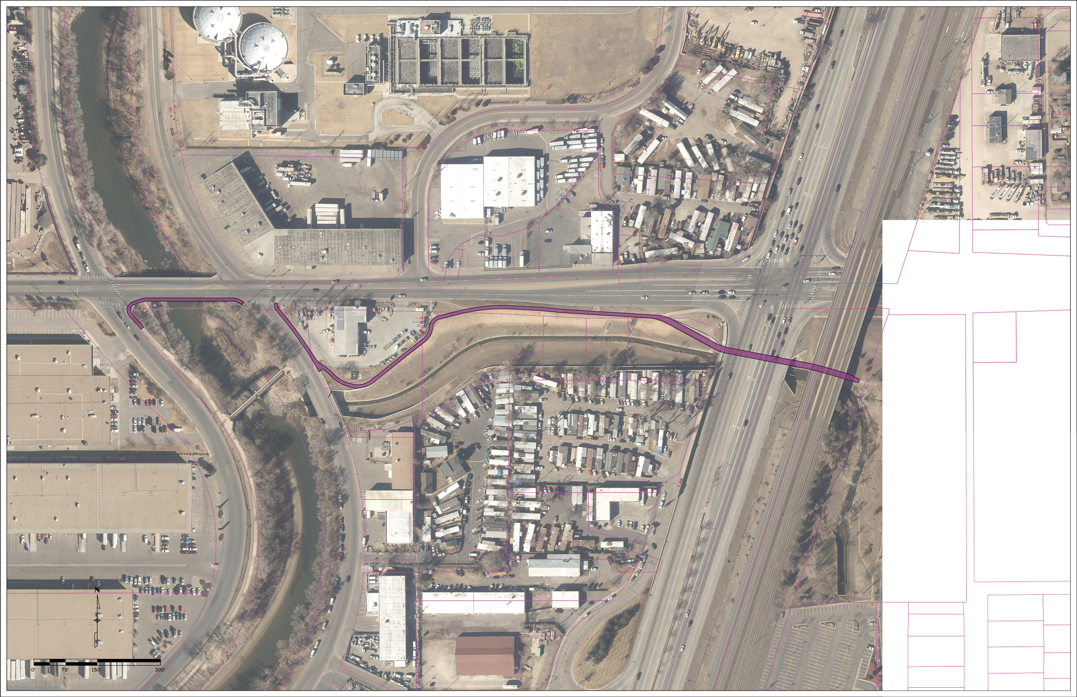
Little’s Creek Trail Wayfinding South of Bowles Avenue
Enhanced and additional wayfinding signage would be installed along the Little’s Creek Trail south of the Bowles Ave intersection to enhance multimodal connections across Santa Fe Dr between the Mary Carter Greenway Trail and the Littleton light rail station
Benefits:
- Improves pedestrian/bicyclist connections to transit
- Improves pedestrian/bicyclist safety by reducing potential crossing conflicts at the Bowles Ave intersection
Click on image to enlarge
Next Steps
The project team will:
- Use results from technical evaluation of the Corridor Themes and public input to develop Recommended Alternatives.
- Develop an Implementation Plan for the Early Action Projects, Recommended Alternatives, and Future Actions.
- Publish a PEL Report that documents the process, recommendations, and Implementation Plan.
Stay Involved
Learn more or contact us
Sign up for our distribution list so you are notified of project updates and opportunities to provide your feedback:
Visit the project website to learn more: www.codot.gov/projects/santafepel

Call us
Call us at 303-524-8386
Email us
santafepel@gmail.comVisitor Survey
Please fill out the following information to help us understand your lifestyle and demographics. Note: This information will be confidential and used to help inform the Santa Fe Drive Action Plan and engagement approach.
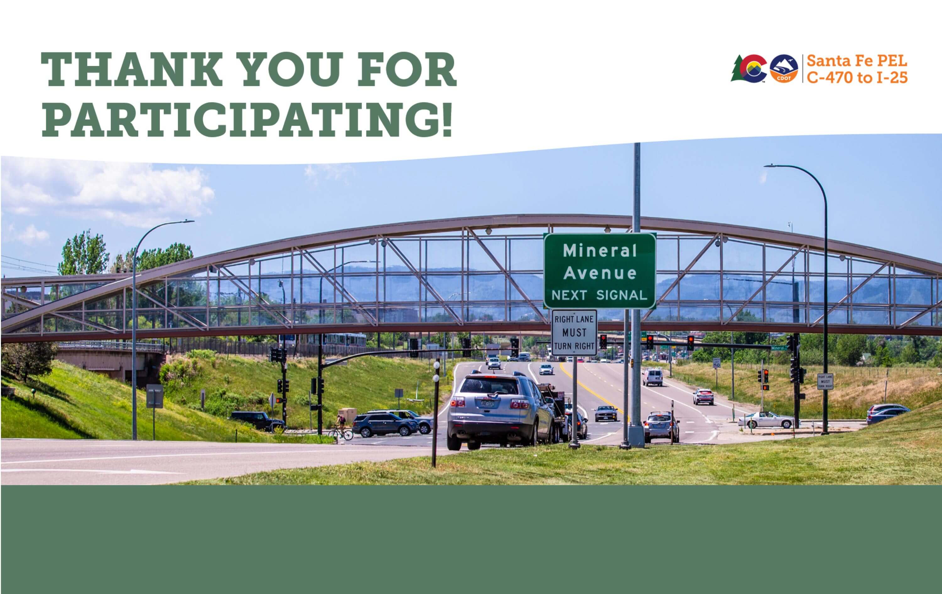
Thank You