Hwy 65 Virtual Engagement
Highway 65 PEL Study
Welcome to the Highway 65 PEL Study virtual public meeting!
We are excited to share our three corridor options with you! Please click through this 14-slide presentation to review background information, explore study recommendations and learn about our next steps. The entire session should take around 30 minutes to complete.
Learn more general information about Planning & Environmental Linkages (PEL) studies.

COVID-19 update

The Department of Transportation has postponed all in-person meeting to prevent the spread of COVID-19. Public engagement is still a priority and we appreciate you joining us online to learn more about this study.
How to navigate

Click the arrows on the right and left of your screen to go forward or backward. Use the navigation bar on the left of your screen to revisit any part of the meeting.
Provide comments

Click the comment button at the top right of your screen to provide a comment to our project team.
Content Overview
This virtual engagement session includes...

Background
Learn a little about why we are doing this study and what work we’ve already completed
Study Recommendations
Explore the recommended options for Highway 65 and tell us what you think
Next Steps
Learn about the next steps to complete this study and how future projects will be determined
Have questions, need more information or want to talk with the team?
A live virtual event is being planned for mid-September. Visit the project website to sign up for the project email list and be notified when it’s scheduled. Submit your questions ahead of time through the comment features on this site.
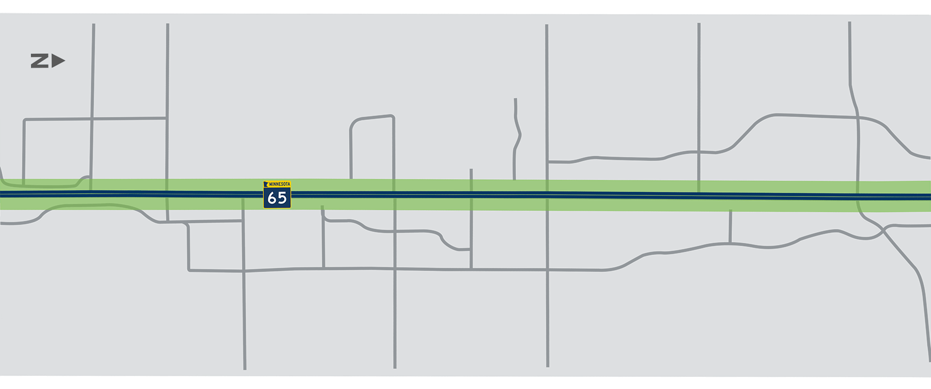
About the Project
Study overview
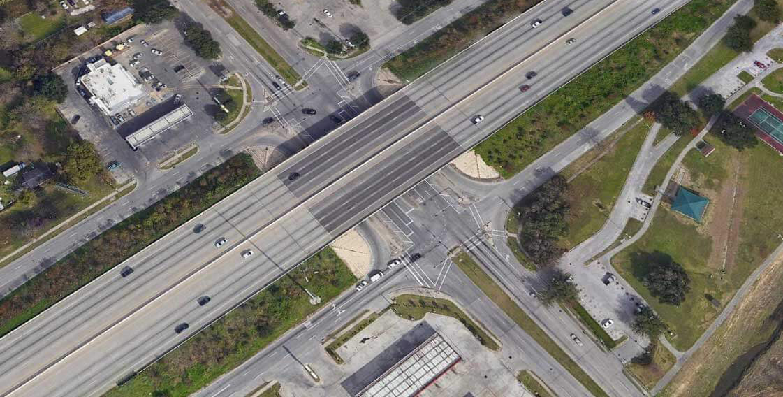
The Minnesota Department of Transportation in partnership with Anoka County and the cities of Blaine, Ham Lake and Spring Lake Park are studying the Highway 65 corridor between Bunker Lake Boulevard and County Road 10/Mounds View Boulevard.
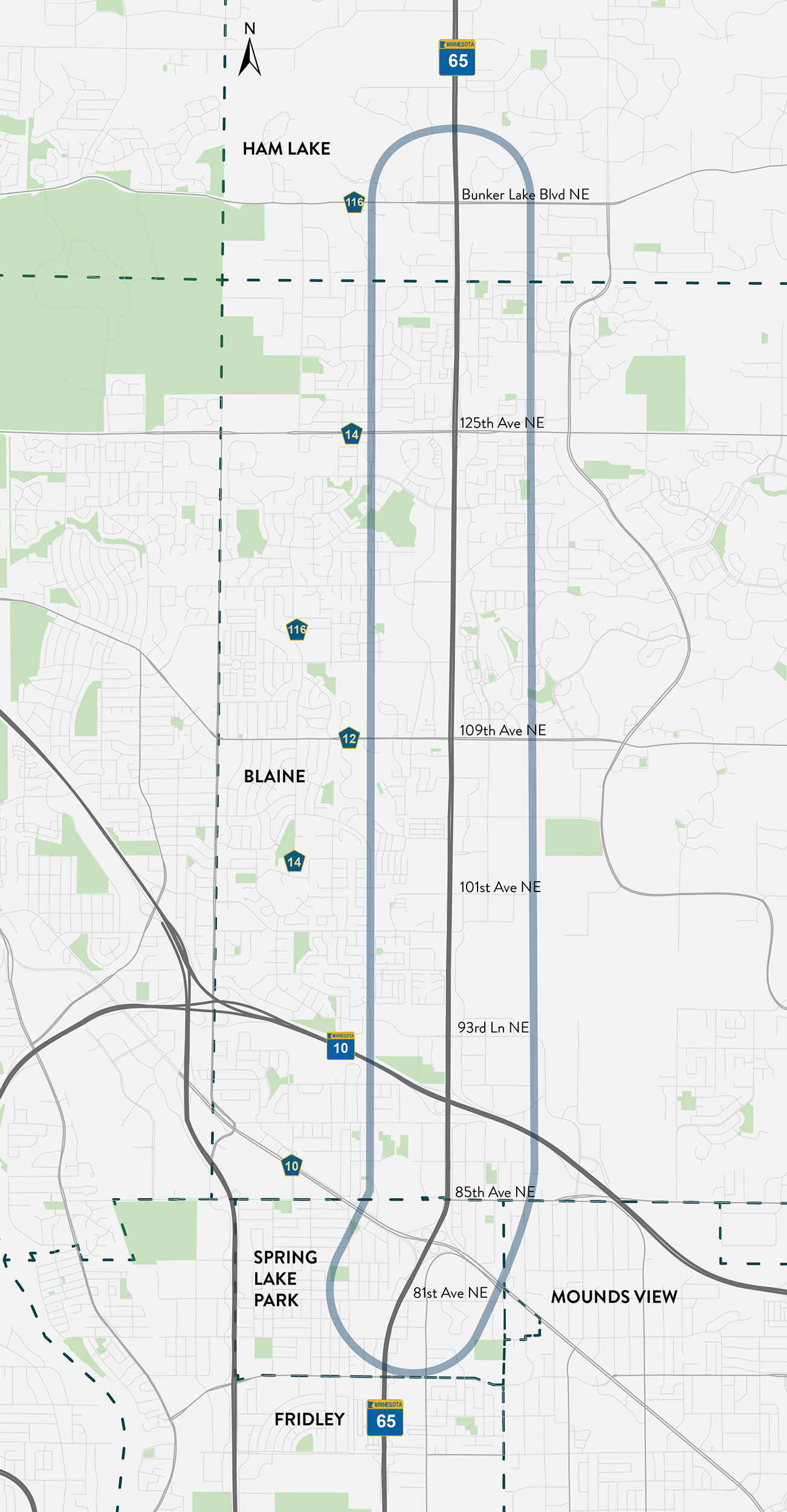
Click the image above to enlarge.
Study purpose
The purpose of the study is to identify cost-effective solutions to address the following issues on Highway 65 in this area:
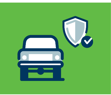 |
Primary Transportation ProblemVehicle Safety |
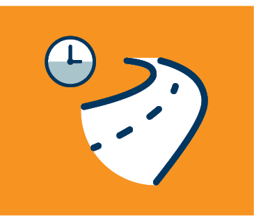 |
Primary Transportation ProblemVehicle Congestion |
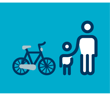 |
Secondary Transportation ProblemWalking and Biking |
Other considerations
Previous Study on Highway 65
Before we jump to our findings, let’s look back and recap where we’ve been.
2005 study
MnDOT completed a multi-year study along the Highway 65 corridor in 2005.
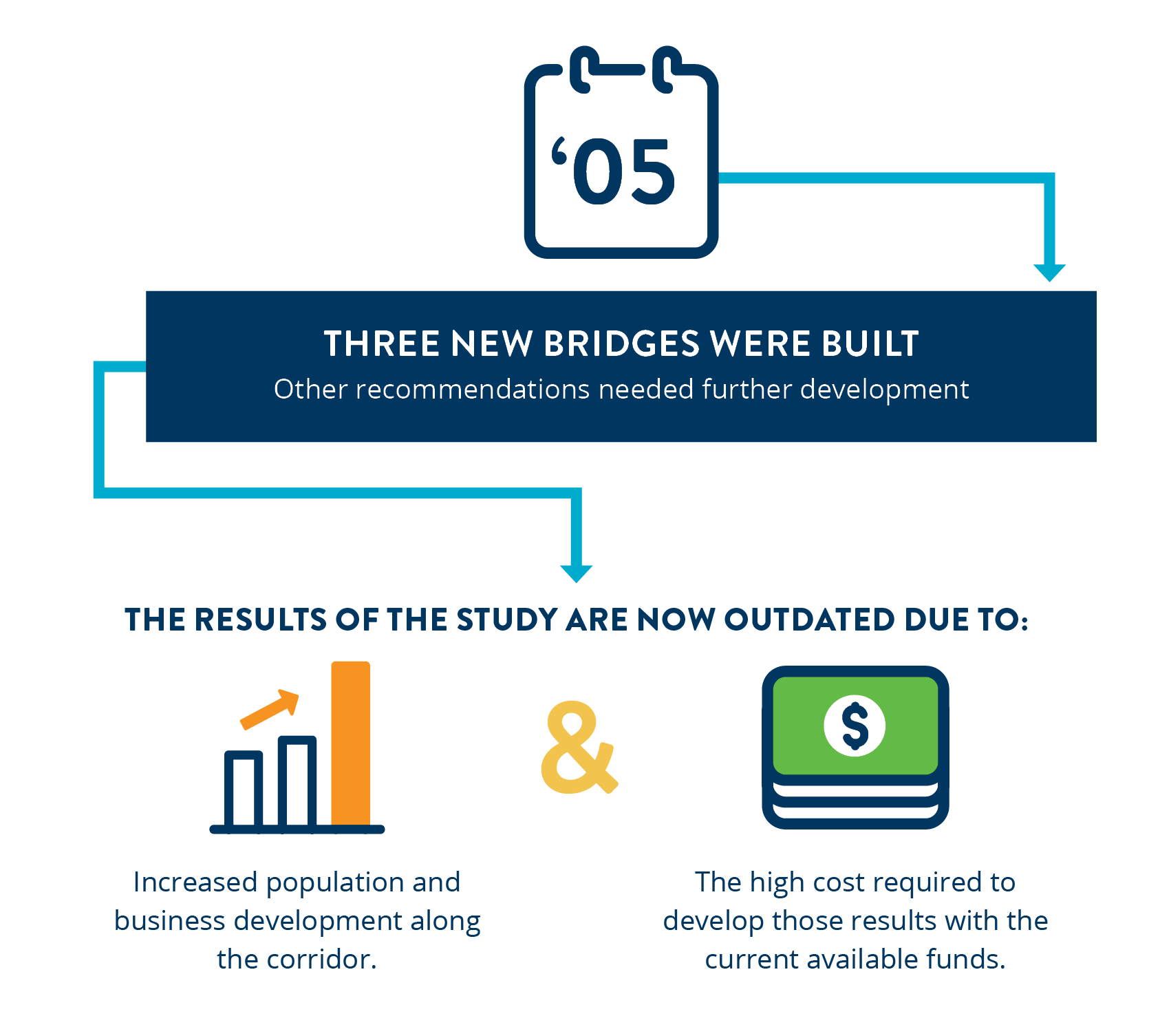
Click the images shown here to enlarge.
Today's study
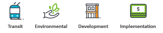
In August, 2018 MnDOT and partners started a Planning & Environmental Linkages (PEL) study of this corridor. A PEL study identifies a flexible corridor vision that addresses transportation, environmental and community goals. It also identifies a roadmap for implementing projects over time to achieve the corridor vision.
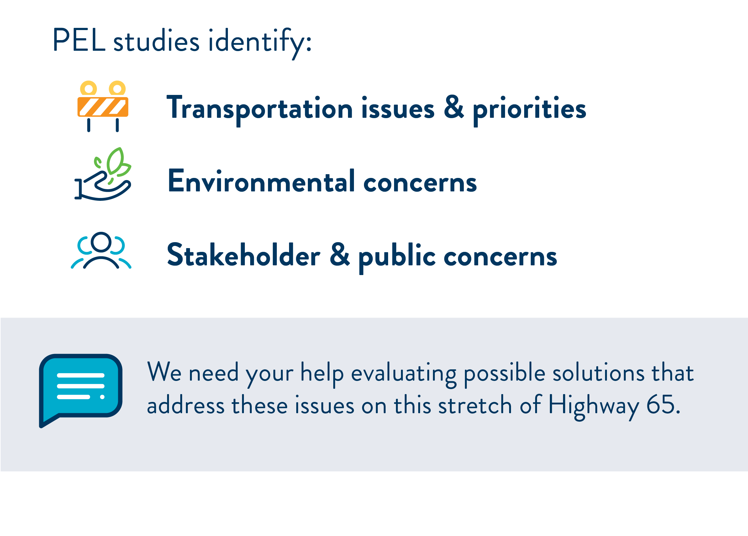
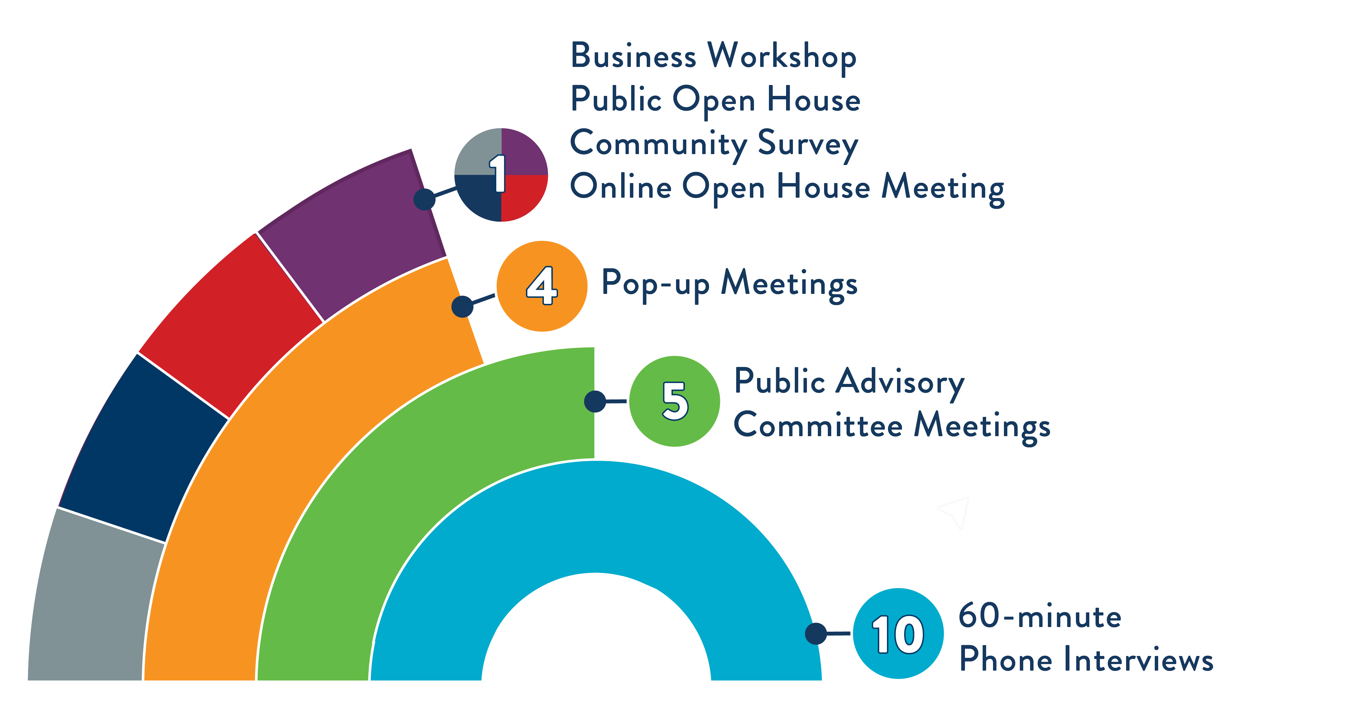
Engaging the Community
Our team has been engaging with the Blaine, Ham Lake and Spring Lake Park communities to gather input that helped our project team identify recommendations for this stretch of Highway 65. The different ways we connected with the community are highlighted below.
Community Feedback
Listening to the community was an important part of this project and the feedback we received, both in-person and online, helped us get to where we are today. Let’s review what we heard!
Problems and considerations
During the first round of engagement, we asked community members if they agreed with the problems and considerations we identified. The majority of respondents agreed that the top two problems in this area are:
- Vehicle Safety
- Vehicle Congestion
This input guided how we evaluated potential solutions moving forward.
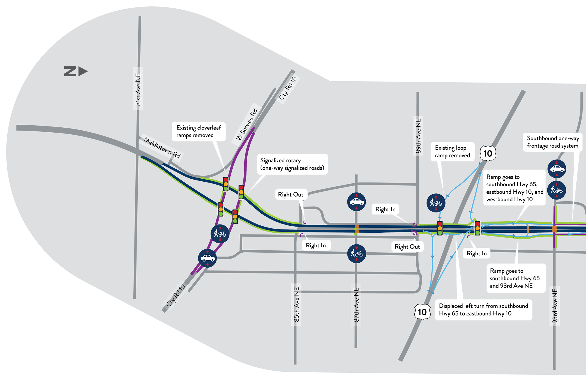
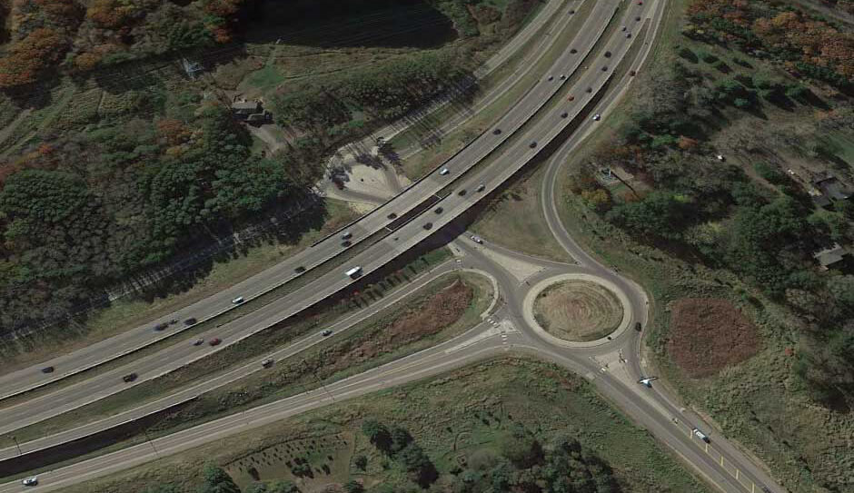
Exploring new solutions
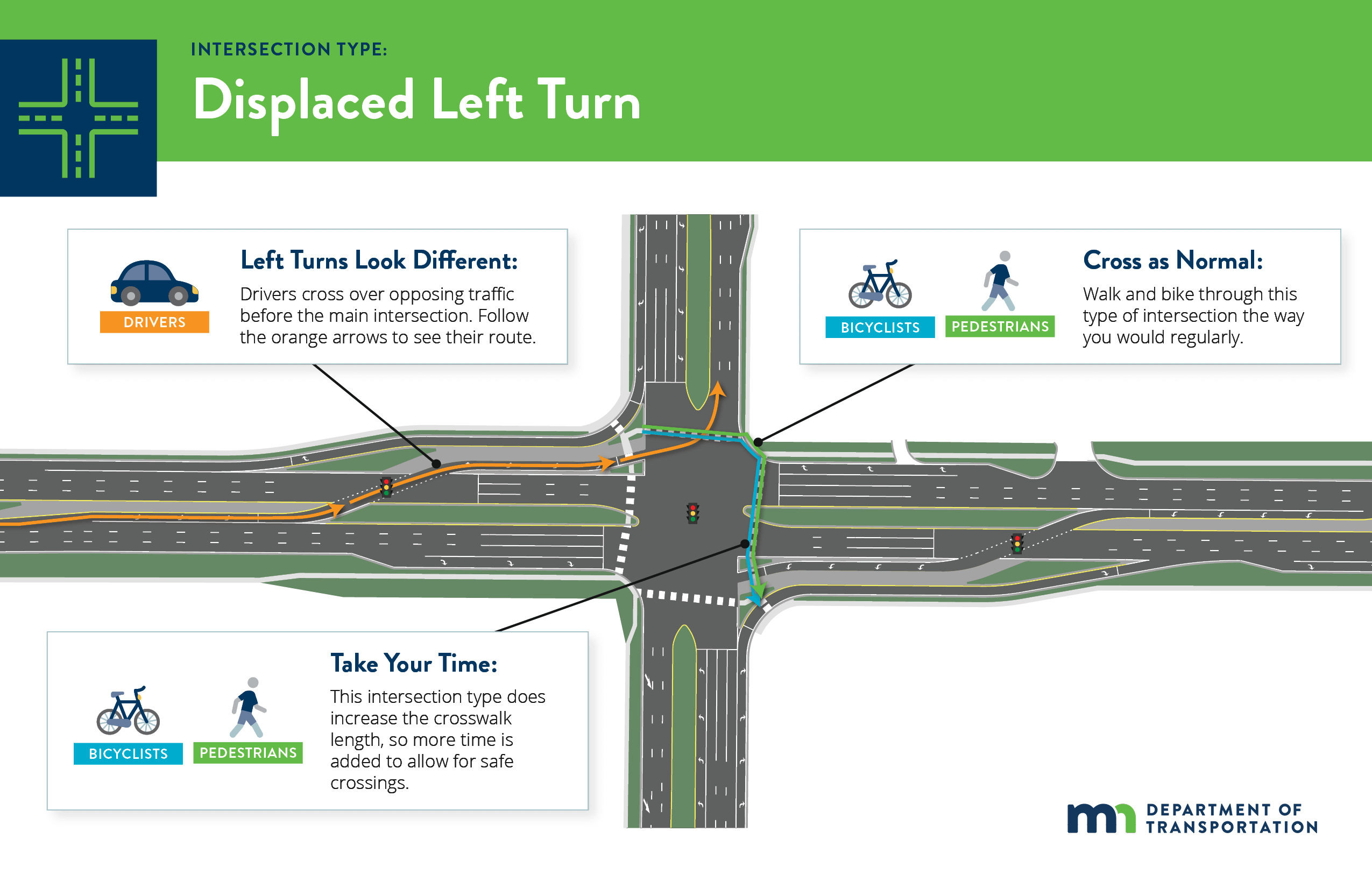
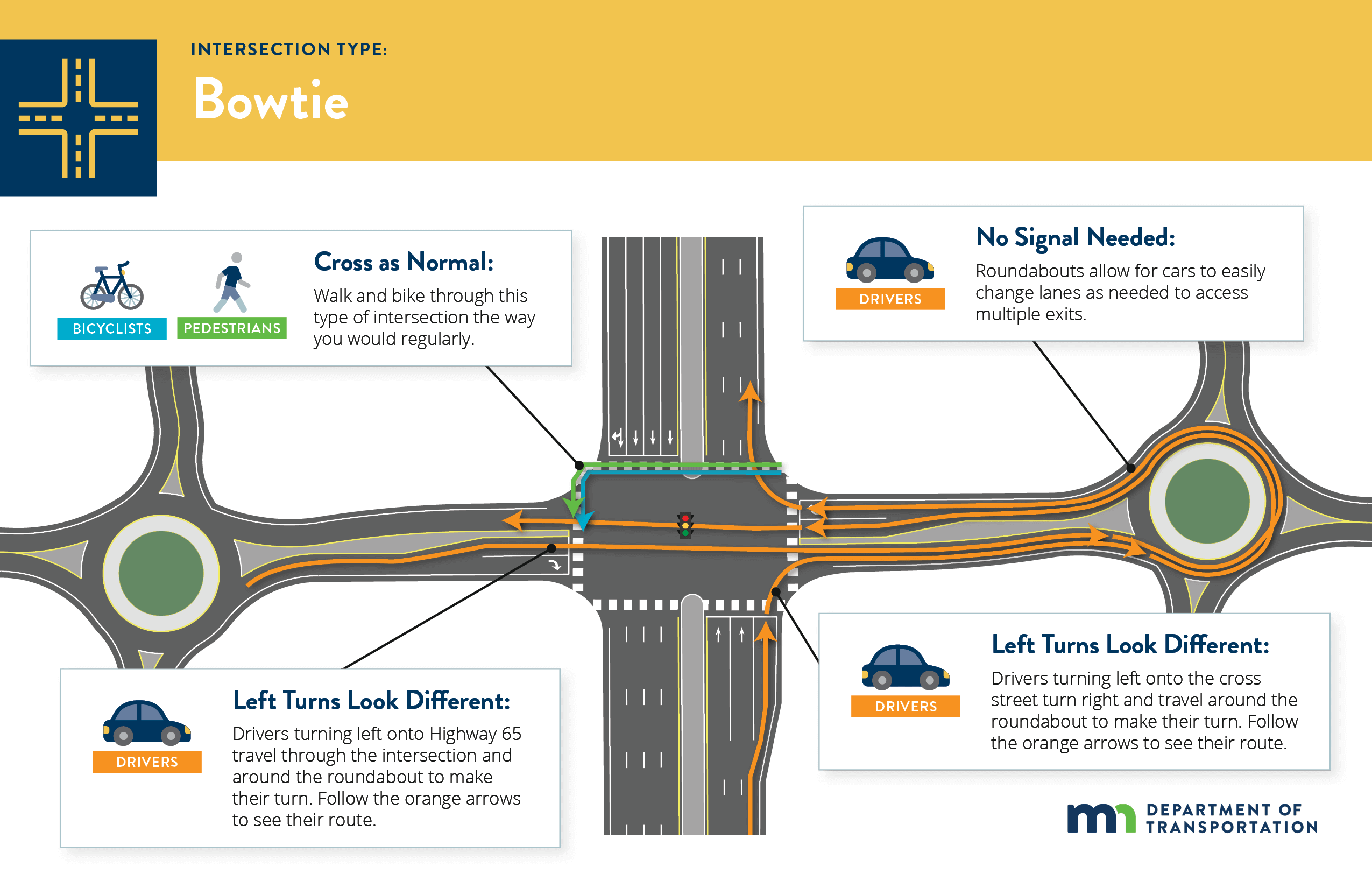
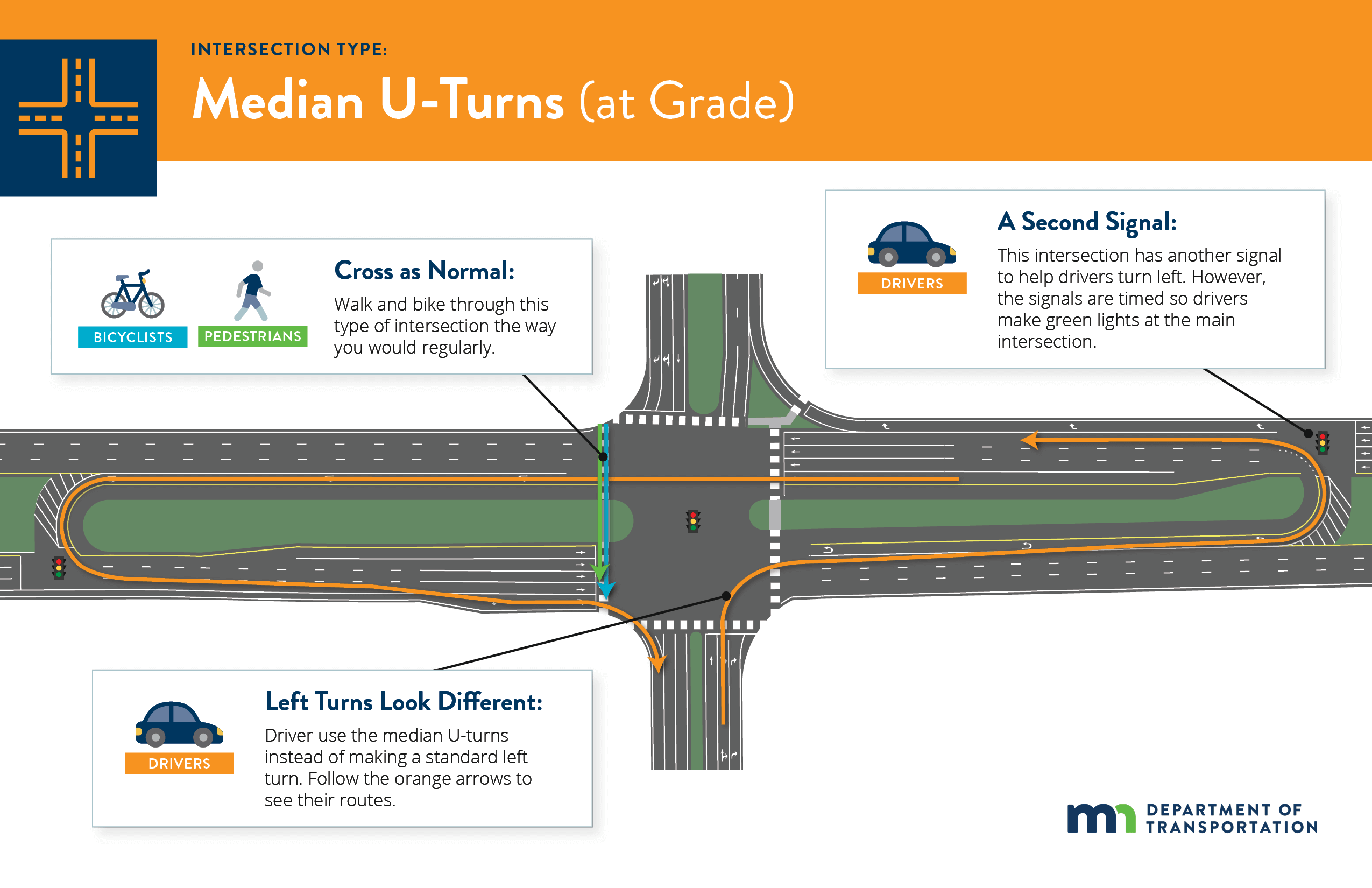
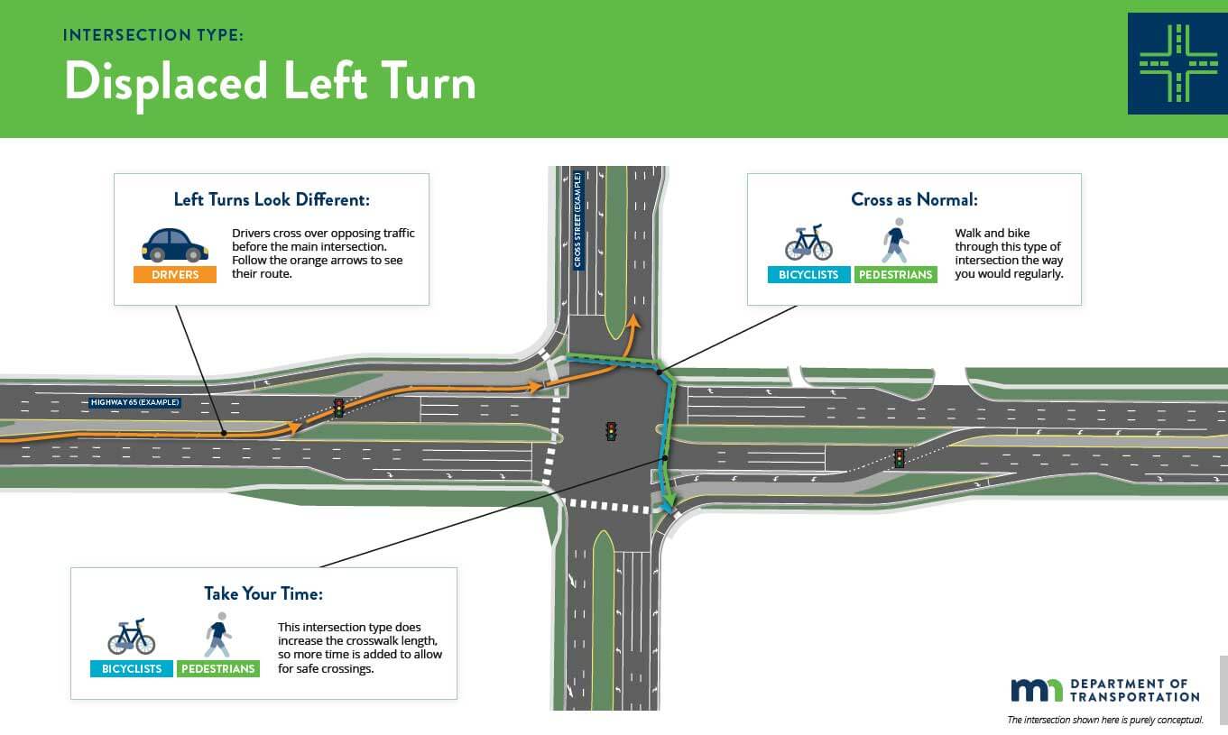
After we agreed on the primary problems and consideration, we moved to the next step in the process, which was to look at different solutions to help address these corridor issues. We knew that traditional solutions, like major bridges and freeways, were not necessarily the most cost-effective solutions, so we explored new tools, like innovative intersection designs. We presented four of the most promising innovative intersection designs to the public during this time:
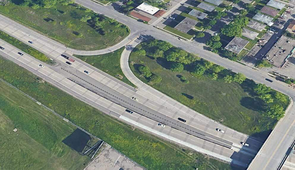
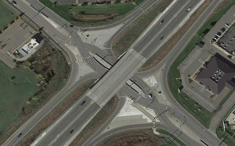
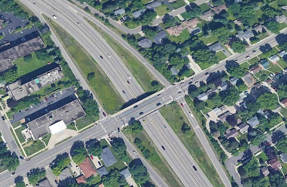
Displaced left turn
Bowtie
Median u-turn (at grade)
Median u-turn (grade-separated)
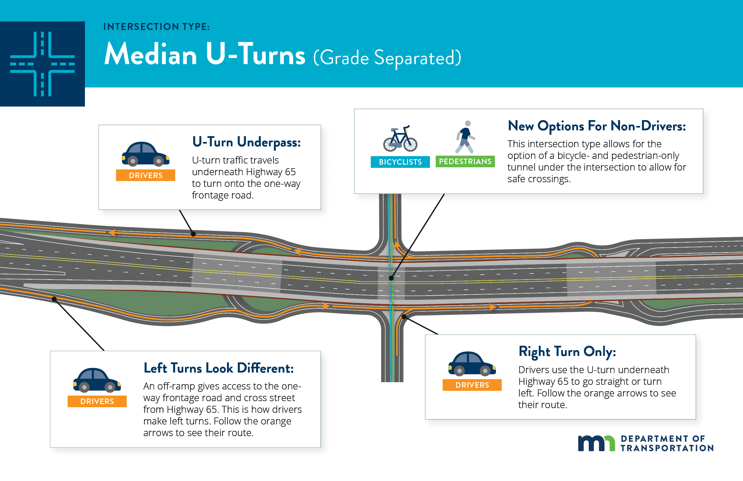
Click the images shown here to enlarge.
Of the four designs, the majority of respondents liked the Grade Separated Median U-Turn design the best. This input helped us understand which potential solutions the community may support moving forward.
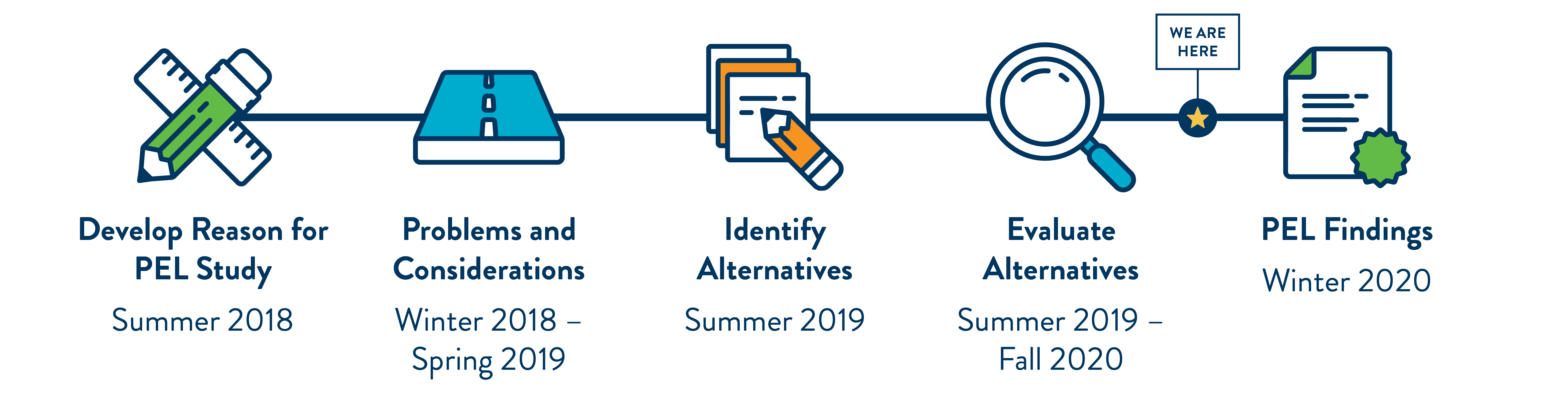
Where We Are Now
Project schedule
After we identified several potential options to improve this stretch of Highway 65, we moved on to the next step – evaluating the options to find the best solutions.
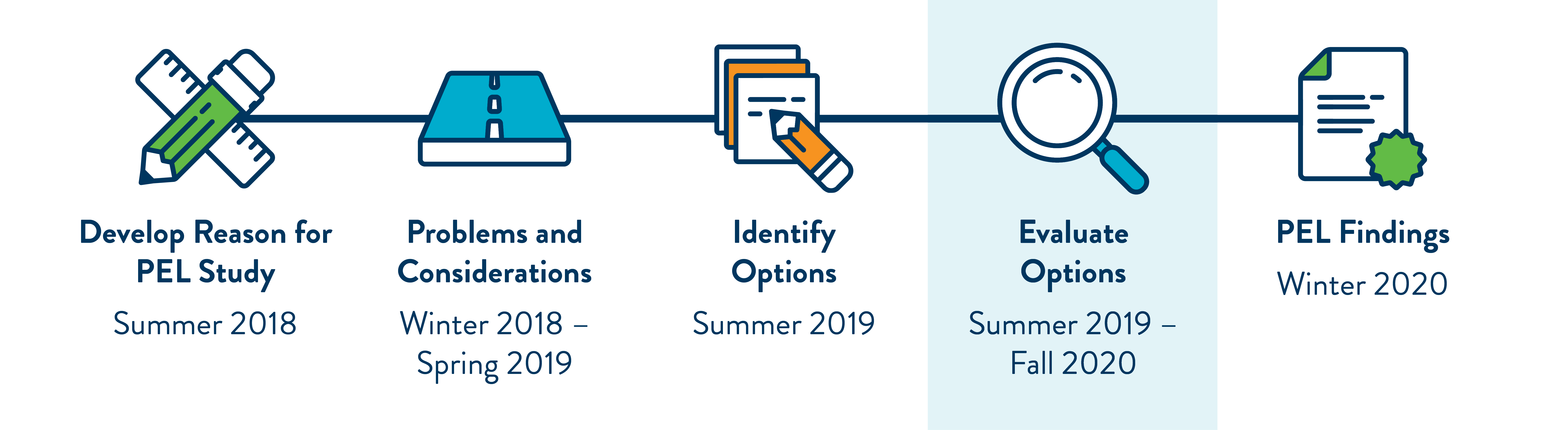
Click the images shown here to enlarge.
Corridor Evaluation
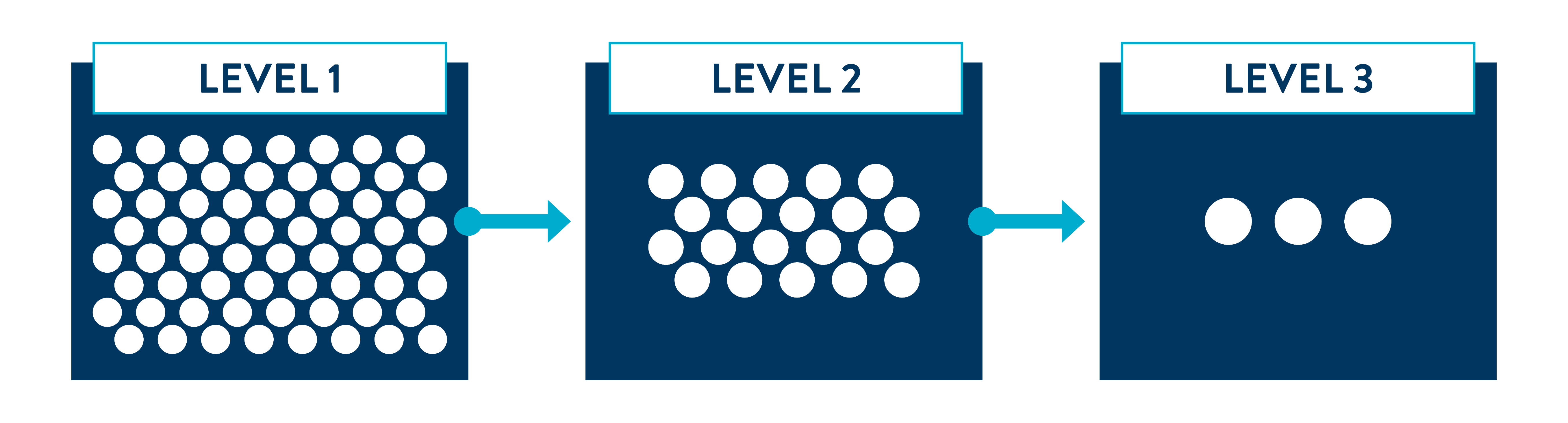
Narrowing down options
We used the input from the community to help us identify many options for this stretch of Highway 65. We evaluated these options through three levels of screening and narrowed them down to the three that best address the community’s primary problems—vehicle safety and vehicle congestion.
Identifying the best solutions
All three options will make traveling along or across Highway 65 safer and faster in this section of Highway 65.
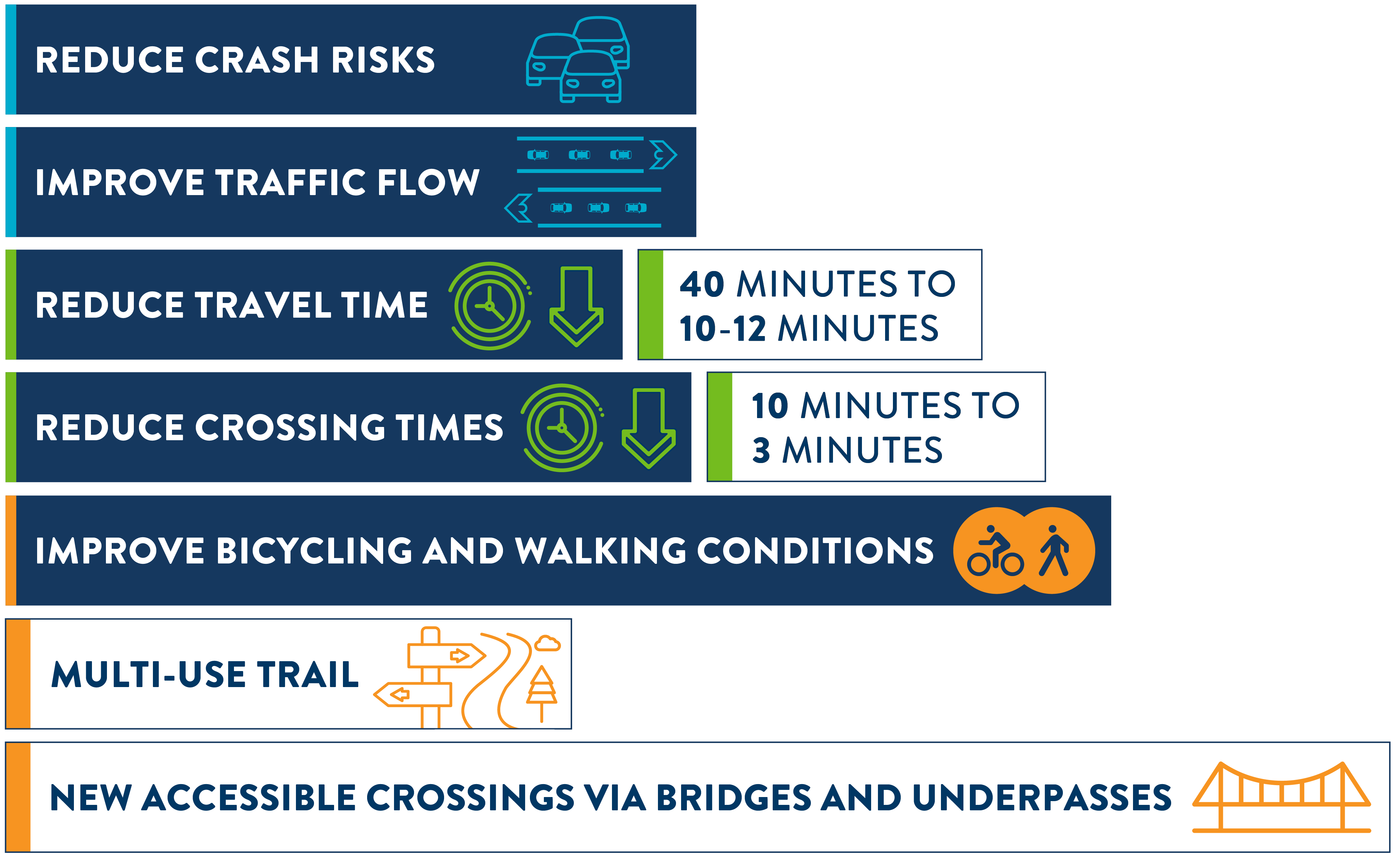
Even though all the options will improve Highway 65, the options look different and have different potential impacts and tradeoffs. Continue through this virtual engagement to explore more.
View the Options Evaluation Matrix to see the full analysis.
Study Recommendations
Based on the results of the evaluation, we are recommending three corridor options move forward as potential solutions for Highway 65. Continue through this virtual engagement to explore each option in detail.
Corridor sections
We split this stretch of Highway 65 into three sections for the purpose of our evaluation. In the following slides, we’ll walk you through the options section by section.
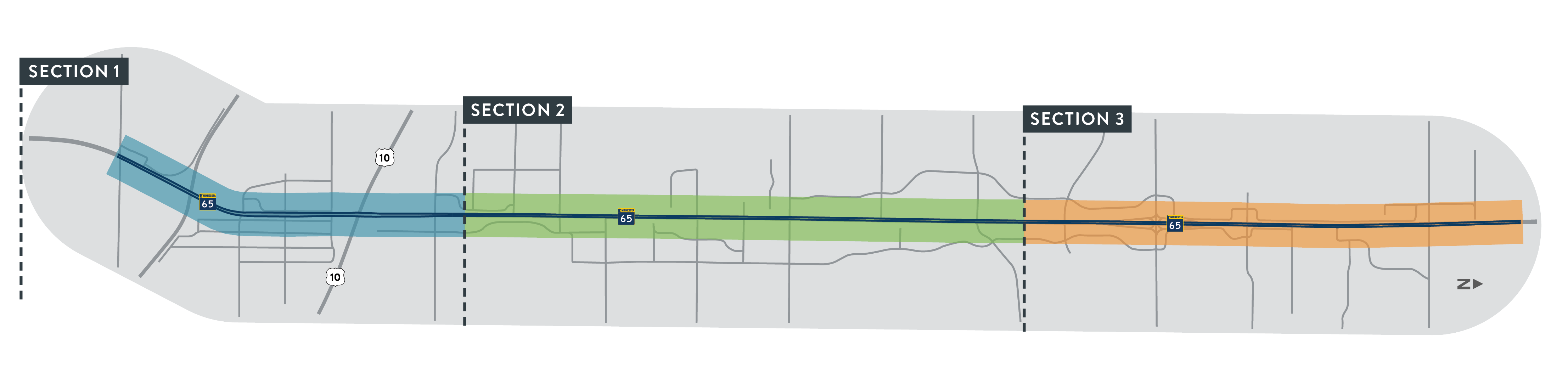
Click the images shown here to enlarge.
Takeaways

These are very preliminary designs
Additional planning and community input will occur (and likely change the designs) before any projects move forward
All options improve the primary problems
You identified vehicle safety and vehicle congestion as the primary problems for this stretch of Highway 65
We can mix and match
The options for one section can be combined with any of the options for other sections
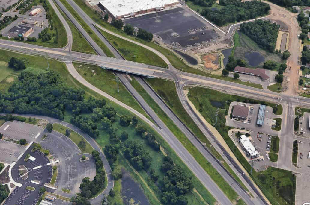
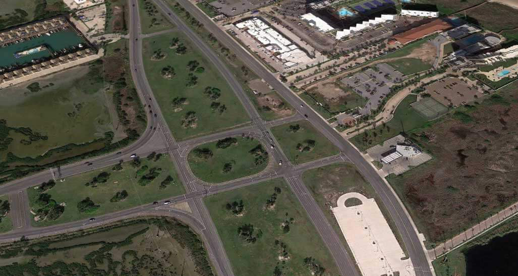
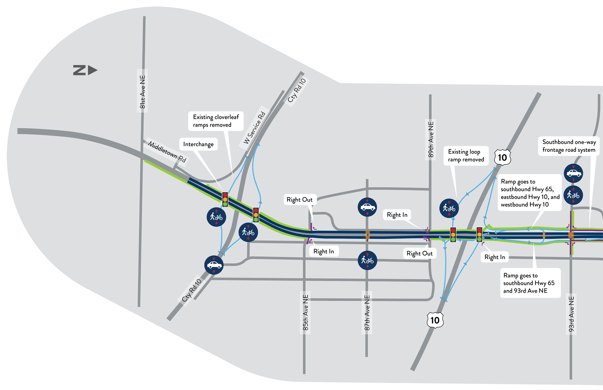
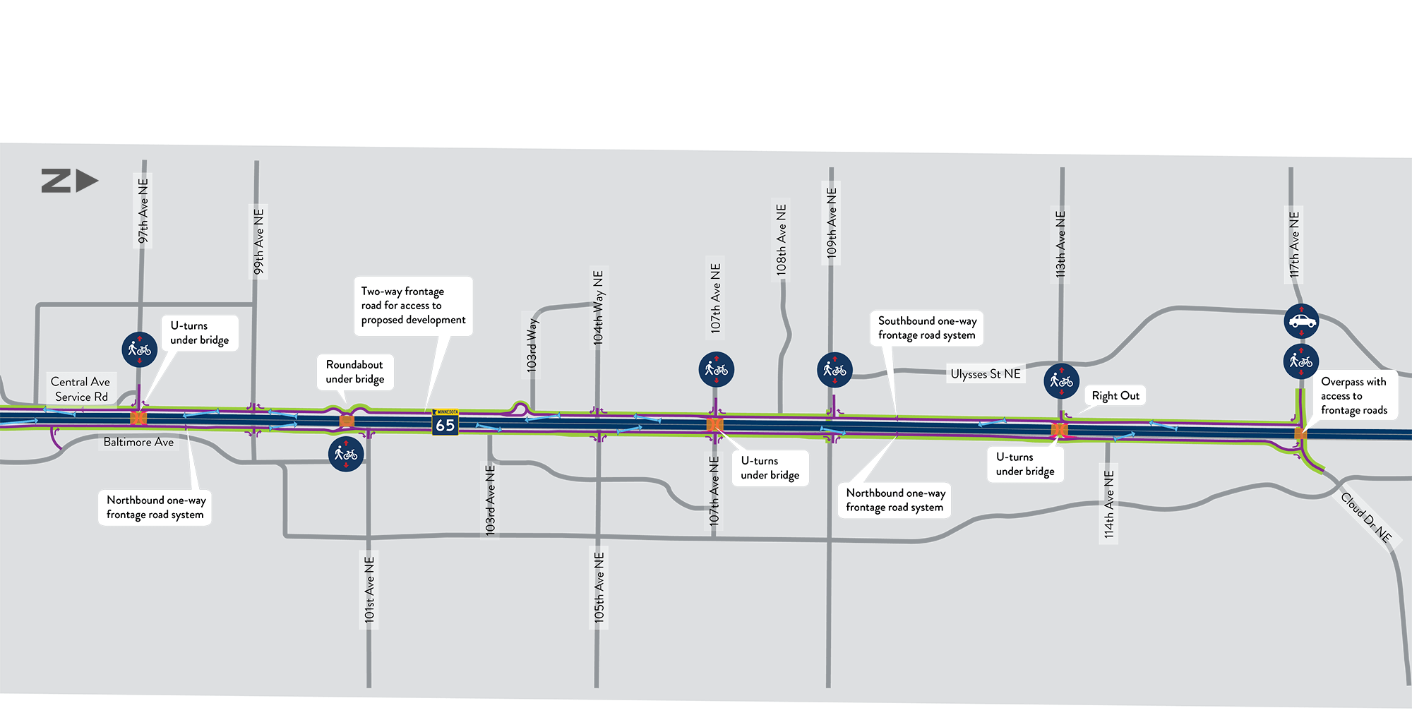
Section 1 Recommendations
Section overview
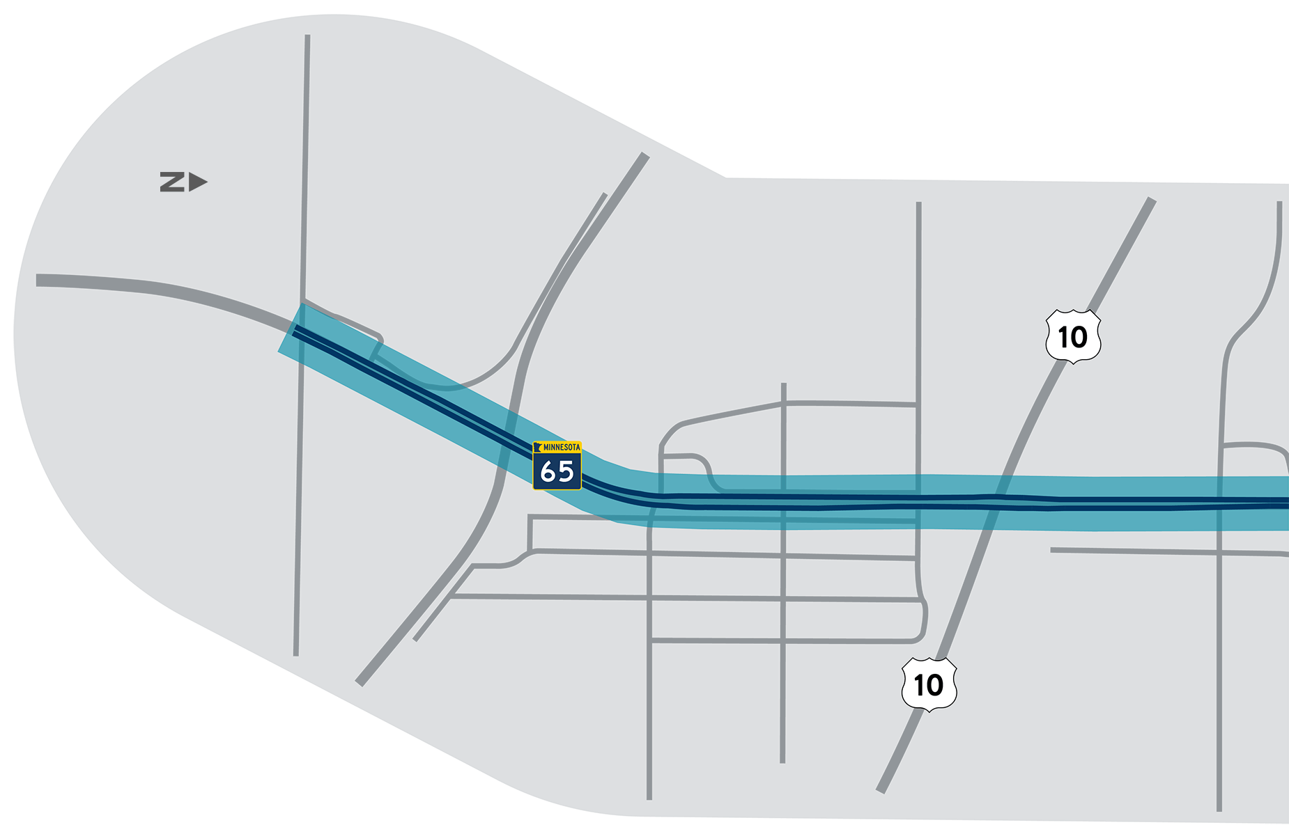
Section 1 includes the stretch from approximately 81st Avenue NE in Spring Lake Park to approximately 95th Avenue in Blaine.
The section is highlighted on the map shown here, and additional information about the evaluation process and key features is included below. Click the green click "Option 1, Option 2, and Option 3" banners for more details and information.
Evaluation summary
| Criteria | Option 1 Freeway | Option 2 Hybrid Freeway | Option 3 Hybrid Freeway + Interchange |
|---|---|---|---|
| Is vehicle safety improved? | |||
| Are vehicles able travel along and across Highway 65 in less time? | |||
| Is safety and comfort for people walking and bicycling improved? | |||
| Level of impacts to existing landowners and businesses | |||
| Cost to build | |||
| Do the benefits outweigh the costs? | |||
| Level of travel impacts during construction |
Tell us what you think...
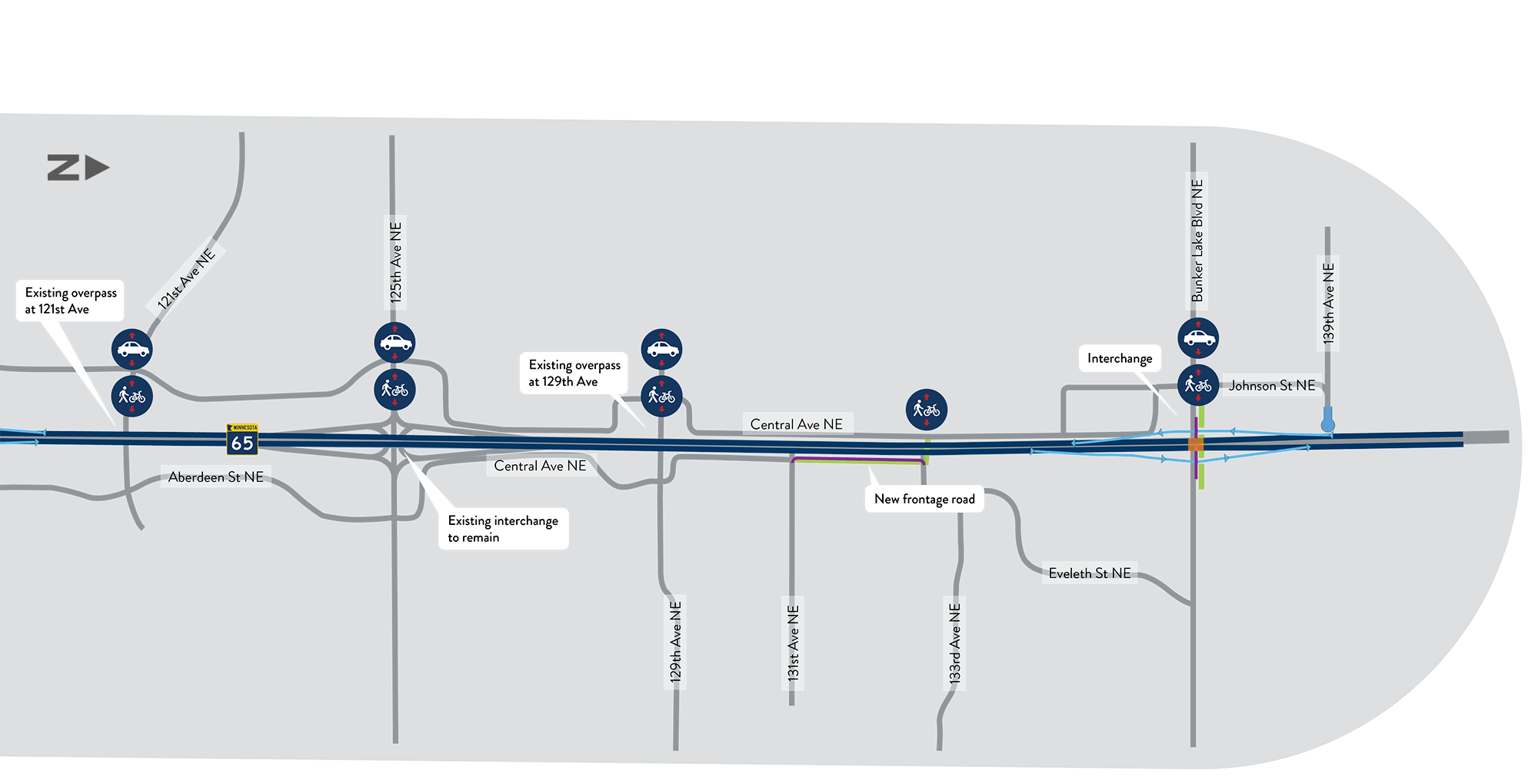
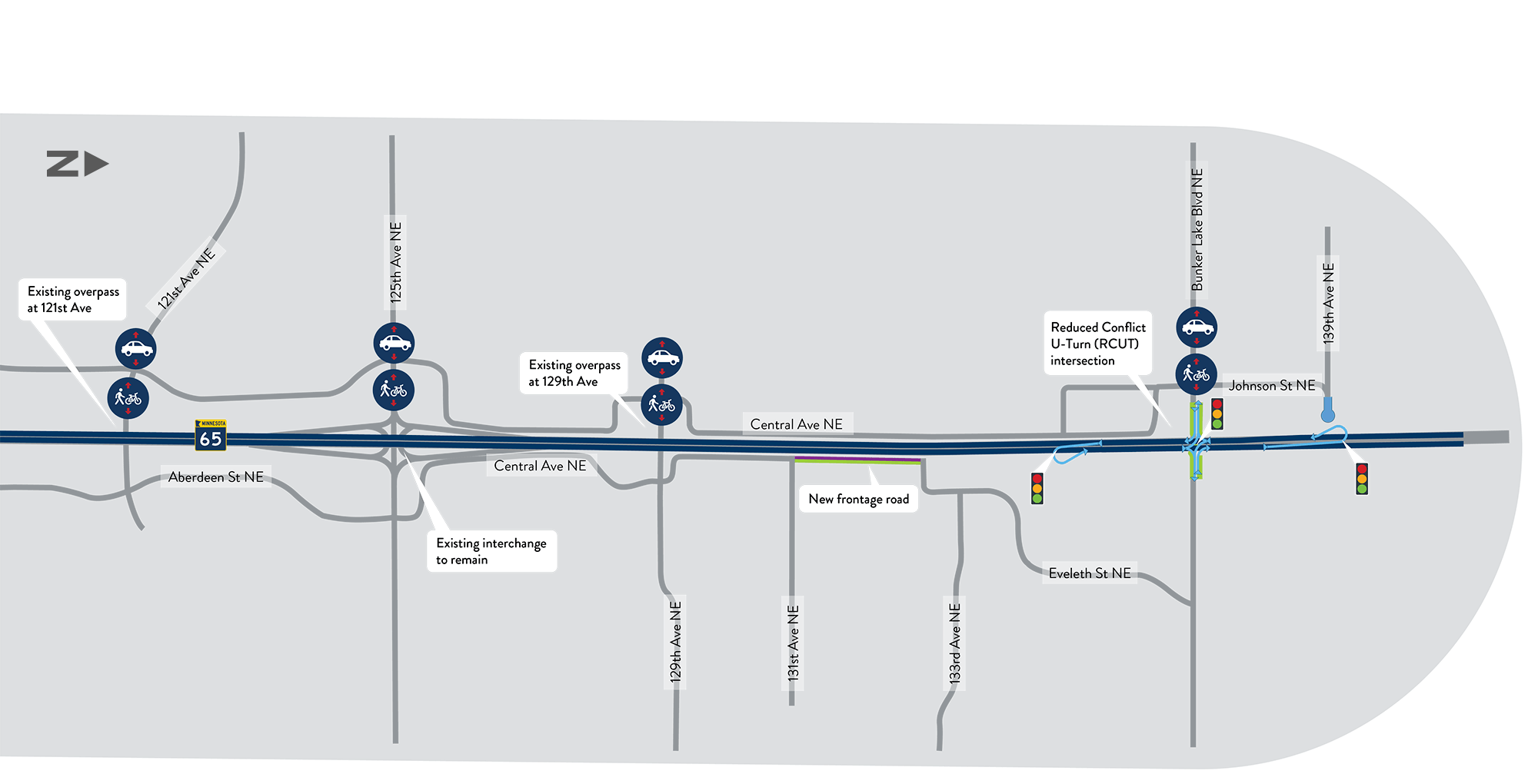
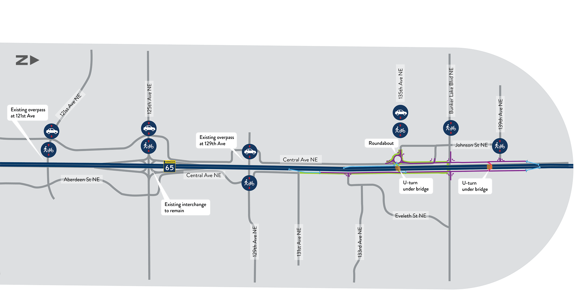
Option 1 – Freeway
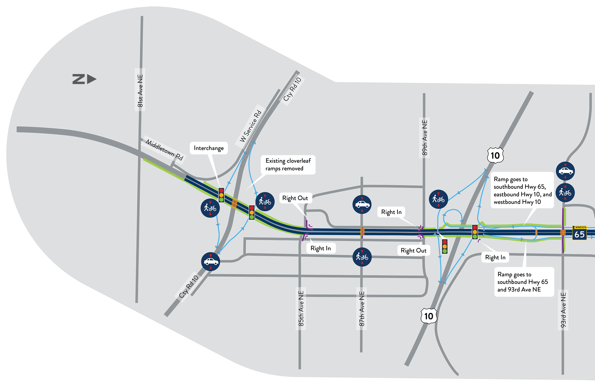
Option 2 – Hybrid Freeway
Option 3 – Hybrid Freeway + Interchange
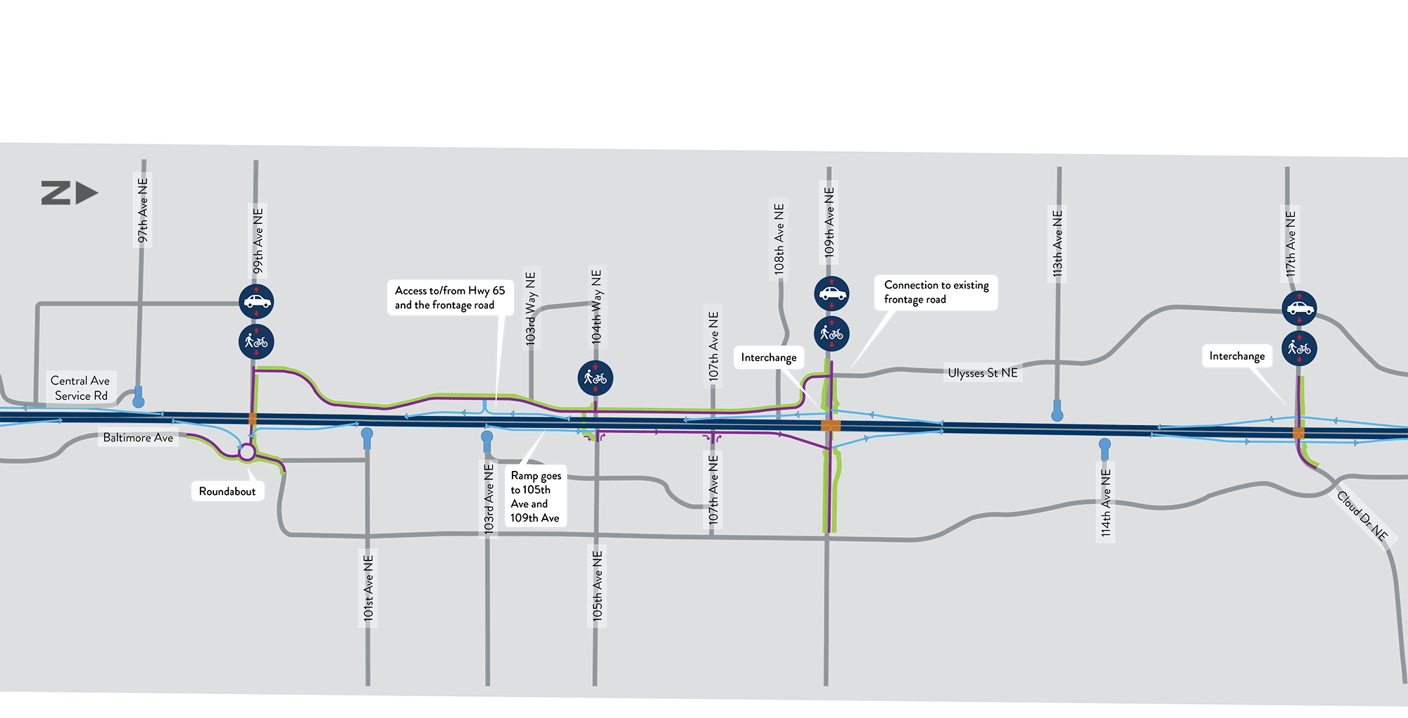
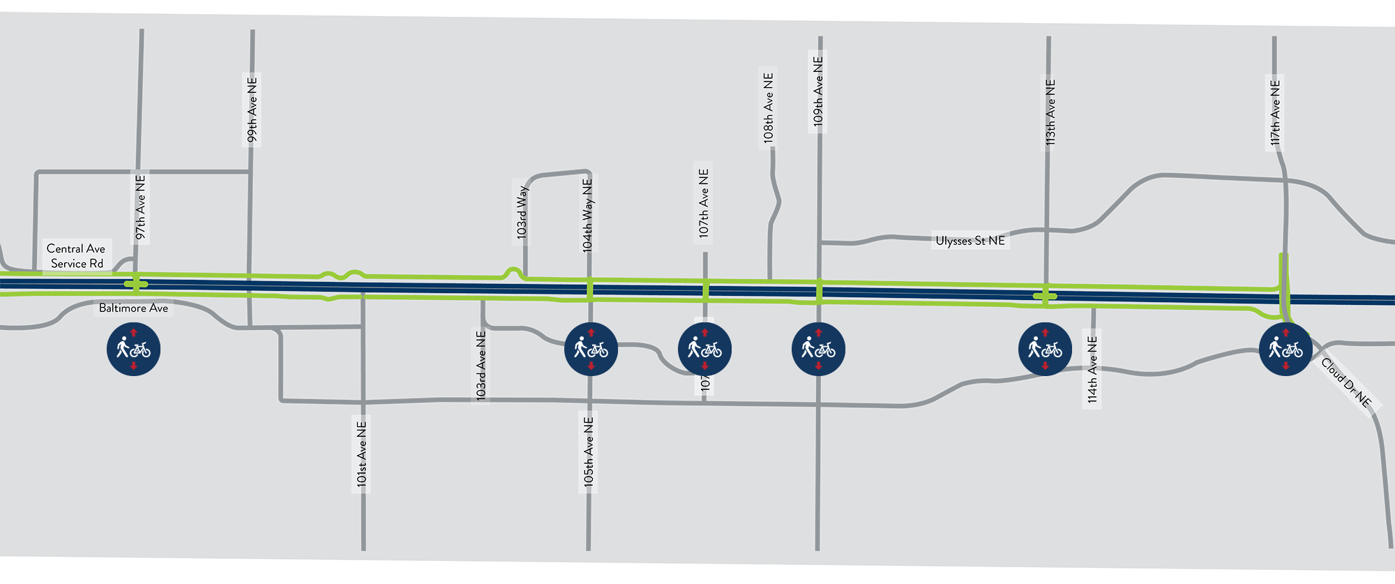
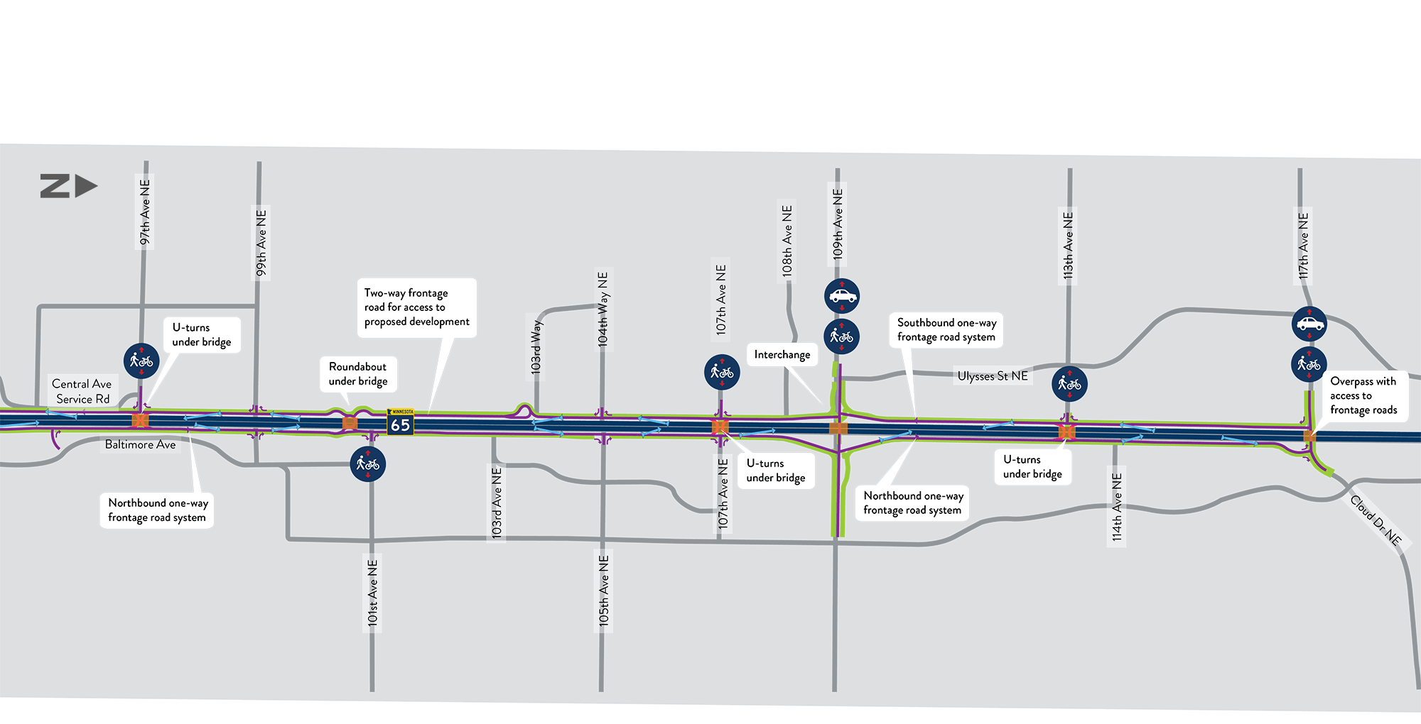
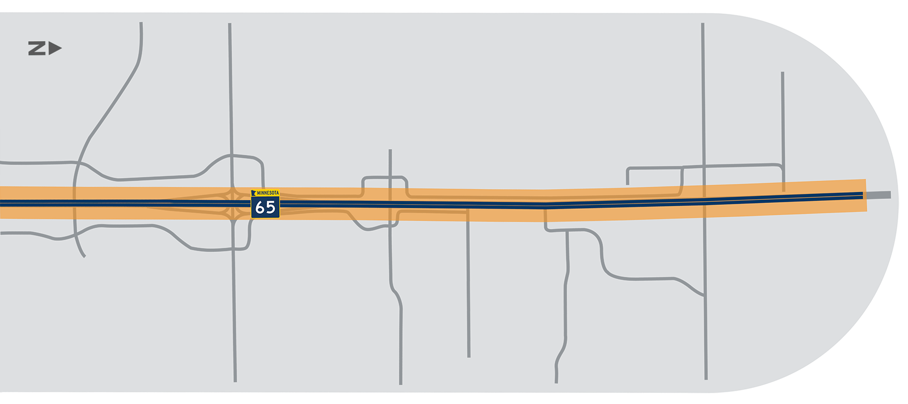
Section 2 Recommendations
Section Overview
Section 2 includes the stretch of Highway 65 from approximately 95th Ave NE in Blaine, MN to approximately 117th Ave NE/Cloud Drive NE in Blaine, MN.
The section is highlighted on the map shown here, and additional information about the evaluation process and key features is included below. Click the green click "Option 1, Option 2, and Option 3" banners for more details and information.
Evaluation Summary
| Criteria | Option 1 Freeway | Option 2 Hybrid Freeway | Option 3 Hybrid Freeway + Interchange |
|---|---|---|---|
| Is vehicle safety improved? | |||
| Are vehicles able travel along and across Highway 65 in less time? | |||
| Is safety and comfort for people walking and bicycling improved? | |||
| Level of impacts to existing landowners and businesses | |||
| Level of impact to wetlands | |||
| Cost to build | |||
| Do the benefits outweigh the costs? | |||
| Level of travel impacts during construction |
Tell us what you think...
Option 1 - Freeway
Option 2 - Hybrid Freeway
Option 3 - Hybrid Freeway + Interchange
Section 3 Recommendations
Section Overview
Section 3 includes the stretch of Highway 65 from approximately 117th Ave NE/Cloud Drive NE in Blaine, MN to approximately 143rd Avenue NE in Ham Lake, MN.
The section is highlighted on the map shown here, and additional information about the evaluation process and key features is included below. Click the green click "Option 1, Option 2, and Option 3" banners for more details and information.
Evaluation Summary
| Criteria | Option 1 Freeway | Option 2 Hybrid Freeway | Option 3 Hybrid Freeway + Interchange |
|---|---|---|---|
| Is vehicle safety improved? | |||
| Are vehicles able travel along and across Highway 65 in less time? | |||
| Is safety and comfort for people walking and bicycling improved? | |||
| Level of impacts to existing landowners and businesses | |||
| Cost to build | |||
| Do the benefits outweigh the costs? | |||
| Level of travel impacts during construction |
Tell us what you think...
Option 1 - Freeway
Option 2 - Hybrid Freeway
Option 3 - Hybrid Freeway + Interchange
What's Next?
Project schedule
Our next step will be to complete this study by summarizing all the technical information, community input and recommendations in a final report. The report will be released by MnDOT in late 2020. This virtual public meeting is the last engagement opportunity for this study.
Click the images shown here to enlarge.
After this study is complete...
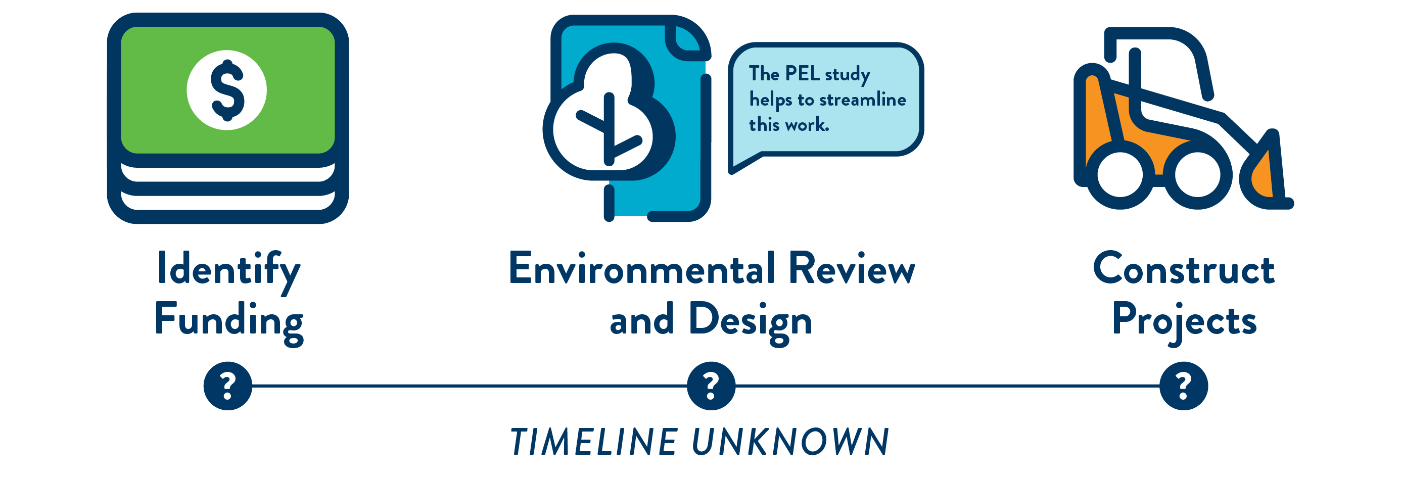

Future design
Future projects will be designed within the corridor vision identified in this study.
Funding availability
Individual projects will be designed and implemented over time as funding is available.
Project processes
As they are developed, each specific project will go through additional planning, analysis and community engagement. Changes may be made to the design during these processes.
Stay Connected
Thank you for your interest in the Highway 65 Study! We encourage and value your input throughout the process.
Sign Up For project updates
For more information about the project and to sign up to receive email updates, please visit:
www.dot.state.mn.us/metro/projects/hwy65hamlake-slp
Call the project hotline
Leave us a voicemail message comment or ask a question on our Highway 65 Study project hotline:
763.312.5008
Follow MnDOT on social media
Facebook: www.facebook.com/mndot
Twitter: www.twitter.com/mndot
YouTube: www.youtube.com/c/mndotvideos
MnDOT social media hub: www.dot.state.mn.us/socialmedia
Contact MnDOT
To submit a general comment or question for the project team, click on the comment button in the top right corner of your screen.
Questions for the MnDOT project team?
Melissa Barnes, P.E., MnDOT North Area Manager
melissa.barnes@state.mn.us | 651.234.7718
Kent Barnard, Communications and Engagement
kent.barnard@state.mn.us | 651.253.2803
Want to talk with the team?
A live virtual event is being planned for mid-September. Visit the project website to sign up for the project email list and be notified when it’s scheduled. Submit your questions ahead of time through the comment features on this site.
Share this information!
Please pass along the link to this virtual open house to family, friends and coworkers who use this stretch of Hwy 65 regularly. Use the links below to share this website through Facebook, Twitter, an email, or an SMS text message.